Skip to content

Tahoe Backcountry Snow

  • Winter 25-26 Forecasting JournalSeasonal forecasting narrative and journal.
  • Current Wx. at 7650′Current weather station info at 6350′ in Carnelian Bay.
  • About
  • Glossary of Terms
  • Archive
  • It’s a start leading to a whole lot more

    February 13th, 2026

    Backcountry obs.:

    It finally snowed over the past two days. Not a lot, but enough to refresh the snow pack (if only modestly) and inject some needed optimism into the hearts of local backcountry skiers.

    Dawn patrol tours in the Mt. Rose backcountry on both 2/11 and 2/12 between 8450′ – 9500′ revealed 3-8″ of fresh, fluffy snow, poorly bonded to the haggard surface crusts below. Skies both mornings were mainly overcast with light snow showers and cold temps in the low 20s. Winds remained light for most of the storm, but by Thurs morning a pronounced northerly flow had taken over, creating light orographically-enhanced snow showers over the Mt. Rose complex.

    High temps across the Tahoe Basin remained below freezing above 8000′ on both Weds and Thurs (2/12 & 2/13), helping to preserve the new snow. Between 7000-8000′, highs reached the middle 30s on both days, especially during peeks of sunshine. High humidity throughout the system made for hot, sweaty ascents and quick melting once temps crested freezing below 7000′.

    While the new snow definitely lifted spirits, its contributions to quality skiing have been modest at best. Low angle terrain skis fast and 50% smoother than the start of the week, but be ready for plenty of bumps. That’s improvement! Steeper pitches are quite prone to small sluffs and still ski with plenty of scratch and chatter.

    More snow is most welcome.

    Weather and forecast thoughts:

    Despite two days of on again off again snow that never seemed to arrive any gusto, 8″ accumulated over 48 hours at 6350′ in Carnelian Bay. The snow arrived in two rounds: 2″ of wet and heavy above freezing snow on 2/11 and a surprise 6″ during the wee hours of 2/12.

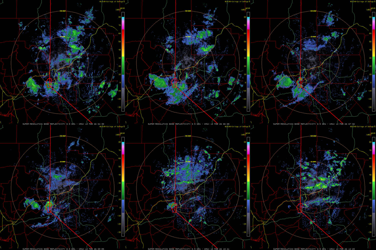
    The surprise band on 2/12 came in as the surface low moved south and east of Tahoe, changing the low level wind flow from S to N. Just enough low level moisture, already in place from the day before, combined with colder air and additional orographic lift from local topography to produce a brief band of heavy overnight snowfall. By dawn, 6-8″ had fallen at lake level from Incline to Kings Beach to Tahoe City, while many local backcountry zones barely received an inch.

    Radar imagery from overnight on 2/12.

    The system wrapped up last evening (2/12) as the low trekked south and eastward across the continent. In its wake, a ridge of high pressure builds in for today and most of the upcoming weekend (2/13-2/15). Skies will be generally sunny with high temps reaching anywhere from the low 30s to low 40s across the backcountry above 7000′. Lows through Sun (2/15) will drop into the 10s and 20s with some inversions setting up, especially if skies clear and winds remain calm. Freezing fog could also enter the picture in colder valleys and depressions across the area.

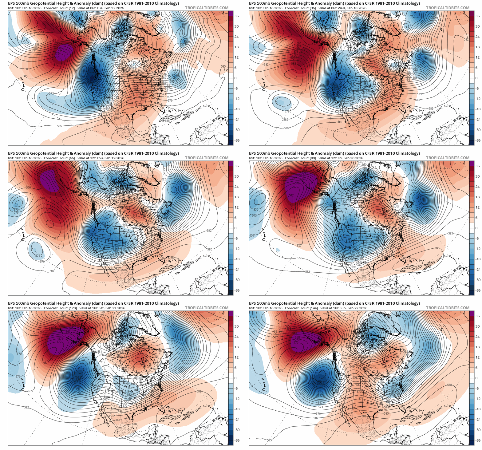
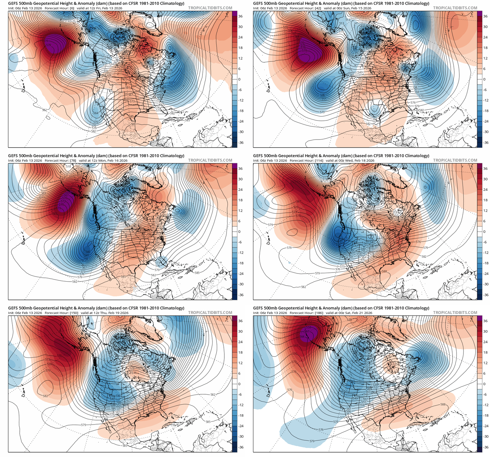
    Despite the lackluster performance of the 2/11 system, it served as a primer for what could be the most productive storm series of the season to date. Starting during the overnight hours of late Sun (2/15) into early Mon (2/16) models show a series of cold storms impacting the Sierra through mid to late next week (2/15 – ~2/19). The storm series arrives in concert with a deepening trough of low pressure out of the Gulf of Alaska, a classic pattern for cold, productive Sierra dumps.

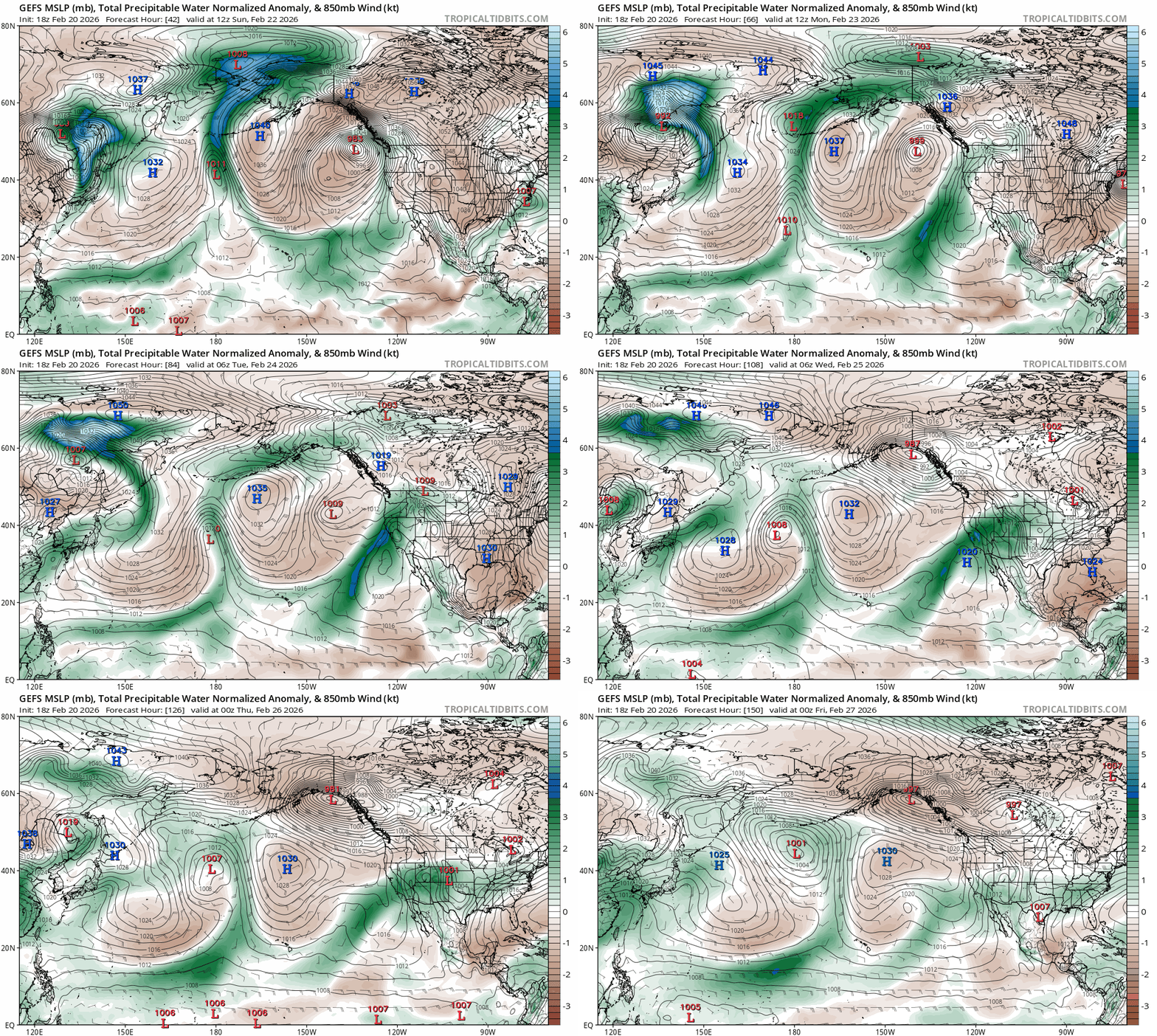
    GEFS 500mb height anomalies from 0400 on 2/13 – 1600 on 2/20.

    With the storms still 3 days out, models will evolve on timing and exact snowfall amounts. However, there is good agreement for cold air, efficient moisture transport and a strong, dynamic lifting environment, all essential pieces for prolonged, heavy snowfall. Before even entertaining any preliminary snowfall forecasts, it’s worth noting how these essential ingredients are lining up.

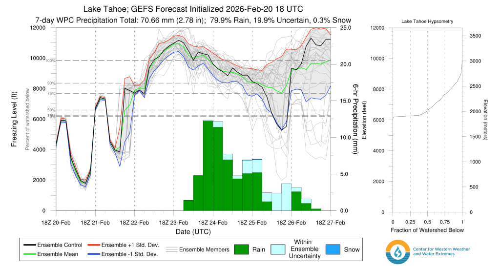
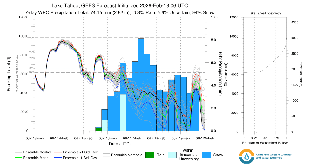
    Different from the previous storms this season whose fetch of air originated in the subtropical east Pacific, these systems are dropping into the eastern Pacific from the Gulf of Alaska, pulling in copious cold air. GEFS ensembles reflect this with freezing levels starting out below lake level Sunday night as precip starts, then falling and remaining well below 6000′ in the storm.

    GEFS ensemble plume for freezing levels in the Tahoe Basin.

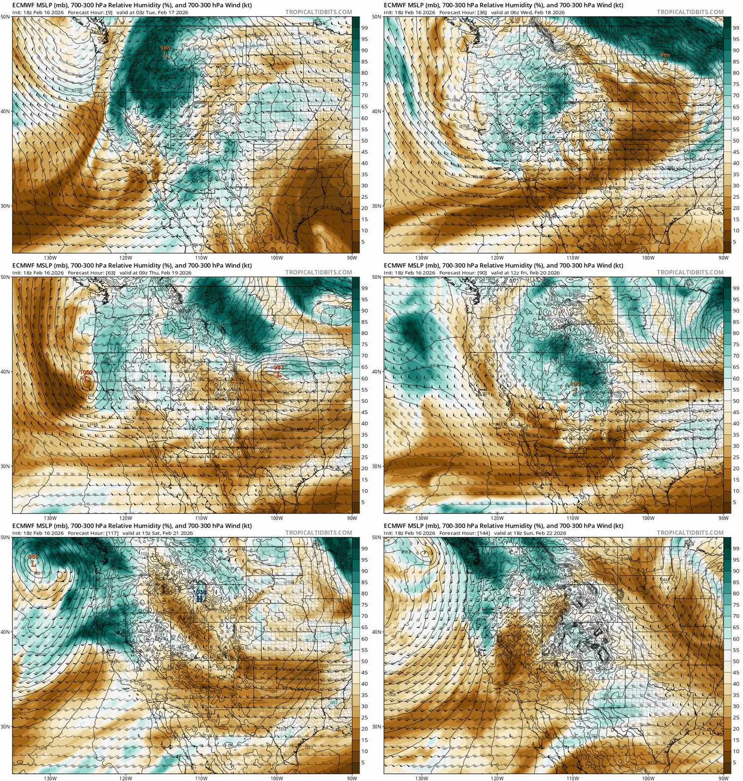
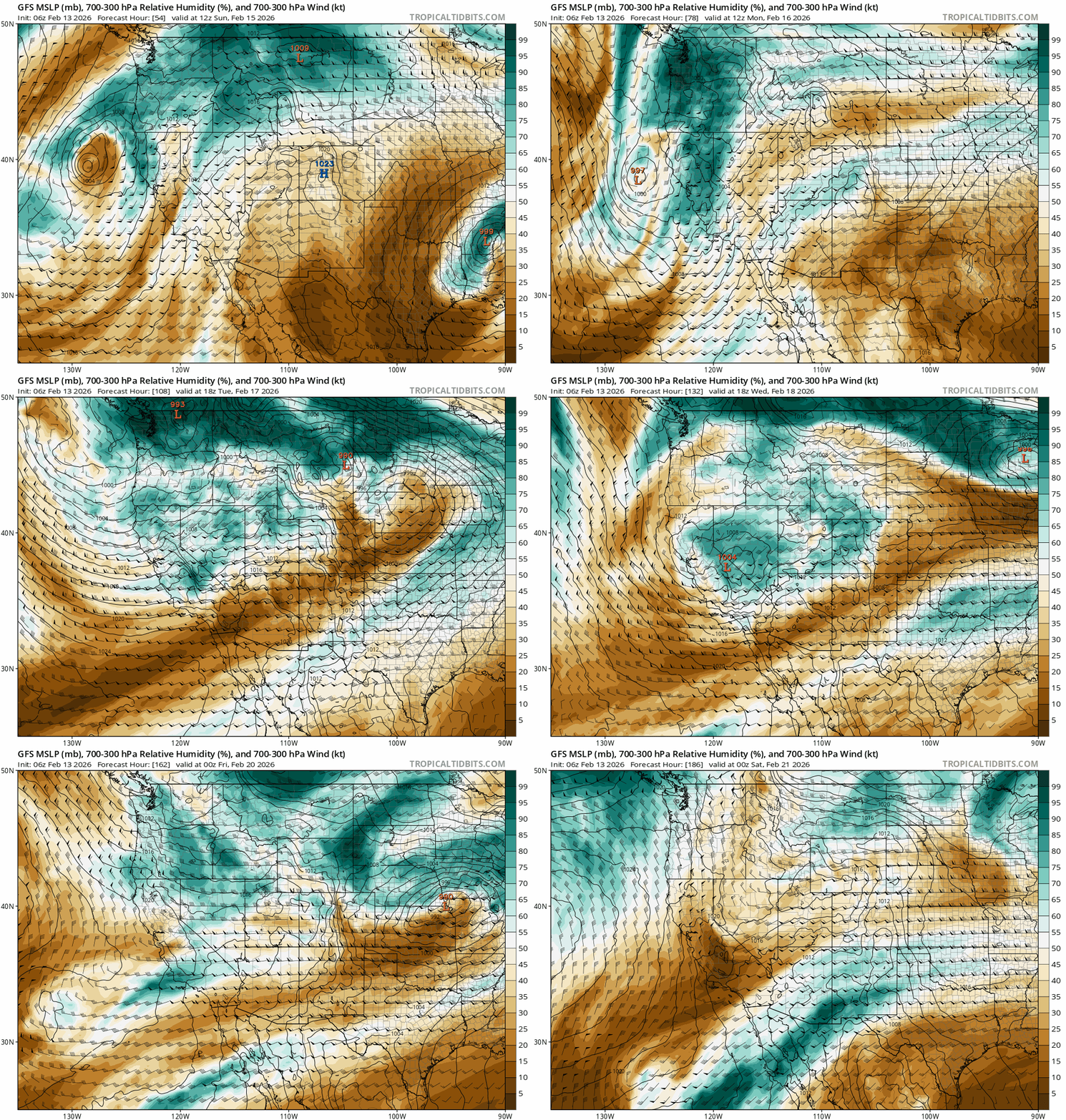
    The storms also look to combine low level moisture with the cold air. Models depict the flow of wind traveling down from the north, around the low pressure and across the warm, moisture rich waters off the CA coast. The green shading below translates to mid level relative humidity values.

    Mid level RH and winds from 0400 on 2/15 – 1600 on 2/20.

    While there is abundant mid-level moisture, it’s not nearly as high as it would be in a warmer AR scenario pulling in subtropical moisture from across the Pacific. However, the cold nature of the storm and its dynamics will act to more efficiently precipitate out any available moisture as heavy snows in the Sierra.

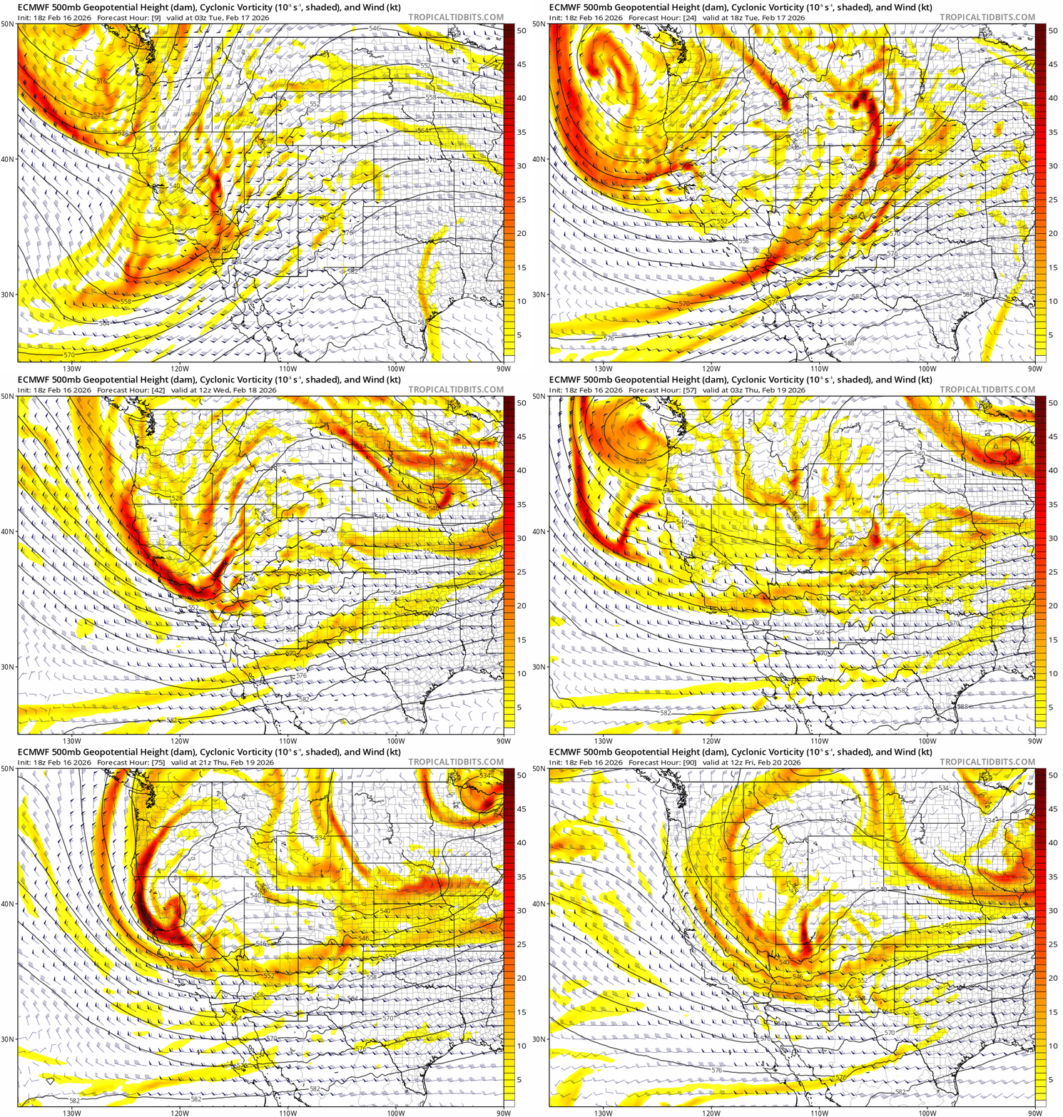
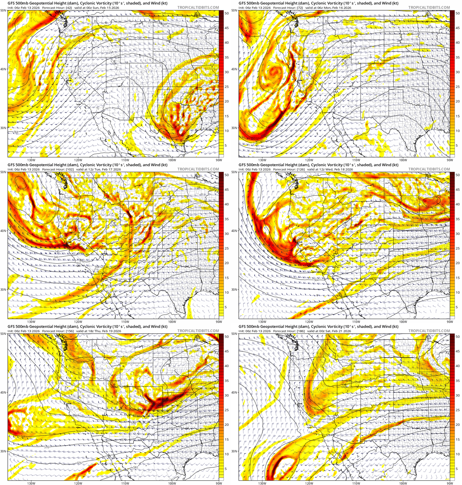
    Taking a look at the mid level dynamics of the storm series, there will also be plenty of vorticity (aka atmospheric spin) which acts to lift air columns, an essential for creating precipitation.

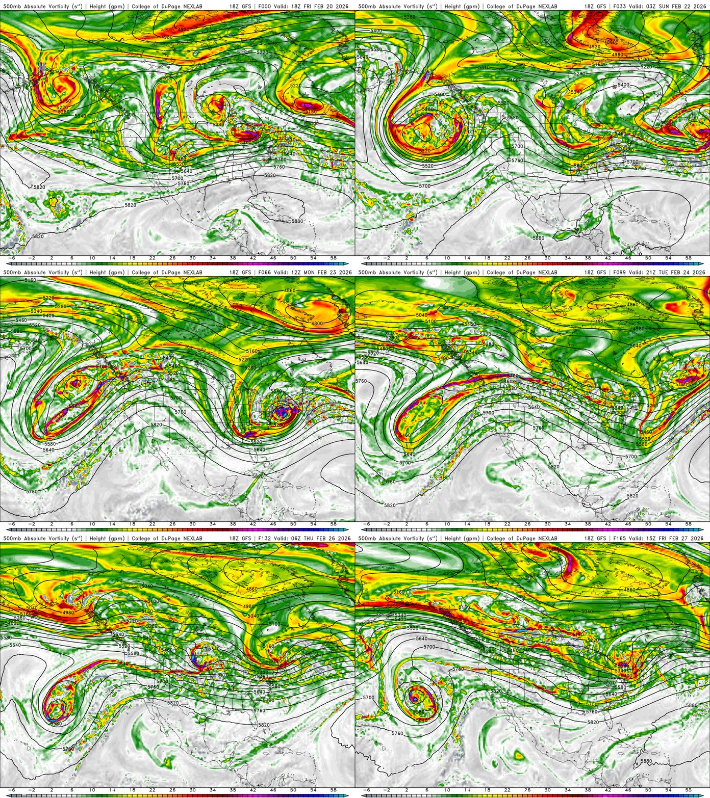
    GFS 500mb heights, vorticity and winds for 2/14 at 1600 – 2/20 at 1600.

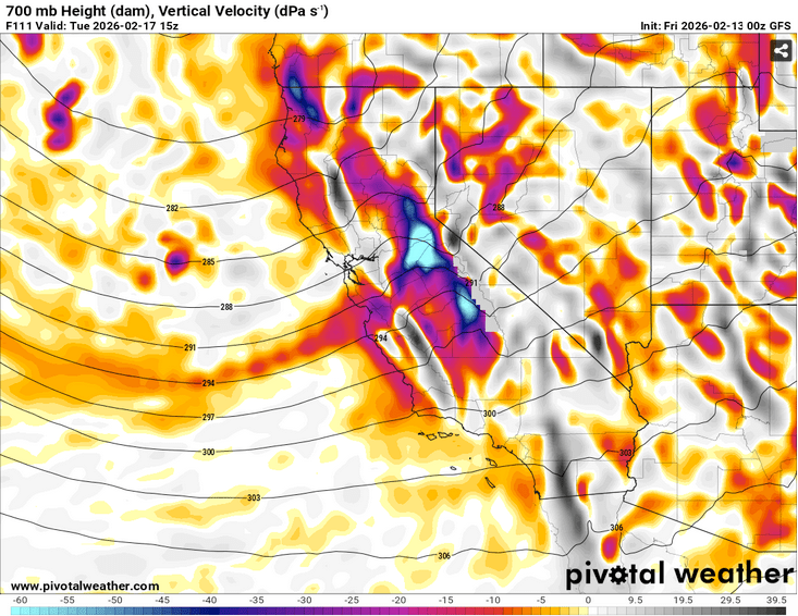
    Add this to the upsloping flow off the ocean and into the Sierra, and the air will most certainly rise, as noted in this image of vertical air velocity in the low-mid levels for Tues (2/17) around 0700 PST.

    GFS vertical velocity at 700mb for 2/17 at 0700 PST.

    While not record breaking, the ingredients are all coming together for a prolonged, cold Sierra storm, an ole’ fashioned Sierra dump. It’s about time.

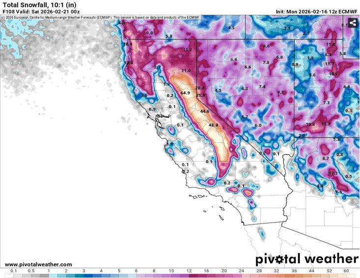
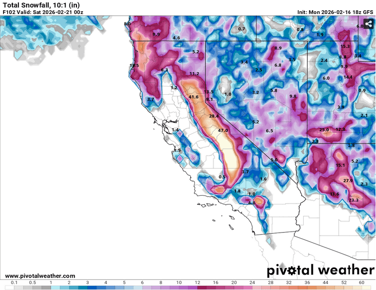
    At this point, ensemble models are hinting at totals through the work week of 3-5+’ of new snow above 7000′. These will continue to change as the storm approaches and a clearer picture emerges for how all the ingredients actually align.

    For now, it’s time to dust off and wax the powder skis. The biggest cycle of the season to date is on its way.

    Share this:

    • Share on Reddit (Opens in new window) Reddit
    • Email a link to a friend (Opens in new window) Email
  • “Waiter, where’s the snow I ordered?”

    February 10th, 2026

    Backcountry obs.:

    New snow has yet to fall on our haggard backcountry snow pack. Curious to check out what the highly anticipated new snow will fall upon, I toured in both the Mt. Rose area and along the west shore at dawn on Sun and Mon (2/8, 2/9), respectively.

    In the Mt. Rose area, melt-freeze crusts exist on nearly all aspects to well above 9000′. N and NE aspects, especially in forested terrain have breakable, yet manageable crusts, while E-S-NW aspects host unbreakable hard crusts. Friday’s brief system deposited up to an inch of thick, lightly wind textured dust atop the old crusts, adding a nearly imperceptible layer of softness to each hard, scratchy turn. Descending from 9900′ on a N aspect, I found surprise pockets of cold, soft snow, but nothing lasting more than 2-3 turns.

    One item of note: I discovered 6″+ of facets resting beneath a 3/4 delicate, breakable crust on an open, N aspect around 9500′. Once this layer is covered by new snowfall, it may become a source of instability, reawakening the slumbering avalanche demons.

    Along the west shore conditions have taken a much bigger hit from the recent warmth. Gone are the fields of crystalline surface hoar lower down and chalky wind board up high. Between 7000’-8000’, all aspects are baked into supportable melt freeze crusts. Open areas near and just above 7000’ have really taken a hit with the the snow pack shrinking into deflated pillow stage, more reminiscent of late April than early February. Scrubby underbrush and patches of rocks and dirt have begun to reemerge.

    What’s more, abundant runoff has kicked off. Open streams proliferate, requiring tricky crossings on unstable, degraded snow. Many streams never really froze from the fall and have been recently reenergized by the warmth-induced melt. Gurgling waters make for a soothing — and simultaneously discomforting—backcountry soundtrack.

    Weather and forecast thoughts:

    After more than a month without appreciable snow, a doddling storm arrives later today loaded with an appreciable refresh (8-12″) for the Tahoe backcountry above 7000′, especially along the crest. Seasonably cool temps and sunshine return behind the first system for Thurs – Sat (2/12-2/14), before another more impactful storm arrives later this weekend with a solid shot of a proper multi-day dump of Sierra snow.

    This morning (2/10), abundant clouds, light to moderate winds, and generally cool temps preface the arrival of the storm. Inversions are gone with temps ranging from upper 20s to low 30s near 6000′ to low 20s along the crest. Precip continues to hold off, however, and will likely not start in earnest until later this afternoon. Tonight snow picks up, especially on the western side of the Basin and along the Sierra Crest, lasting into most of Weds (2/11) before tapering off into intermittent snow showers Weds night into Thurs. Snowfall totals will generally be light around the lake (2-4″), while greater amounts fall on the west shore.

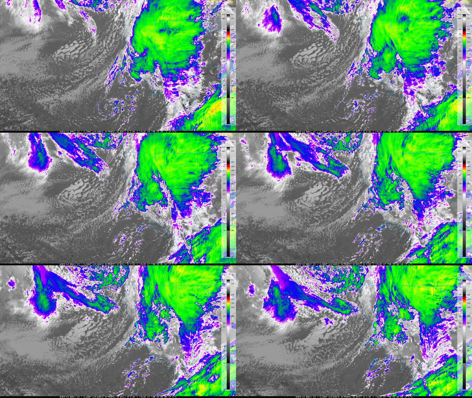
    IR satellite imagery early this morning shows today’s system spinning off the Central Coast.

    High res models bring the storm east to the CA coastline later today, but then suggest it stalling and spinning about somewhere between Monterrey and San Francisco, sending waves of rain and snow into the Sierra this afternoon through Weds.

    Total liquid amounts through Thurs just before sunrise suggest up to 1″+ throughout the Sierra, likely translating to 8-12″+ of moderately dense new snow above 7000′.

    3km NAM total accumulated precip. through 2/12 at 0400.

    Snow levels for this storm look to start out around 6500′ later this afternoon with freezing levels near 7000′, before falling through the night and into tomorrow morning, then rising back to near lake level throughout the day on Wednesday (2/11).

    GEFS ensemble of freezing levels and precip. for the Tahoe Basin.

    Forecast confidence is moderate in the snow level due to the swings in freezing levels noted above, even during the storm. While there is just enough cold air in place for mainly snow throughout the Tahoe Basin, it is borderline. A warmer than normal Eastern Pacific, the source of the moisture coming into the Sierra, also lingers as a background warm signal for each system, especially for those that linger and spin over the area for a while. The longer a cold air mass resides over the warm ocean, the more opportunity it has to moderate.

    The storm wraps up with the exception of lingering showers along the higher terrain for Weds night into Thurs (2/12) bringing light additional accumulations.

    Thurs and Fri (2/12-2/13) sunshine and near average temps return with highs in the low to mid 30s and lows in the low 20s across the backcountry.

    Signs of the next — and likely more impactful — storm arrive on Saturday (2/14) with high clouds and increased winds. Models continue to align around the possibility of a multi-day, cold Sierra storm: a proper “banger” bringing feet of new snow, possibly down to 5000′. The start of the storm has been pushed back to early Sun (2/15), but lasting through the middle of the coming week with snow at or below lake level for the entire storm cycle.

    Climate Prediction Center guidance over the past two days has also consistently favored an outcome with >80% of 2’+ for the Sierra above 7000′. A promising sign.

    More to come on this storm sequence as it gets closer.

    It’s been a long time coming, but the snow ordered weeks ago looks to finally arrive in the coming days.

    Share this:

    • Share on Reddit (Opens in new window) Reddit
    • Email a link to a friend (Opens in new window) Email
  • Winter’s long awaited return is nigh.

    February 7th, 2026

    Backcountry obs.:

    Conditions in the backcountry remained largely stable throughout the week with no new snow under the continuation of the recent warm, dry pattern. Obs from tours on the East Shore near Diamond Peak on Weds (2/4) and Fri (2/6) showed supportable, well-worn surface crusts on most aspects, making made for chattery descents, while zones with pure southerly exposure and sufficiently deep snow pack hosted creamy corn snow, if timed correctly. Non supportable, cold, crispy crust with a few inches of old, cold snow still held on in isolated high elevation, sheltered N-E facing terrain.

    Evidence of the changing pattern arrived on Fri AM with a blanket of persistent high cloudiness and moderate SW winds. By afternoon, an inch+ of new snow fell across the highest elevations (8500’+), while a few rain showers spritzed lower elevations. .06″ of rain fell at 6350′ in Carnelian Bay.

    Still skiing? Good on ya! It’s been a rough go for those wanting fresh turns on smooth, fluffy snow. But dry spells do bring opportunities for backcountry exploration, resort training laps, or dabbling in other sports. Luckily the big pattern shift shown in model guidance from earlier in the week has held on. Change is in the cards.

    Weather and forecast thoughts:

    A month of Ullr Fests, snow dances, and screaming at the sky will finally pay off in the coming weeks as the pattern shift from warm and dry to cool and wet finally returns to the Sierra starting early next week (2/9) and continuing into the week after the holiday weekend. While cold and beneficial storms do return, none jump out as overly impactful, at least for the coming week. Substantial refreshes with snow down to lake level look most likely, while massive dumps seem less likely, at least initially.

    For the coming weekend (2/7-2/8), warm dry conditions return after the cloudy, spritzy interlude yesterday and early today (2/6) as a shortwave ridge of high pressure returns. Expect highs across the backcountry to again reach the low to mid 40s above 7000′ on both Sat and Sun with lows dropping to near or just below freezing over ridges and summits each night, while valleys and depressions cool well into the 20s under a modestly inverted air mass. After sun returns on Sat, expect high clouds to stream into the area, increasing in coverage on Sun.

    Changes really start to work in on Mon and Tues (2/9-2/10) as the first decent chance for accumulating snows returns to the Sierra with the pattern shift from warm ridging to cool troughing. As noted below, one system takes aim for the late Mon-Weds time frame with another arriving for the coming weekend (2/14).

    GEFS ensemble of 500mb height anomalies from early AM on 2/7 through early AM on 2/14.

    Models will evolve with details coming into focus as time progresses with each storm.

    Looking more closely at the early-midweek storm, models initially suggest a decent refresh of the snow pack for all elevations. Snow levels will start between 7000-8000′ as precip arrives late Mon into the lingering warmth, but will then fall to below lake level overnight and into Tues (2/10) as a new, colder air mass overtakes the region.

    GEFS ensemble of freezing level and precip from 2/7-2/14 for Tahoe Basin.

    Snow looks to start out on Mon evening, falling through Tues and into early Weds before tapering off. By storm’s end, model ensembles suggest around 1-1.25″ of liquid could fall across the backcountry with highest amounts favored along the Sierra Crest. This translates into roughly 6-12″+ of new, well-deserved snowfall.

    GEFS total liquid precip. through Weds, 2/11 at 1800 PST.

    Diving a bit deeper into the first system, 500mb vorticity indicates decent dynamics with a nearly perpendicular upper level flow to the Sierra, ideal for maximizing orographic lift, which helps to squeeze moisture out of the atmosphere.

    Euro ensemble (EPS) vorticity (spin) analysis for Tues, 2/10 at 1600 PST.

    The main limiting factor with the system will be the total available moisture able to be wrung out of the sky. There’s not a ton of moisture with this first system, but enough given the favorable dynamics.

    Total precipitable water at 1600 PST on 2/10.

    Beyond the early to midweek system, another, more significant storm could impact the Sierra through the holiday weekend along with continued cold temperatures.

    Finally, the return to winter is upon us. Bring on the cold, fluffy turns!

    Share this:

    • Share on Reddit (Opens in new window) Reddit
    • Email a link to a friend (Opens in new window) Email
←Previous Page
1 … 4 5 6 7 8 … 52
Next Page→

Create a website or blog at WordPress.com

Loading Comments...

    • Subscribe Subscribed
      • Tahoe Backcountry Snow
      • Already have a WordPress.com account? Log in now.
      • Tahoe Backcountry Snow
      • Subscribe Subscribed
      • Sign up
      • Log in
      • Report this content
      • View site in Reader
      • Manage subscriptions
      • Collapse this bar