Skip to content

Tahoe Backcountry Snow

  • Winter 25-26 Forecasting JournalSeasonal forecasting narrative and journal.
  • Current Wx. at 7650′Current weather station info at 6350′ in Carnelian Bay.
  • About
  • Glossary of Terms
  • Archive
  • The winter that wasn’t returns.

    February 24th, 2026

    Backcountry obs.:

    I started the week yesterday (2/23) at dawn with a quick north facing tour in the Mt. Rose backcountry between 8400′-9200′. Despite the warmth late last weekend, cold, soft powder had held on in shady, north facing protected areas. Leaving the shadows, snow quickly turned transitional with every variety of breakable crust imaginable on offer: thin and zippy to thick and deadly to stuffed crust! One lap on the bipolar snowpack was enough to start the week off right.

    As of this writing (2/24), any remaining cold powder from yesterday has likely been soaked with warm rain at all elevations, even above 10,000′. Much like the endangered pika, there’s no more mountain to climb to escape the warmth of this system.

    Weather and forecast thoughts:

    Fresh on the heels of the coldest cycle of the season, the warmest cycle of the season is now impacting the Tahoe backcountry with rain for Tues (2/24), tapering off tomorrow (2/25). A subtropical moisture feed has already pushed snow levels with this system to around 9000′ and these will continue rising throughout the day as rain intensity increases. At the storm’s peak this evening, snow levels will likely be above 10,000′! Rain tapers off tomorrow (2/25) and in its wake, warm temps and sunny skies for the rest of the work week will make memories of cold powder feel like a fever dream.

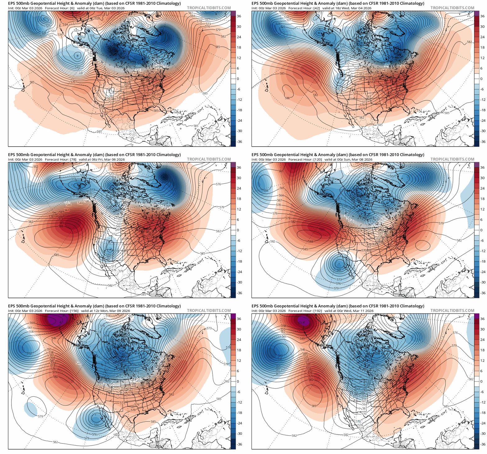
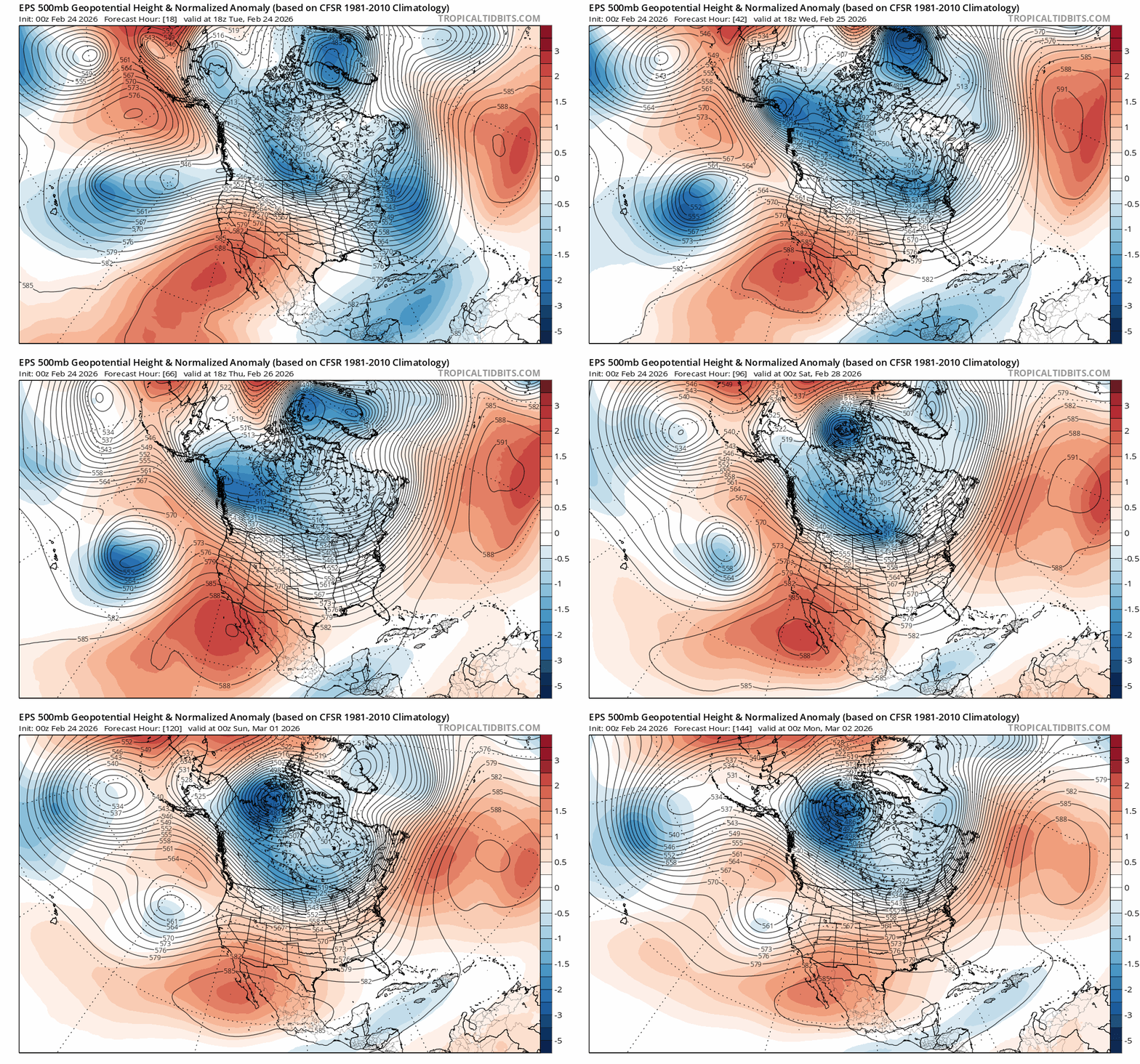
    Taking a look at the big picture, the pattern responsible for the glorious, cold snow from last week has flipped completely, replaced by a ridge of high pressure over the west and a fetch of warm, moist air pumping in from the subtropics. 500mb height anomalies tell the story with the black lines pointing out into the Pacific SE of Hawaii.

    Euro ensemble 500mb height anomalies from 2/24 at 1000 PST to 3/1 at 1600 PST.

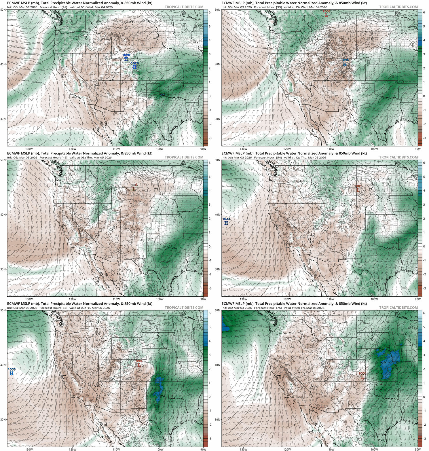
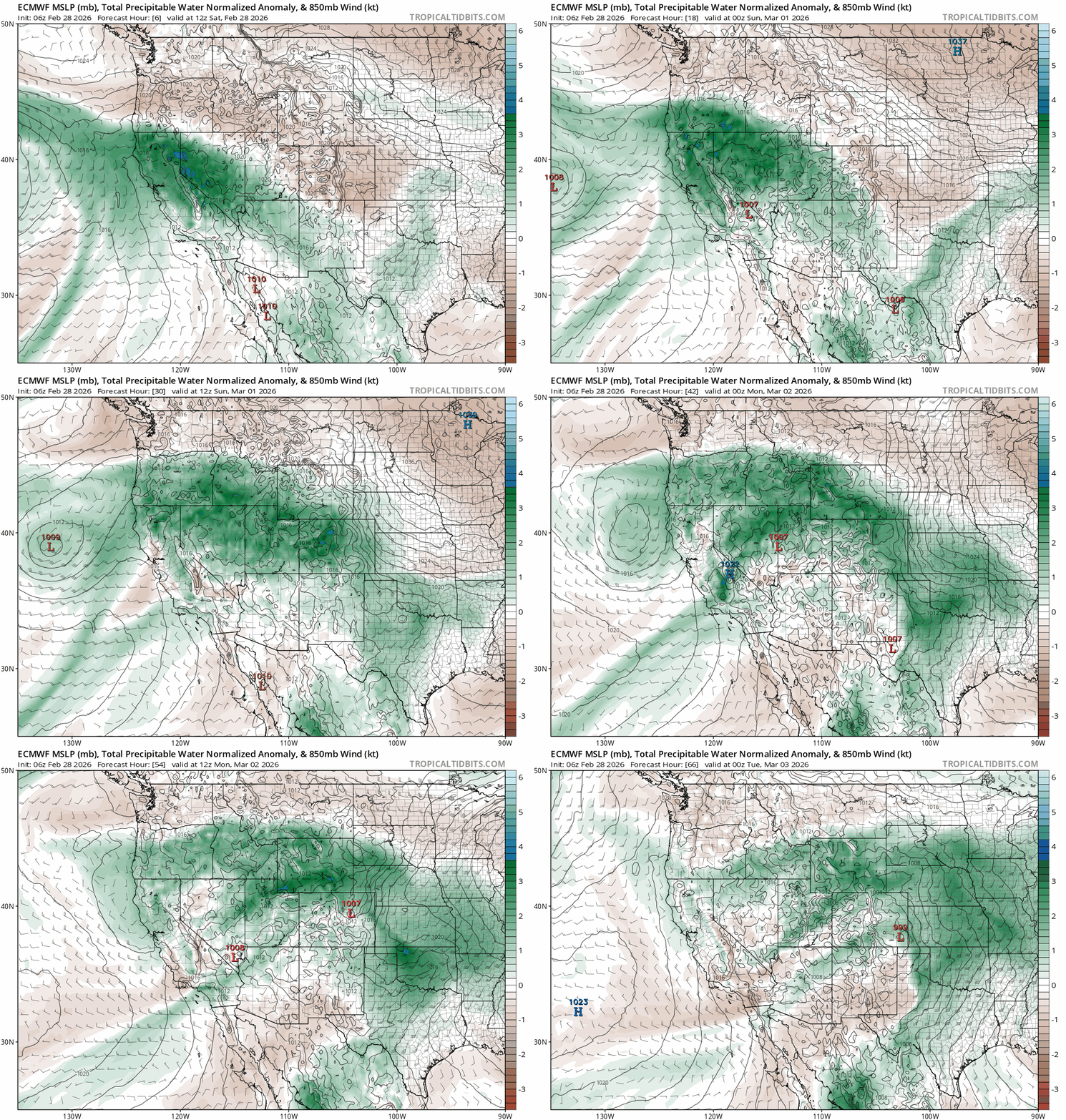
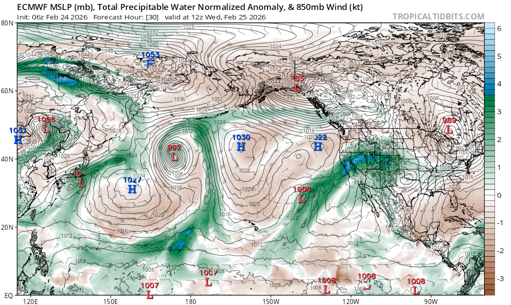
    NE of Hawaii is an area of low pressure, spinning counter clockwise and funneling moisture into the west in a weak-moderate AR (atmospheric river), as noted in the normalized precipitable water (PWAT) anomaly analysis. This shows how much more precipitable moisture is in the total atmosphere than the climatological norm.

    Normalized PWAT anomalies for 2/25 at 0400 PST.

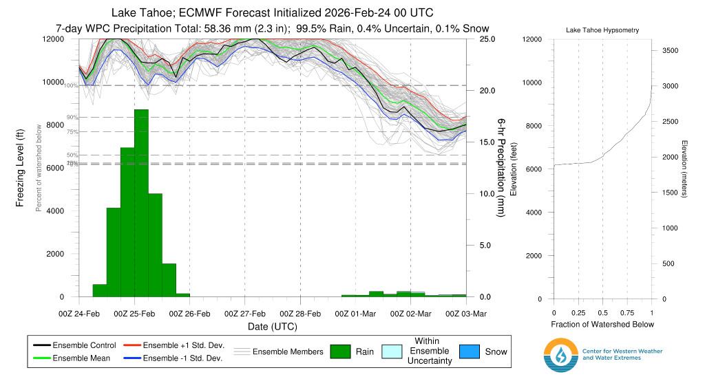
    The result of this warm, wet connection is rain for all elevations of the Tahoe backcountry. Models are in good agreement for freezing levels topping out above the terrain between 11,000′ – 12,000′ later this afternoon, before falling to between 10,000′ – 11,000′ this evening and into tomorrow (2/25).

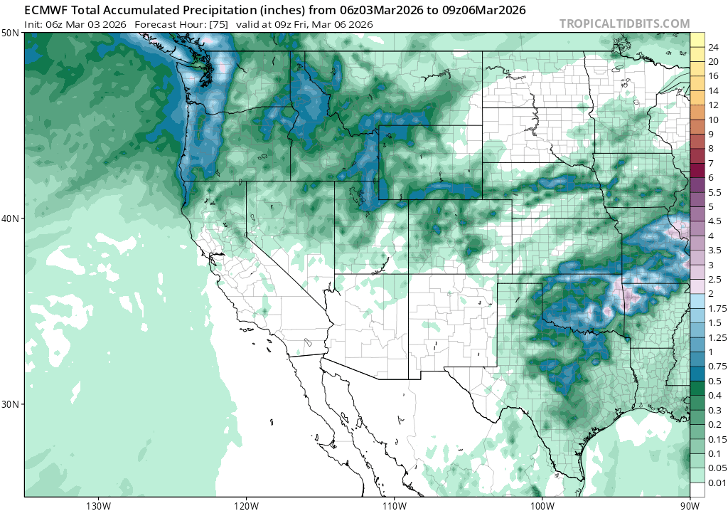
    The one saving grace is that the rain will likely not be too heavy in the Sierra, with only a few inches of liquid (1-3″) falling, with the highest amounts N and W along the crest.

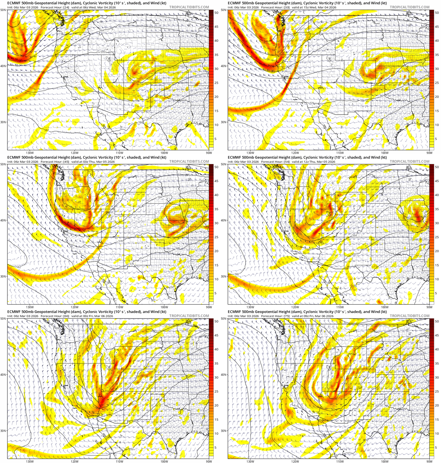
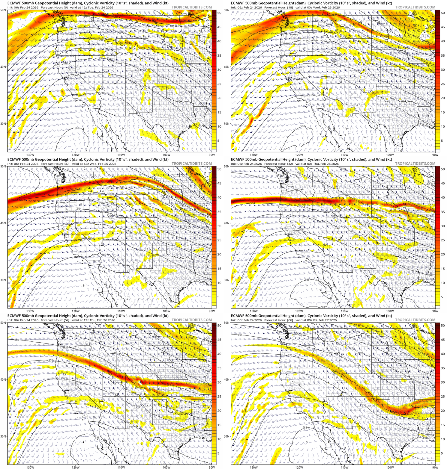
    Despite the robust moisture, the location of the low pressure way out in the Pacific tempers the dynamic forcing of the system, which in turn limits the strength and amount of precip that the Sierra will receive. If the low were closer to the coast, rainfall would be heavier, potentially creating flooding concerns with more rain on snow melt. Note the lack of strong vorticity (atmospheric spin) which favors dynamic lifting in the atmosphere.

    Euro 500mb heights, winds and vorticity from 1000 PST on 2/24 – 1600PST on 2/26.

    In this case, we just get to contend with a significantly degraded backcountry snow pack.

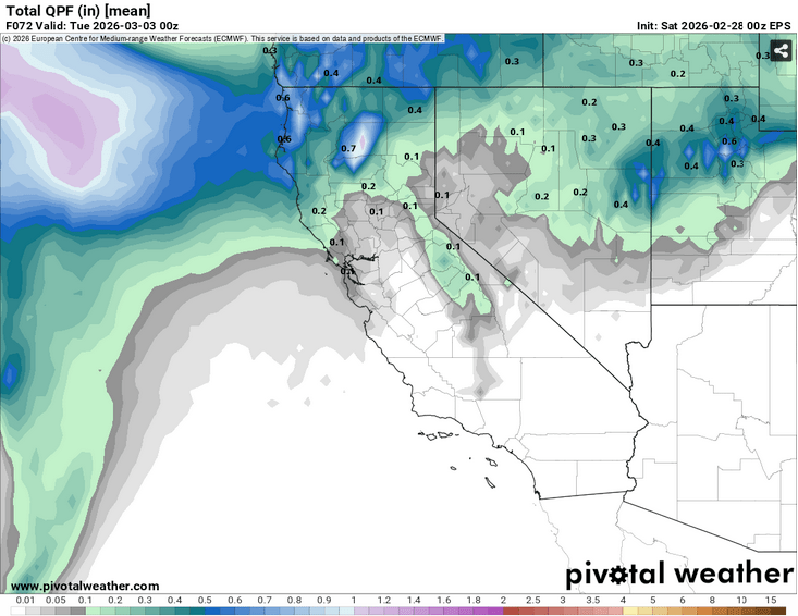
    Behind this week’s system, warm and dry weather returns going into next weekend (2/28-3/1). The low responsible for spinning the subtropical moisture into Tahoe today may eventually trek into the Sierra late this weekend, bringing somewhat cooler temps and chances for rain and high elevation snow Sun into Mon (3/1-3/2). But at this point, backcountry impacts look to be modest.

    Looking way out into the beginning of March, models agree on a return of warm and generally dry conditions with no big, cold systems yet in sight.

    Share this:

    • Share on Reddit (Opens in new window) Reddit
    • Email a link to a friend (Opens in new window) Email
  • Glorious powder… for a limited time only

    February 20th, 2026

    Backcountry obs:

    What a storm cycle! Throughout the region, the backcountry picked up anywhere from 4-6’+ of snow from Mon – Fri AM (2/16-2/20). In Carnelian Bay at 6350′, I measured a storm total of 60″ on my home snow plot, clearing the table every 12 hours. On Tues (2/17) from 0700-1900, 23″ of snow fell — nearly 2″ per hour for the period! The storm obliterated my forecast of 2’+ for lake level communities. The cold air and intense lifting dynamics of the system aligned to dump out every bit of moisture onto the mountains as snow.

    During the storm cycle, the backcountry felt spooky, vengeful, dangerous. I headed out on a few short-lived sojourns into the Mt. Rose wilderness to sample conditions as the storms wound down. A deep, cold, powdery snowpack had replaced weeks of crust, comprised of various layers that collapsed underfoot whilst breaking trail. A tour near Incline Peak on Thurs (2/19) at dawn revealed 108cm (42″) of new settled snow above the antecedent crusts. The new snow depth made travel strenuous and descents rather slow on mellow, non-avalanche terrain.

    This morning (2/20) the day broke cold, crystalline, and brilliant as the sun poked through a few low clouds and precipitating flakes, filling the atmosphere with glistening pixie dust at first light. New snow on south aspects from 7600′-9200′ above Incline Village showed signs of consolidation. Gone was the stepped, trap door sensation under foot while breaking trail, replaced by a right-side up feeling snowpack allowing skiers to sink only up their shins while plodding through the fresh powder. Wind effect was mostly absent except on the highest ridge tops. Pristine was the word of the morn’.

    But change is afoot.

    Weather and forecast thoughts:

    The coming weekend is going to be mostly sunny and cool, with temps moderating on Saturday and Sunday (2/21 – 2/22). Above 7000′, highs on Sat will reach the mid-upper 20s with lows plunging again to the low 20s to upper 10s on Sat night. Sun will be a bit warmer with highs cresting freezing between 7000-8000′ under sunny skies. Winds will also begin increasing out of the SW on late Sun heralding the arrival of a new storm system for the beginning of the week. Currently models show precipitation arriving into the Sierra around late Mon (2/23).

    Unfortunately, models are in good agreement that the coming storm system will be warm and wet, with high snow levels 8000’+ as it taps into a subtropical AR (atmospheric river).

    GEFS ensemble of precipitable water from 2/22 at 0400 PST to 2/26 at 1600 PST

    While there will be ample subtropical moisture, current models show that the parent low feeding moisture into CA will remain far offshore, limiting forcing dynamics over the Sierra.

    GFS 500mb vorticity showing modest dynamics with the low offshore, yet directing a subtropical feed into CA.

    Record breaking rainfall doesn’t look likely, but a solid soaking of rain on snow does.

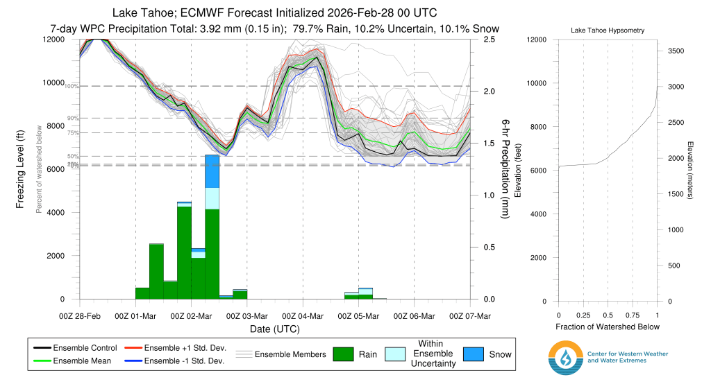
    Freezing level guidance concurs, showing mostly rain for the Tahoe Basin as freezing levels approach 11k before slowly dropping past 8000′ by Weds morning.

    GEFS ensemble for freezing levels through 1000 PST on 2/27.

    As noted by the wide spread in the lines, which represent each ensemble member forecast, there’s still quite a bit of uncertainty as to whether snow levels will fall or remain high on the back end of the storm around the end of the work week.

    So if you have waited all winter for deep, cold powder, this is your moment. Seize it! By next week, the picturesque invernal forests, floaty turns, and soft pillow drops of this weekend will be replaced by soppy, rain soaked snow and fresh anxieties surrounding the remnants of winter.

    Share this:

    • Share on Reddit (Opens in new window) Reddit
    • Email a link to a friend (Opens in new window) Email
  • Just getting started

    February 16th, 2026

    Backcountry obs.:

    The coldest and most robust storm cycle of the season is here and has already dropped several inches of new snow to all backcountry elevations across Tahoe. As of this writing, just about 4″ of new snow has fallen at lake level in Carnelian Bay, with higher amounts above 7000′. Remote sensors as of 1830 on 2/16 indicate between 5″-10″ of newly fallen snow, with the highest amounts along the west shore and Sierra Crest.

    Steady, light-moderate snow fell throughout the day today with freezing levels holding at around 7000′ through most of the day, before plunging well below lake level in the late afternoon. As such, today’s warmth contributed to higher density snow at all elevations from the storm’s onset that is now being buried with colder, low density snow. This is generally a recipe for a right side up snow pack, but layers of varying density storm snow are likely throughout the multi-day event.

    While winds started out fairly moderate around dawn in the 10-20 knot range, they dropped off around midday, before picking up out of the southwest towards late afternoon. Expect SW winds to ebb and flow with each successive wave of snow this week, especially in higher terrain.

    Weather and forecast thoughts:

    This cycle is just getting started. While today’s accumulations around the lake were fairly light by Sierra standards (2-5″), they will continue to stack up as multiple pulses of energy crash into the area over the course of the work week. Temps will also cool, pulling snow levels down to lower elevations and boosting snow totals in the mountains with progressively higher SWE (snow to water equivalent) ratios through Weds (2/18). By Friday (2/20) Tahoe communities are on track to receive 2’+ of new snow, while backcountry zones could gain 3-5’+ of new snowpack. Temps will hover in the low 20s through Thurs (2/19) above 7000′, with teens above 9000′. No need to fret about snow levels with this round.

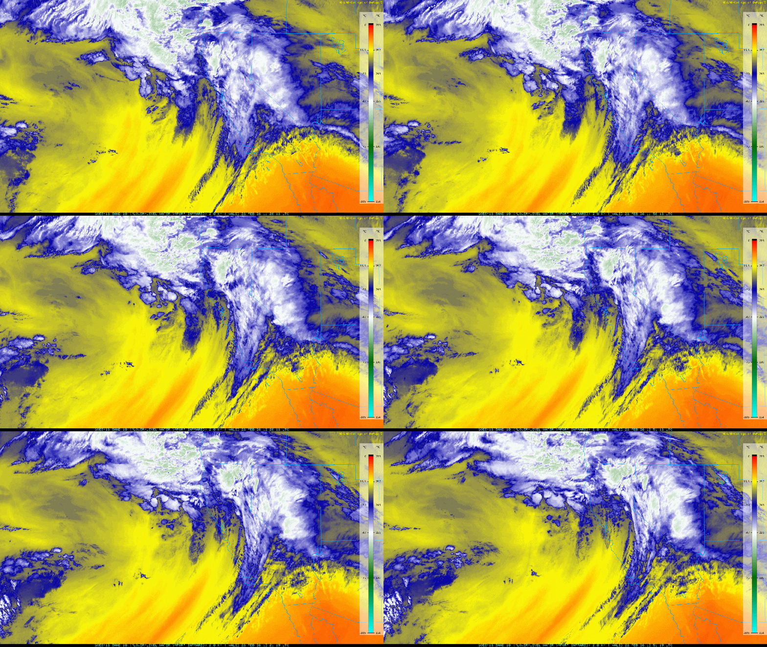
    Current IR satellite imagery shows that the bulk of the upper dynamics from today’s system have moved into the Great Basin. In its wake is cold, highly unstable air, eager to lift up the western slopes of the Sierra keeping nearly constant snow showers going through the evening.

    IR satellite imagery on the evening of 2/16/26.

    Cold snow showers will continue through the overnight and into tomorrow morning with the greatest accumulations occurring along the crest and over higher terrain.

    The pattern keeps going. Tomorrow (2/17) an even colder and more potent low drops in from the Gulf of Alaska triggering another 24 hour round of heavy snow for Tahoe from mid morning through mid morning Weds (2/18). And the gravy train just keeps on coming with additional pulses through Friday evening and possibly into late next weekend.

    EPS ensemble 500mb height anomalies from 2200 PST on 2/16 – 1000PST on 2/22.

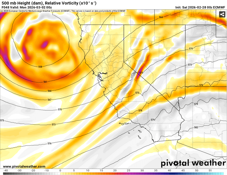
    While the long wave trough pattern opens the door to storms, each individual pulse that drops in will have solid lifting dynamics as noted in models depicting mid level (500mb) vorticity, aka. atmospheric spin. Additional terrain-enhanced lift (orographics) will help to further enhance snowfall rates and totals.

    Notice the yellow and orange vorticity values associated with the curved height lines. The areas just ahead of the highest vorticity values and curves tend to harbor the strongest dynamic lift, and resultant precipitation.

    ECMWF 500mb heights and vorticity from 2200 PST on 2/16 – 0400 PST on 2/20.

    While dynamics with this storm sequence are robust, the biggest limitation to giant snowfall totals is the available moisture with this system. Earlier storms this season had a subtropical moisture source delivering copious moisture, but also warmth, translating to stubbornly high snow levels and dense, thick snow. This go around moisture is more limited and not associated with any subtropical AR’s as noted in the Euro model for atmospheric relative humidity through the week and into the weekend.

    ECMWF atmospheric relative humidity and mean wind values (700-300mb) from 2/16 at 2200 PST – 2/22 at 1000 PST.

    However modest this moisture might be, the robust dynamics and cold air mass of the pattern will conspire to make the most of atmospheric moisture, creating impressive multi-day snow totals of quality, low density snow.

    ECMWF 10:1 snow totals through 2/20 at 1600 PST.
    GFS 10:1 snow totals through 2/20 at 1600 PST.

    While there is some discrepancy in the current models on where the heaviest snow will fall, a solid cycle dropping multiple feet on Tahoe is the most likely outcome. By week’s end Tahoe communities will likely have 2’+ of fresh snow while backcountry zones above 7000′ could rest beneath an addition 3-5’+, especially along the Sierra Crest and points south of Tahoe. Mammoth and June, you’re in the sweet spot again…

    And sneaking a peak beyond the week, models suggest the cold storm parade will march on into the weekend and the following week.

    Winter’s back!

    Share this:

    • Share on Reddit (Opens in new window) Reddit
    • Email a link to a friend (Opens in new window) Email
←Previous Page
1 … 3 4 5 6 7 … 52
Next Page→

Create a website or blog at WordPress.com

Loading Comments...

    • Subscribe Subscribed
      • Tahoe Backcountry Snow
      • Already have a WordPress.com account? Log in now.
      • Tahoe Backcountry Snow
      • Subscribe Subscribed
      • Sign up
      • Log in
      • Report this content
      • View site in Reader
      • Manage subscriptions
      • Collapse this bar