Backcountry obs.:
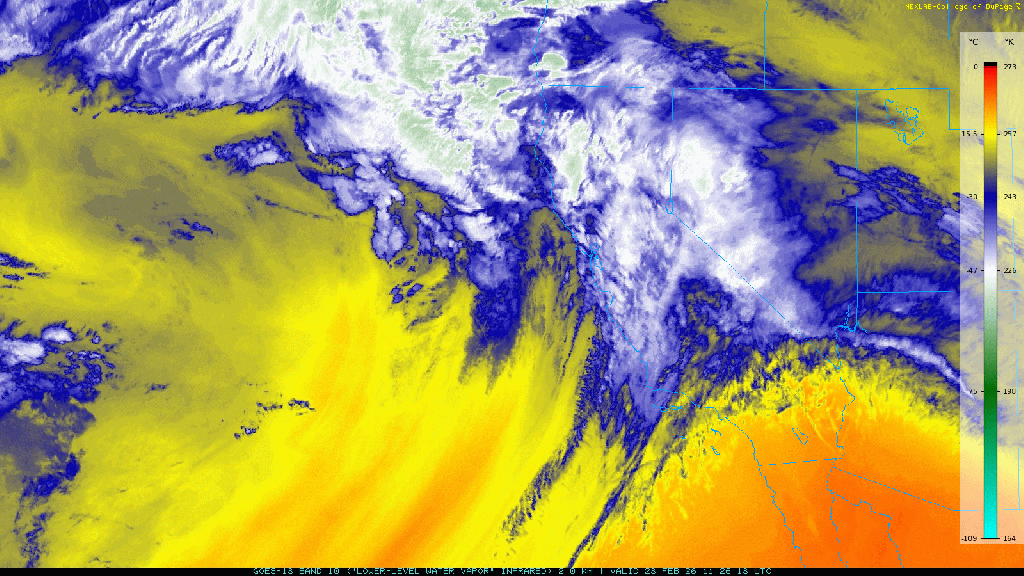
Colder overnight lows have finally returned offering solid overnight refreezes to the snowpack and a slowing of last week’s dramatic melt. Last weekend’s disturbance brought in a cooler, more seasonable air mass and spritzes of new snow across the backcountry.
A tour through the Rose backcountry between 8650′-9700′ at dawn on Mon (3/2) revealed a solidly refrozen and supportable surface, comprised of inches-thick rain/melt freeze crust. Runnels from the recent rains still exist but have mellowed, making for smoother skiing. The Sun (3/1) system that brought rain to lower elevations, dropped a trace to .5″ of snow across the Rose backcountry. Treed lee areas retained the most new snow, while ridges and open bowls had been scoured down to bare crusts. Even the deepest pockets of dust offered little more than a dampening of the fast, scratchy chatter made with each turn. Ski crampons and whippets recommended.
Now that the Sierra seems to have definitively shifted out of powder season, the corn chase is on. Enough cold air has finally returned to refreeze the surface each night, while sunny skies and above freezing temps each afternoon are surely softening the surface into buttery corn.
Worth noting is that below 7500′, the snowpack is quickly retreating, especially on solar aspects. There’s not much ski season left.
Weather and forecast thoughts:
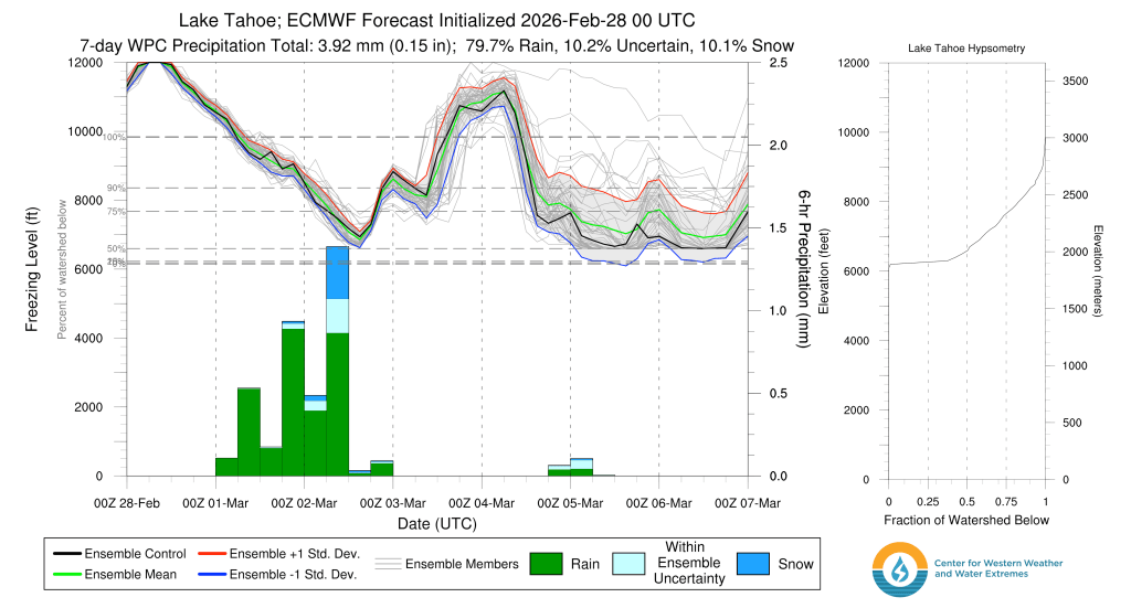
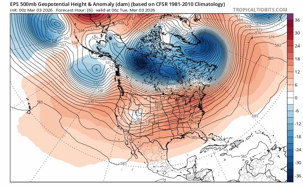
Spring-like weather is here as noted by the arrival of warm sunny days interspersed with quick-hitting cool disturbances. Today (3/3) will be sunny and warm with high temps reaching the low-mid 40s in the backcountry with lows cooling back to the upper 20s. Tomorrow (3/4) a relatively weak and moisture-starved shortwave trough drops in from the PacNW. Winds and clouds will increase, along with the chances for snow showers, especially over higher terrain. Late week and into the weekend, dry conditions return with near to above normal temps, continuing on into the second week of March.
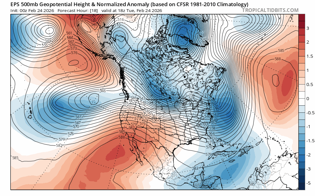
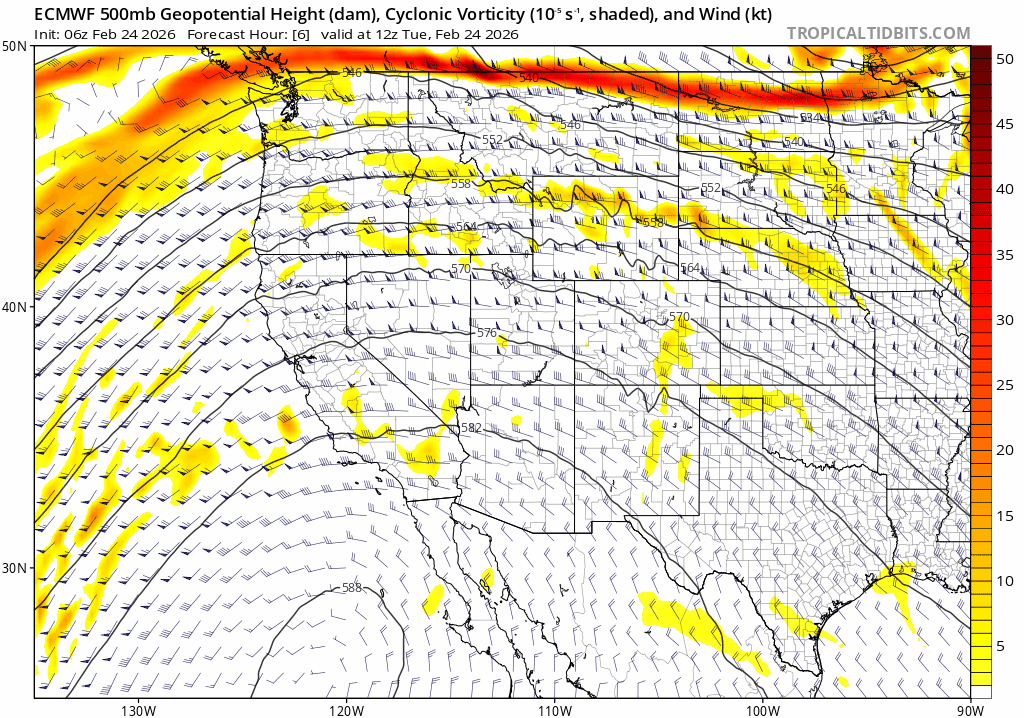
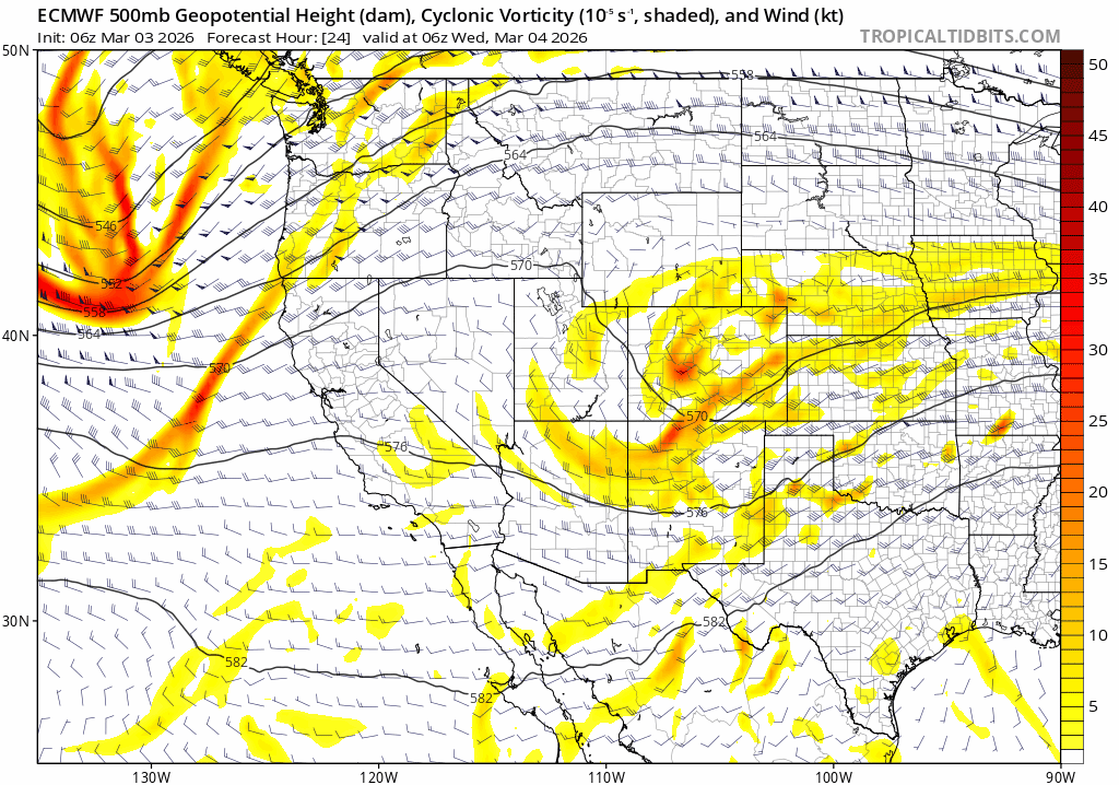
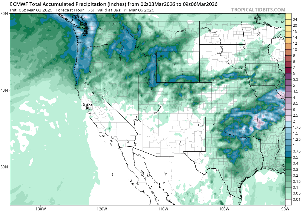
As noted above, tomorrow’s quick hitting system splits off from a trough of low pressure in the PNW, then drops down across the Sierra and Western Great Basin on Weds and early Thurs (3/5 – 3/6). Due to its trajectory in from the NW, the system will be cooler with snow levels around lake level. However, despite middling lifting dynamics and a cooler source region, the system is unlikely to create much impactful precip with total snow amounts between 1-4″ with the highest amounts along the Sierra Crest.
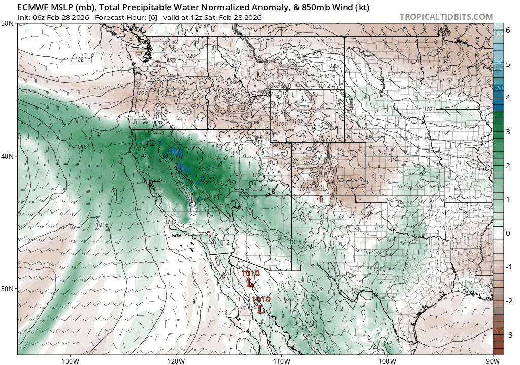
Atmospheric lifting dynamics, as noted by vorticity and 500mb heights through early Fri AM (3/6), do show sufficient lift and instability to create modest rain and snow, especially with the added influence of springtime surface warming on Weds afternoon.
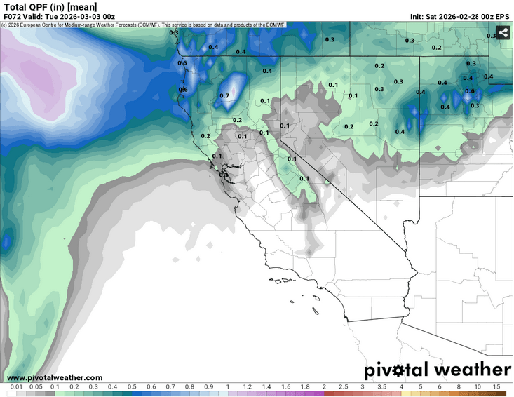
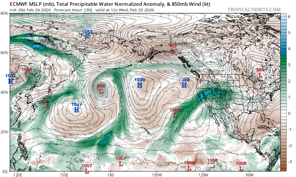
But despite the dynamics, models for the same period consistently show the system starved for moisture, as noted by meager precipitable water anomalies:
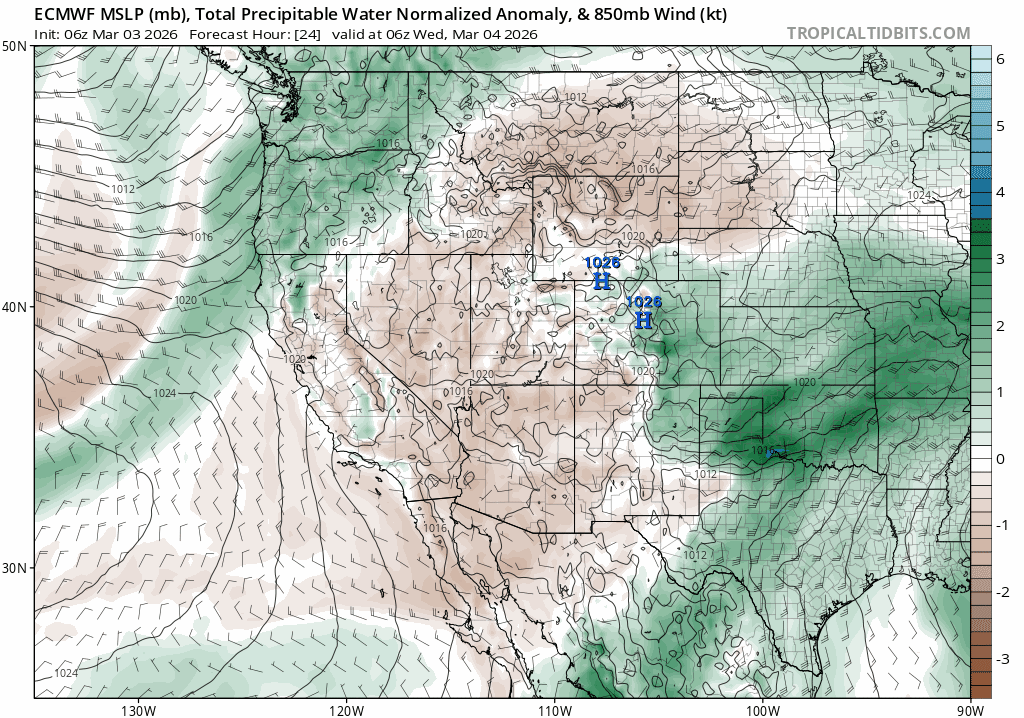
By late Thurs night into Fri (3/5-3/6) total liquid precip. amounts look very light, with only up to .5″ falling near the Sierra Crest.
Behind the system, cool N and NE flow will keep temps down near seasonal levels Thurs – Sat (3/5 – 3/7) with highs above 7000′ in the 30s and 40s. Moderate N and NE winds will also chill the peaks through Sat AM before slackening over the weekend.
Sun (3/8) into next week, warmth will slowly rebuild as a long wave ridge of high pressure rebuilds over the East Pacific, also blocking any potential storms from rescuing the quickly receding snowpack.
Apart from this week, it’s time to shift the backcountry mindset from pow to corn.