Backcountry obs:
0500 temp at 8400′ Mt. Rose backcountry TH: 23 deg. New snow: 2-3+’.
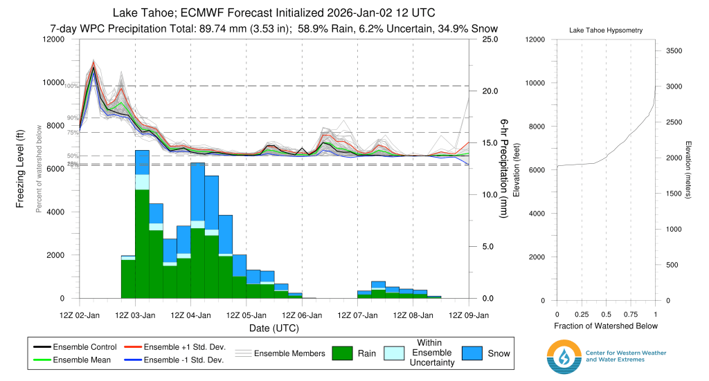
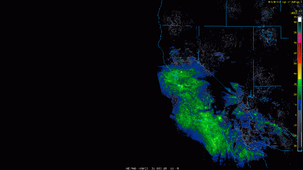
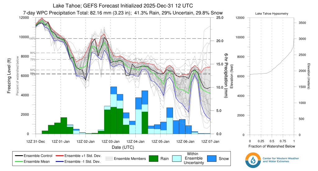
The backcountry’s doing alright. A multi-day day storm from 2026’s first weekend dropped feet of new snow across the area above 7000′., with the greatest amounts focused along the Sierra Crest. Much like the Christmas storm cycle, the recent storms were not all that cold, starting as rain at higher elevations, before cooling off just enough to allow feet of high density cement to further deepen the snowpack. Despite the warmth, the storms bolstered the snowpack giving the nascent season a bit more longevity should prolonged drier weather move in.
Touring above Incline Village at dawn on Mon. (1/5), I found multiple feet of new, wind affected snow starting at 8400′ all the way to 9500′. Ski tracks from the previous day had been either filled or sculpted into elegant mounds and fins. Even in sheltered forested areas, winds had added texture and density changes to the new snow. In open areas, a soft, breakable wind board had formed with notable, yet nonreactive wind slabs across lee micro-features. Sheltered trees held the least affected snow, but layered, upside down density changes throughout the high density snow created notable friction underfoot on the descent. Not effortless snow, but still generally fun at speed if given an assertive pop to each turn. However, the wind affected and layered new snow did raise a few flags for stability concerns.
Weather and forecast thoughts:
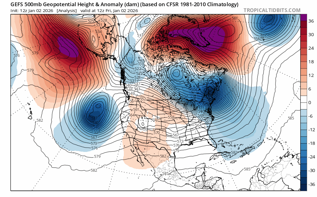
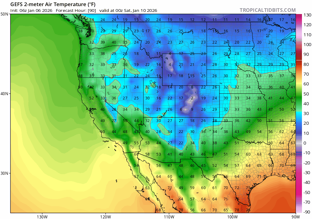
The active pattern responsible for the last storm cycle will wind down throughout the coming week (1/6-1/9), but not before another weak system brushes the area on Weds PM (1/7) bringing chances for another few inches of accumulation to the higher terrain. Temps will be at their warmest for the work week on Tues (1/6), reaching the low to mid 30s above 7000′, before falling back into the 20s for highs Weds – Fri as the approaching system brings in a reinforcing shot of cold air. Expect SW winds to pick up in advance of this next system, before slackening and switching around to the N and E on Thurs and Fri as its attendant low shifts south and eastward.
The system swinging through on Weds PM-Thurs AM will have an “inside slider” identity, bringing cold air and lighter snow amounts, so high snow levels won’t be an issue this time around. The colder airmass will bring lower density snow to rest atop the feet of high density base deposited over the holidays.
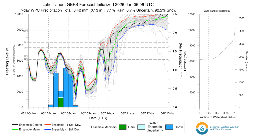
As with most inside sliders, snow totals will be generally light this week. Expect 2-5″ across the backcountry with lesser amounts across the southern half of the Tahoe Basin and at lower elevations. Models still have some spread in forecast snow amounts giving lower confidence in higher end totals.
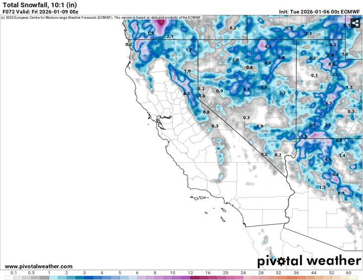
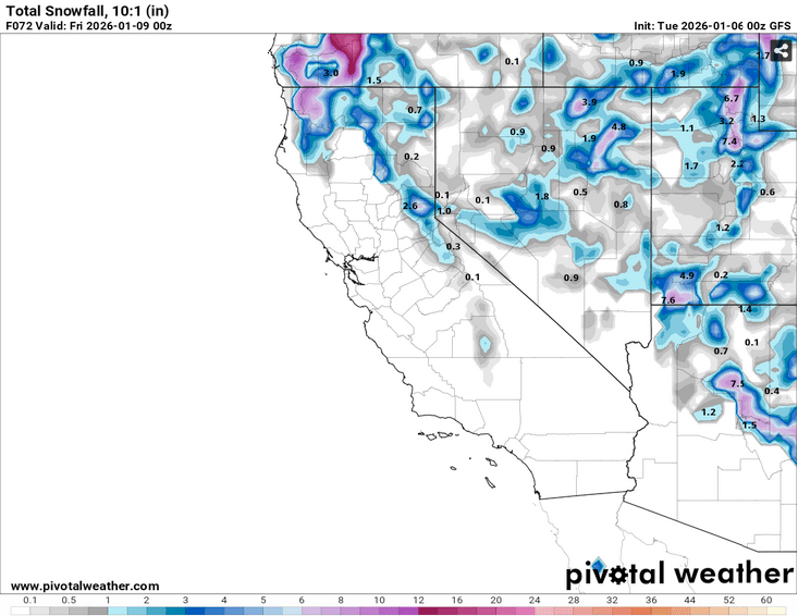
Once the midweek system departs, NE flow will bring in a reinforcing shot of cold air, preserving the new snow. Model guidance doesn’t suggest a strong NE wind event on the backside of the system, but some 10 – 15 knot breezes on ridge tops aren’t out of the question.
Looking ahead to next weekend, ridging looks to take hold over the West Coast, ushering in clear skies, light winds and moderating temps. for the weekend and well into next week (1/12-1/16). Expect the return of daily inversions with cold nights in depressions and valleys with warmer temps on the peaks, yet under a dry airmass. Model ensembles suggest high temps this weekend starting cool, then warming a few degrees each day. By early next week, temps will warm further to a few degrees above average, but likely avoiding any large scale June-uary heat events.
Considering the abysmal start to the winter, the backcountry’s actually in pretty good shape. Low sun angles, and an ample snowpack should help the backcountry weather the upcoming mild stretch quite well.