Backcountry conditions:
Backcountry weather across the Tahoe Sierra this summer has been generally pleasant and unremarkable, alternating between periods of warm and dry conditions, interrupted by multi-day intervals of monsoonal flow and occasional afternoon thunderstorms. While temps trended above average for June through August, periods of extended extreme heat were few and generally short-lived.
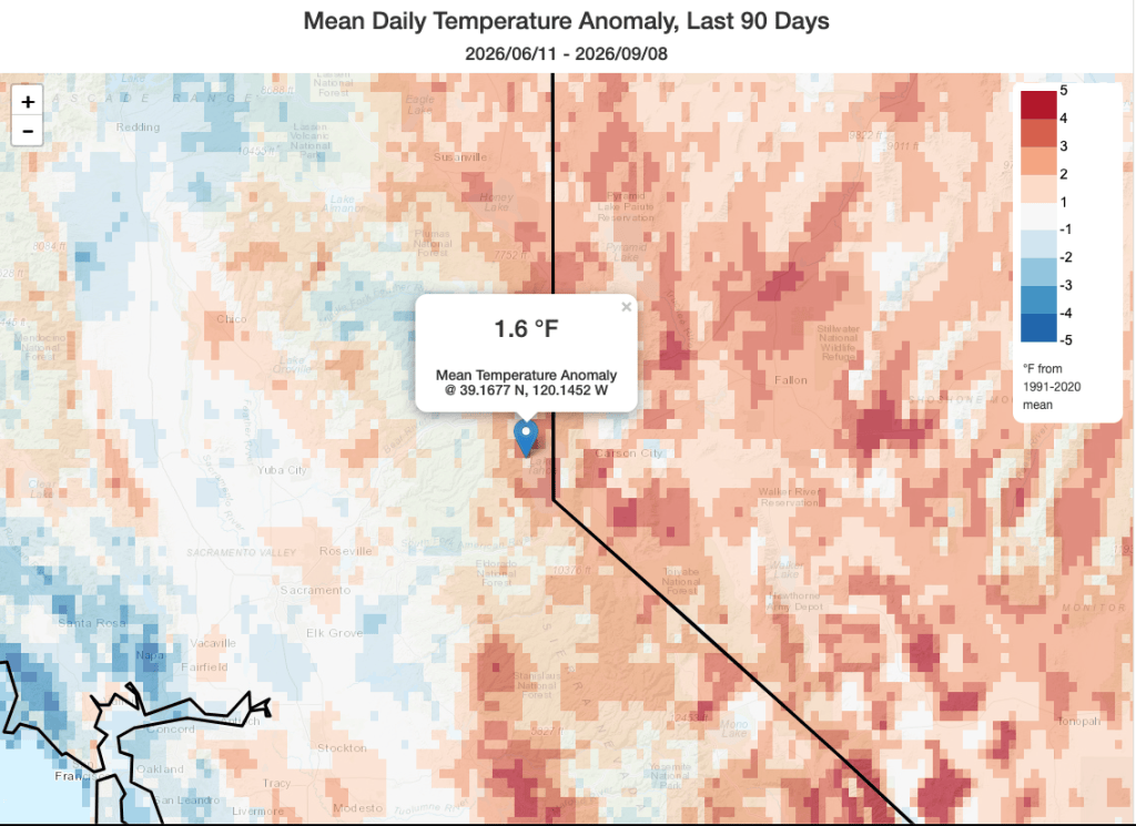
Now that summer’s zenith is behind us, backcountry trail conditions have reached peak dust. A few recent systems brought localized rainfall around the end of August/beginning of September, but whatever moisture fell has long since evaporated, leaving plentiful moon dust that lofts at the slightest breeze or footstep. Meadow wildflowers long-since browned and gone to seed, are now replaced by the late summer soundtrack of crispy mules ear leaves, rustling in the breeze.
El Niño Update:
El Niño is here, and its impacts are already being felt. Anomalous sea surface warming across the eastern equatorial Basin intensified over the past few months, all but assuring a strong to very strong event continuing into the fall and early winter. Models are in nearly unanimous agreement for a powerful event that will likely create significant global impacts for the remainder of 2026 and into the first half of 2027.
Already, hurricane season in the eastern Pacific has been supercharged by warm waters and low upper level wind shear, creating an ideal environment for tropical development. During the first week in September, a conga line of three hurricanes (Lowell, Karina, and Marie) stretched across the Pacific from Mexico to Hawai’i!
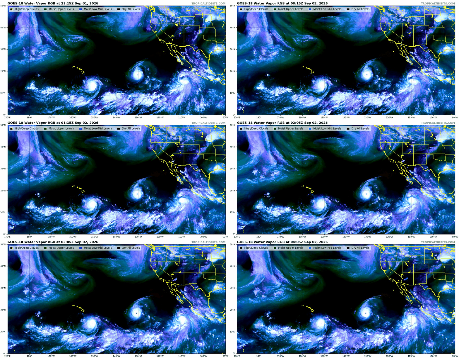
Not only is the signature of El Niño obvious, but record warm sea surface temperatures (SSTs) now extend far north of the main Niño 3.4 region, even reaching the Southern California coast and Hawai’i, providing plenty of fuel for tropical systems.

Warm ocean waters aren’t just fueling hurricanes in the tropics, they’ve made southern California feel more like Florida with hot and muggy afternoons and isolated thunderstorms. Remnant tropical moisture advecting northward has introduced unseasonable instability into the region, helping to fire off afternoon thunderstorms in the summer heat over the past few weeks.
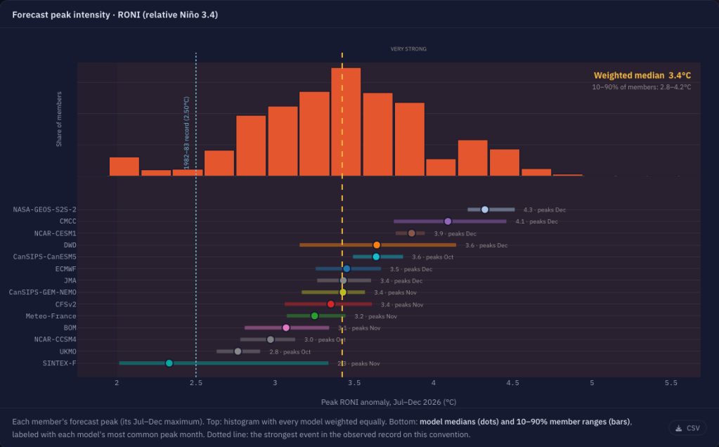
Looking ahead, models indicate further strengthening of El Niño going into the fall and early winter, likely peaking in record territory around Nov-Dec. The greatest share of forecast models predict a median relative (RONI) peak of 3.4°C above normal. To put this in context, the big 1982-1983 event topped out at 2.50°C.
Existing data and research suggest that strong, east-based El Niños tend to enhance the subtropical jet stream in the East Pacific and increase atmospheric water vapor and energy in winter, creating a favorable environment for an active storm train and above average precipitation across CA, especially in central and southern CA. For more on El Niño and its typical impacts on weather across North America, check out the explainer post from June.
Winter 2027 Outlook
Even as a strong El Niño is nearly certain for the remainder of the year, its exact impacts on the Sierra for the coming winter are anything but. El Niño might be the loudest of this season’s teleconnections, but other atmospheric phenomena will impact winter weather patterns, affecting Sierra storms throughout the season.
Furthermore, humans have never experienced an event of such intensity in a global climate ~1.5°C warmer than pre-industrial levels. It’s warmer this year than during any previous, recorded El Niño, and that will impact how things play out. Finally, the sample size with which climatologists are basing their understanding is small, dating back to only around the 1950s. Despite a world of technology, data, and professed certainty, there is still so much unknown in understanding the climate system. Interpreting a seasonal forecast with humility is good practice. This is uncharted territory.
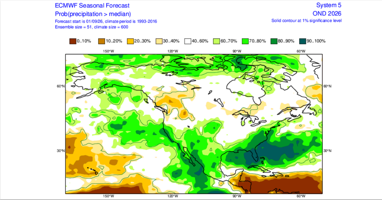
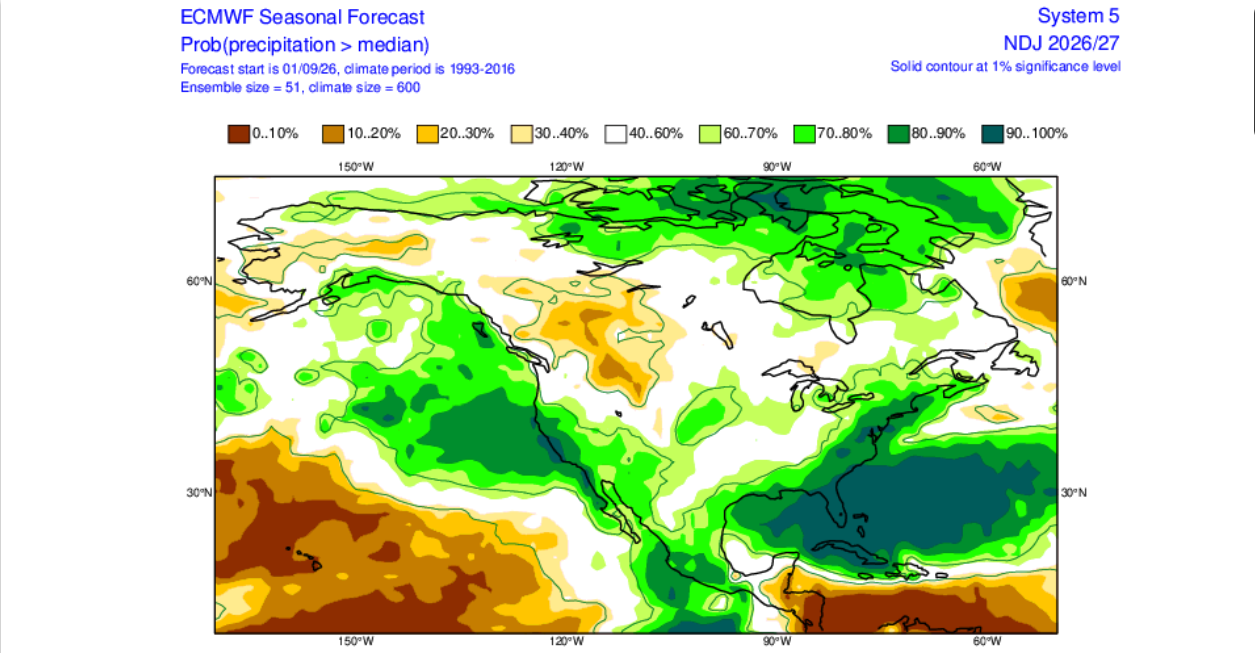
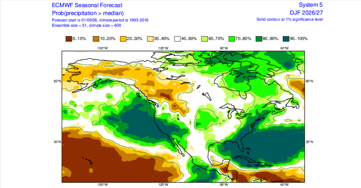
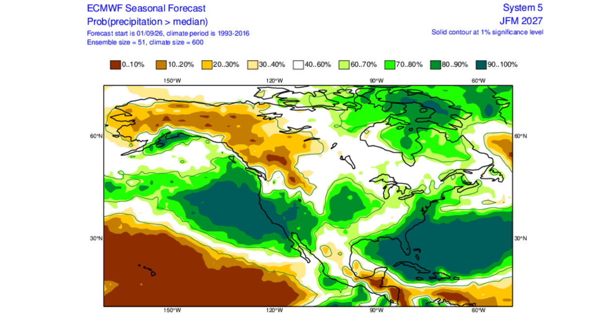
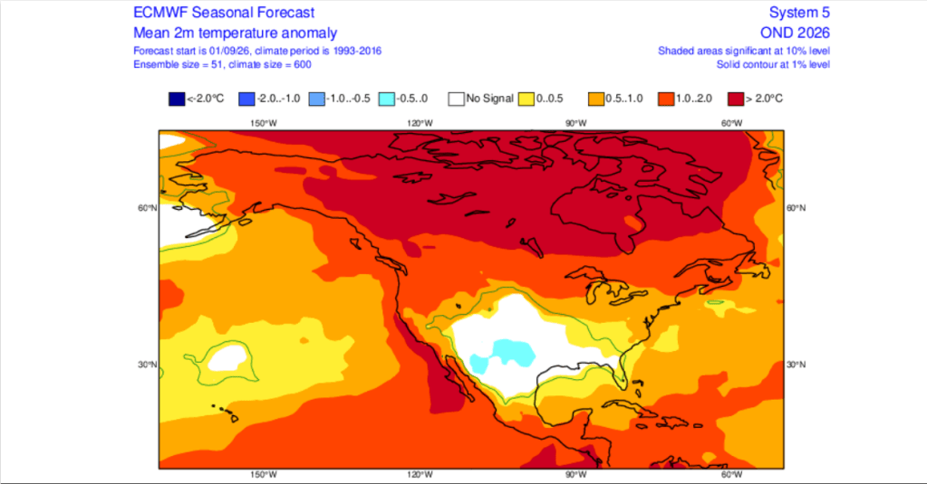
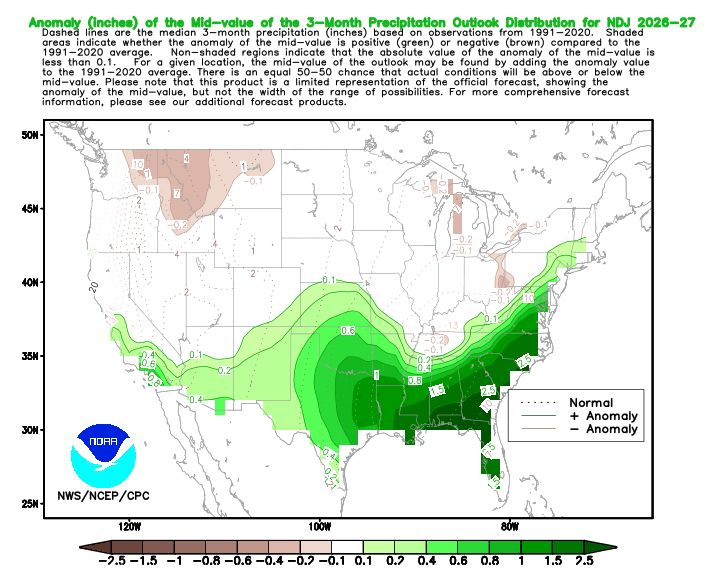
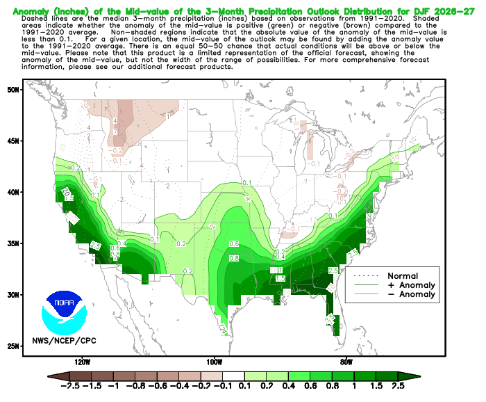
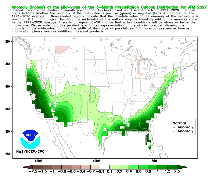
With the caveats covered, the Euro (ECMWF) and NOAA’s Climate Prediction Center (CPC) seasonal forecasts are out, which are beginning to shed some light on what could come to pass for the coming winter. Below is a slideshow of departures from normal probabilities for precipitation and temperature from the most recent early September runs of the ECMWF and CPC forecasts.
ECMWF Precipitation Forecast (Probability of departure from the median)
ECMWF Temperature Forecast (Anticipated ground-level temp anomaly)
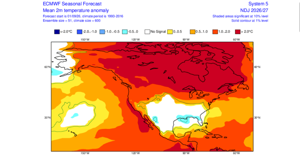
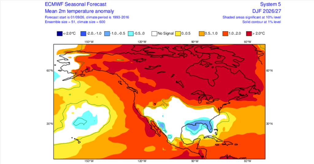
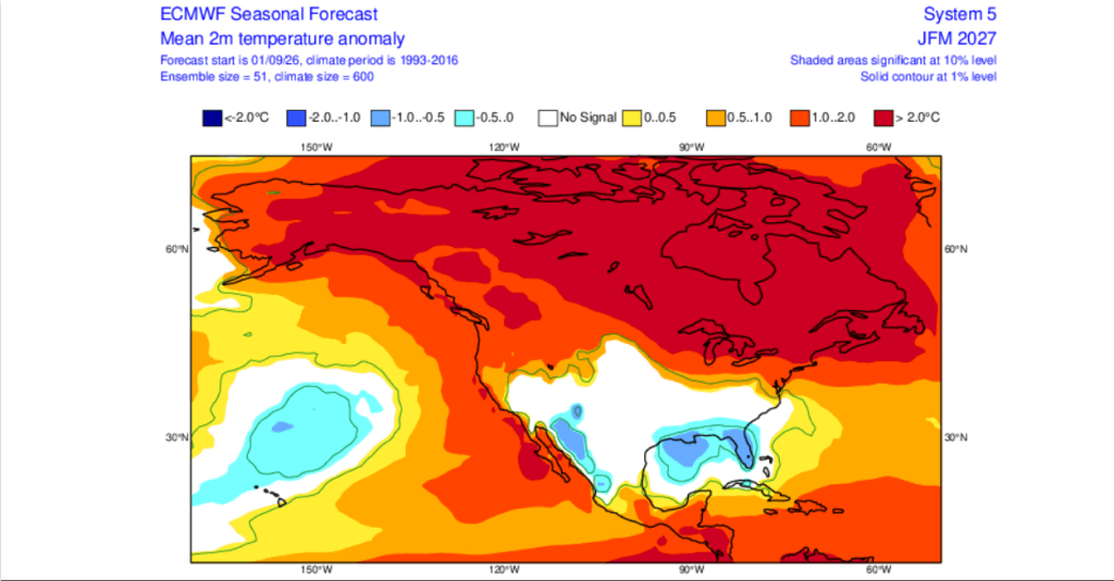
NOAA/CPC Probability of Exceedence (POE) Precipitation Forecast
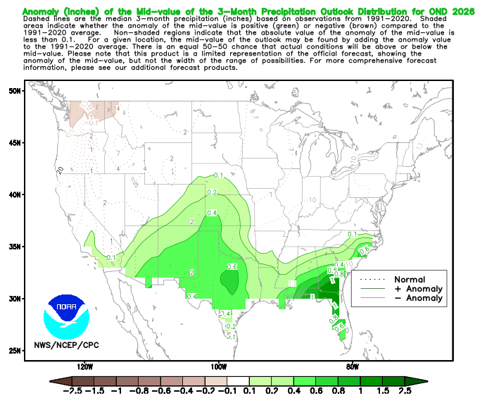
NOAA/CPC Probability of Exceedence (POE) Temperature Forecast
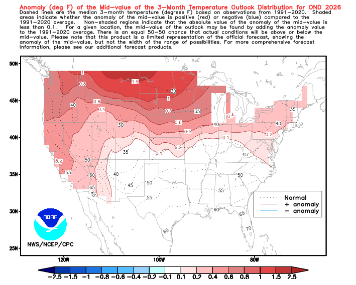
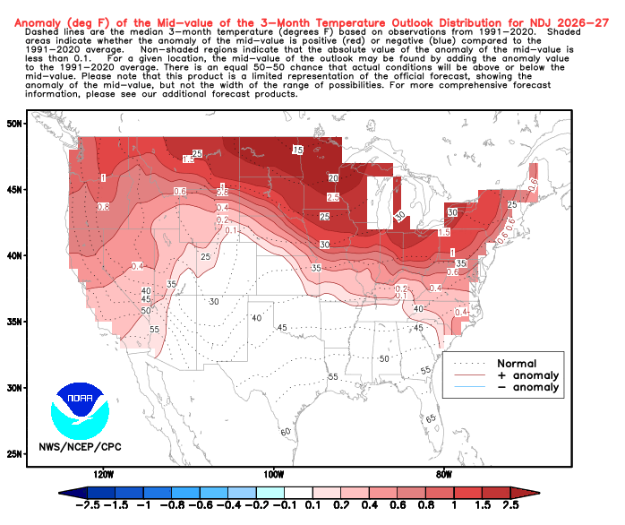
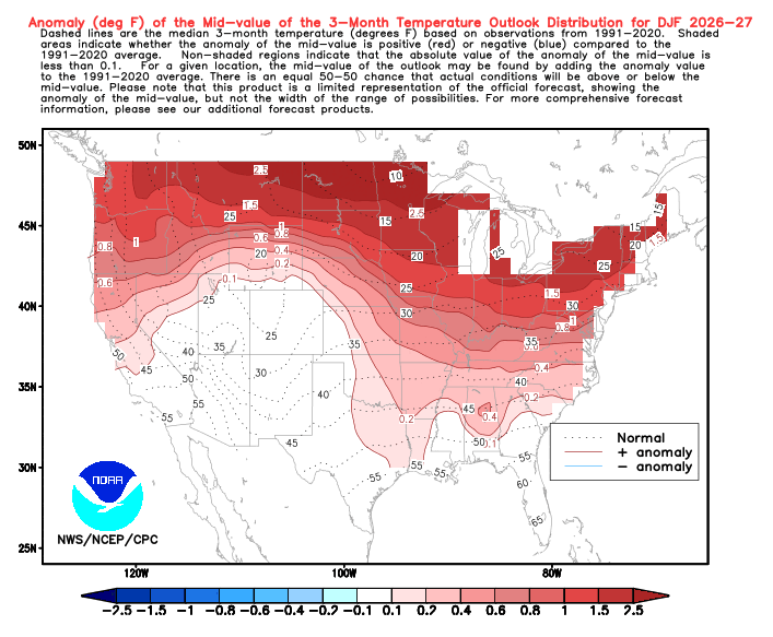
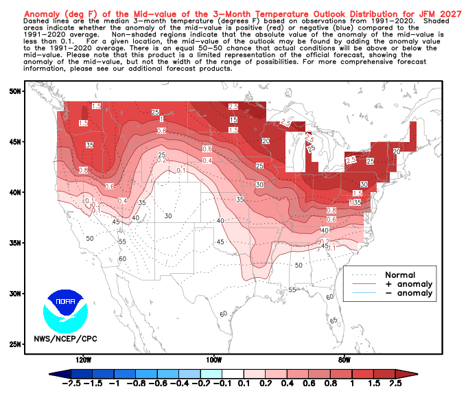
While there are some differences in the models with regard to timing and intensity of the precip and temperature anomalies, both agree on an increased likelihood of a warmer and (much) wetter winter than normal.
What this all means and how it plays out is still anybody’s guess. One key factor will be just how much additional warmth from the ocean translates into higher snow levels, denser snow, and more rain vs. snow events. Will an enhanced storm track and more available moisture phase with cold air out of the Gulf of Alaska to produce monster dumps, even at lake level? Or will a pattern of warm atmospheric rivers emerge with high snow levels, washing out lower elevation zones?
It’s all in play. Time will tell.
 Tahoe Backcountry Snow