Backcountry Obs.:
There’s fresh snow out there. Daily thunderstorms from the most recent storm dropped a few inches of snow at the highest elevations, mainly above 9000′. The storm system responsible for the unsettled weather arrived on Sat (5/2), triggering a daily barrage of showers and storms through today (5/5). Snow levels during the event started high, then dropped to nearly 7000′ by the evening of 5/4, and by midnight, a few inches of snow had fallen across the Mt. Rose area above 7500′. Despite the fresh snow, it mainly fell on dirt except at the highest elevations and in N facing zones where access now requires hiking in, before reaching a continuous, skiable snowpack.
Trail conditions below 8000′, however, are currently excellent–and fragrant too with the multitude of flora bursting forth for the season. Daily rainfall since Sat (5/2) has been generally light to moderate with .10″-.50″ falling each afternoon, tamping down dust and creating a soft, springy surface on which to run, hike, or carve by bike. Below 8000′, trails are generally open with the occasional snow patch on shady N facing terrain. Above 8000′, and along the west side of the lake above 7000′, trails are still snow covered, but quickly burning out.
The recent rains and retreating snowpack make for an abundance of water flowing in most creeks and rivers, yet at moderate, past peak flows, facilitating simple, stress free creek crossings. Because peak melt already passed in late March and early April in response to the multi-week March heatwave, stream flows will steadily decline with spring’s progression.
Weather and forecast thoughts:
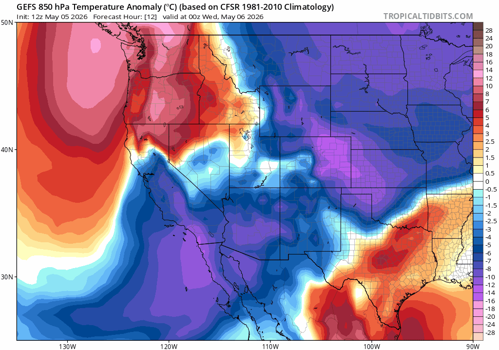
The storm system responsible for firing off daily storms since Sat (5/4) will finally move out of the area this evening (5/5), setting the stage for sunny skies and warm temps for the remainder of this week and the coming weekend. Beyond next weekend, models are in good agreement for even more warmth and sunshine as robust ridging builds in across CA into the week of May 11th.
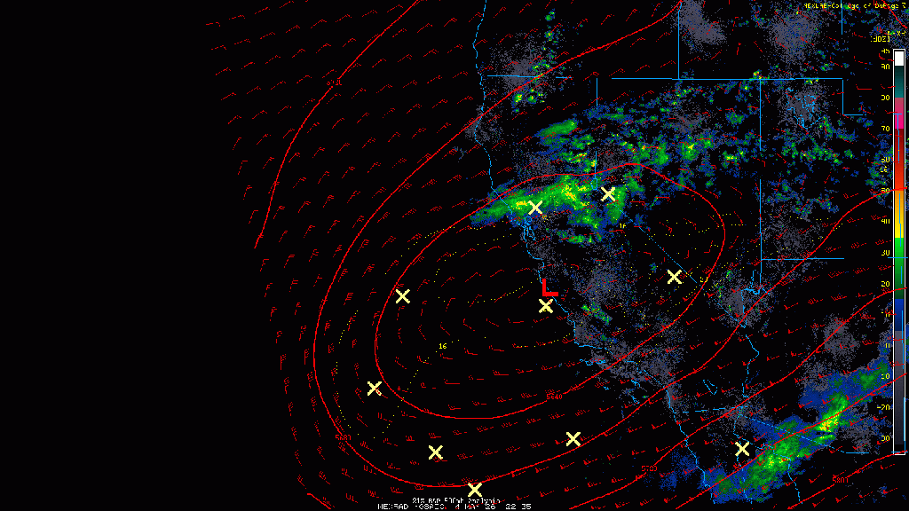
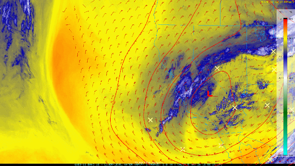
The stubborn, cut off low that has meandered off the CA coast since the weekend created some impressive storms and rainfall across Tahoe. Storms brought a mixed bag of lightning, hail, graupel and even snowfall on Monday evening. I even received a report of a backcountry traveler in Johnson Canyon having to shelter from nearby lightning on Sun afternoon (5/3)!
The heaviest and most consistent rain set up on Mon (5/4/) as a deformation zone formed right over Tahoe and the I-80 corridor, bringing a train of heavy showers and storms that transitioned to a wet snowfall late in the evening above 7000′. By Tues morning, the rain and 2″ of snow melted down to a total of 1.08″ of liquid at a 7650′ remote sensor above Incline Village.
This evening the low pressure responsible for the active weather is finally moving off to the east. In its wake, clearing skies and cool overnight lows are expected tonight with lows in the low 40s in the mountains, with mid-upper 40s around the lake and in Truckee. Dense morning fog is possible for valley floors tomorrow (5/6) as abundant low level moisture and calm, clear conditions provide an ideal setup for nocturnal radiation fog.
Tomorrow (5/6) high pressure begins to build over the area keeping skies clear and boosting afternoon temps. Highs will reach the mid- upper 50s above 7000′ with 60s in mountain communities. As the week wears on, temps will climb a few degrees each day going into the Mother’s Day weekend with highs into the 60s in the upper elevations with low – mid 70s possible around the lake.
Nighttime lows throughout the period look to cool efficiently each night in the dry airmass under mostly clear skies. Where snowpack does persist at the highest elevations (around and above 10k ft), a weak corn cycle may still hold on across open N facing slopes and bowls.
Looking out into next week, model ensembles show good agreement in the ridge of high pressure peaking early before gradually ebbing later in the week.
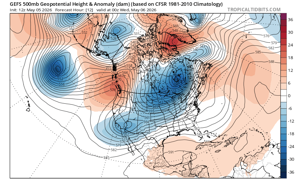
In response, temps will likely peak during the first half of the work week before cooling off towards the weekend with little chance of any precip during the period.
After nearly a month of warmish weeks and cool, unsettled weekends, the pattern looks to finally flip this coming week heralding spring’s arrival to the mountains.
