Backcountry obs.:
The recent cool and showery pattern of recent days continues to foster varied spring conditions across the Tahoe backcountry on both trails and the remaining snowpack. As of dawn on Sun (4/26) and Tues (4/28), usable snow had become interrupted with large dirt patches at TH elevation in the Mt. Rose area, requiring some route finding to enter and exit with skis. Above 9000′, coverage is largely consistent on N and E aspects, yet on a deflating snowpack: rocks and stumps are emerging, along with the occasional section of summer trail. Recent cold temps have been great for the melt freeze cycle, creating firm, supportable and delightfully-textured snow. Morning ascents tend to be quick and grippy underfoot, while descents are firm and fast, yet confidently edgeable.
High elevation N facing bowls near 10k ft, still hold pockets and panels of soft, wind-deposited fluff, composed of layers of light accumulations from recent afternoon snow and pellet showers. If they haven’t already, these areas will transition quickly to melt freeze crust with incoming warm and sunny days for the rest of the week.
Weather and forecast thoughts:
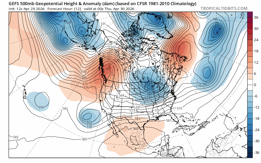
Today (4/29) marks the first day truly sunny day since the past weekend with mostly sunny skies and no afternoon showers across Tahoe. The rest of the work week and first part of the coming weekend look to bring moderating temperatures and a mix of clouds and sun through Sat (5/2) as a transient ridge of high pressure sets up over the Pacific NW, largely shielding the Sierra from unsettled weather.
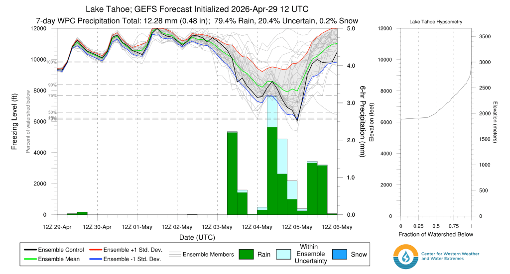
Above 7000′, highs will range from the upper 40s to mid 50s on Thurs (4/30), climbing a few degrees higher Fri-Sun (5/1-5/3), before cooling off back into the 40s for the beginning of next week. Lows for the period will cool into the mid to upper 30s most nights with valleys and depressions cooling to around freezing in the calm, stable airmass. Surface refreezes on the remaining snowpack are a good bet for the backcountry through the weekend.
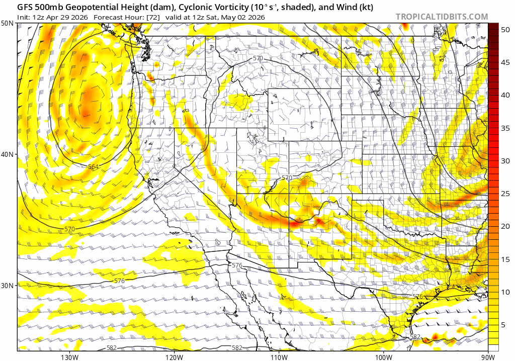
The reprieve from unsettled weather is thanks to a building ridge of high pressure over the Pacific NW, which model ensembles show remaining in command until late Sat and into Sun (5/2-5/3). However, around midday Sat, a cut off low looks to pinch off the Pac NW ridge, then drop down the coast, deepening and strengthening along the way.
As the low approaches CA, it looks to strengthen, bringing good dynamic forcing along with it, as noted in 500mb height, wind, and vorticity (atmospheric spin) analysis below. The low and its favorable, lifting dynamics approach late Sat, then meander and spin their way slowly into Central CA through Tues (5/5), before ejecting out to the east.
Moisture with the system is not terribly organized, so a widespread, heavy rain/snow event currently looks unlikely. However, when coupled with the incoming dynamics of the approaching low, there will be sufficient precipitable moisture to help fire afternoon showers and thunderstorms, especially Sun – Tues (5/3-5/5).
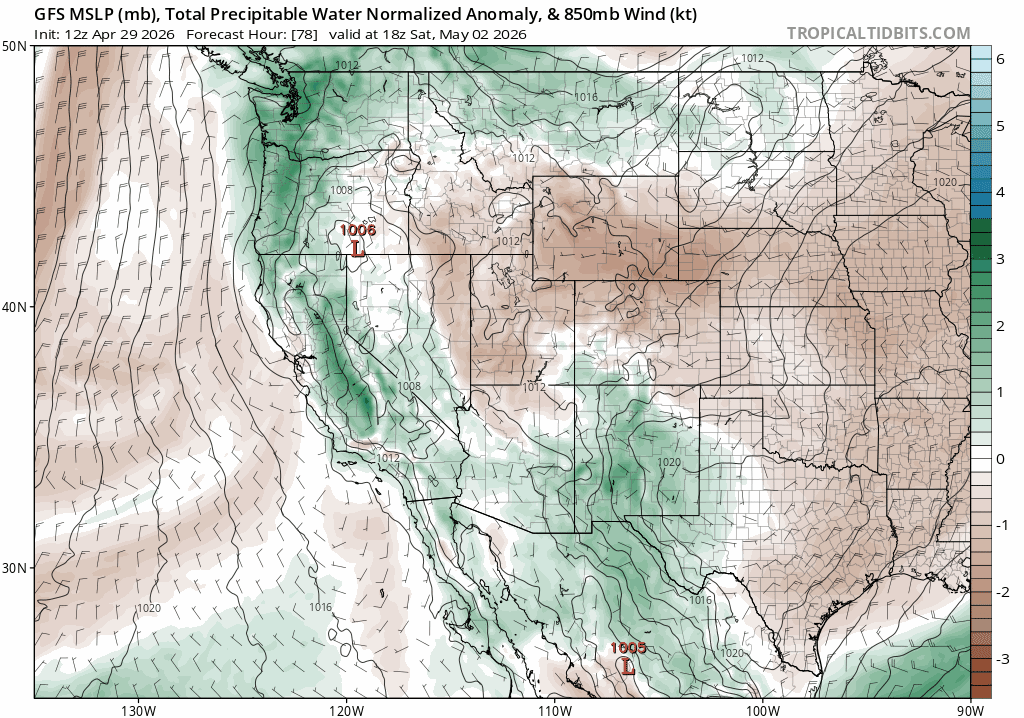
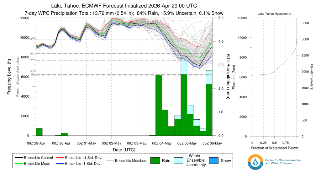
This far out, forecast confidence for snow level predictions is pretty low, but based off the NW origin of the low, temps will fall with its arrival, and so too will snow levels. Both the ECMWF and GFS have quite a bit of spread in their freezing level predictions, but do show agreement on a marked drop in snow levels–and an increase in precip chances– throughout the day Sun into Mon (3/3-3-4) and persisting into the middle of the first week in May.
This is a tricky pattern. Although the incoming system looks similar those throughout much of the past month, it too will have its own personality. Expect changes to the forecast timing and character of the system as its arrival draws nearer.
For now, expect warmer and drier weather through Sat, with mainly sunny skies. Clouds will increase on Sat with the approaching system, along with SW winds. Cool temps and periods of showers and afternoon thunderstorms are likely Sun lasting through the middle of next week.
Looking beyond to end of next week, models hint at the return of warmth and sunshine once this weekend’s system finally kicks out, perhaps lasting longer than just a few days.
Get out and enjoy the spring sun and remaining snow while they last. More change is in the offing.
