Backcountry obs.:
Cool nights, sunny days and occasional winds helped promote excellent spring skiing across the highest Tahoe backcountry zones this past weekend (4/17-19). Heading out at dawn on 4/19, I found mostly supportable melt-freeze conditions across the majority of aspects above 8600′ in the Mt. Rose backcountry. Transitional, yet frozen winter snow, adorned with breakable crusts, topped the snowpack in high north facing bowls above 9000′. Well-frozen spring corn at various degrees of development blanketed the rest of the backcountry on E-S-W aspects. High clouds and a 10-20 knot SW wind slowed surface melt until mid-late morning on Sun (4/19) when clouds dissipated, and the sun finally got to work softening surface snow.
Popular zones are heavily tracked with multiple skin tracks and deep ruts left behind from late day skiers sinking deep in water-logged snow, while untracked, clean surfaces are more common than not further afield. A refresh would be nice.
Wx. and forecast thoughts:
A deep, closed low inching its way into northern CA today will deliver the desired refresh to keep backcountry season going. Today (4/21) rain and snow showers will increase in coverage and intensity during the day and into tonight, potentially dropping up to a foot+ of new snow along the Sierra Crest and highest terrain by dawn Weds (4/22). Snow levels will start around 7000′ at daybreak today, then fall to lake level and below by this afternoon. East of the crest and below 7000′, expect a nuisance few inches for most Tahoe communities. Behind today’s system, cool temps and sunshine return to the area for Weds into Thurs (4/22-4/23), before temps warm to near average for Fri and the weekend with renewed chances for isolated showers across higher terrain.
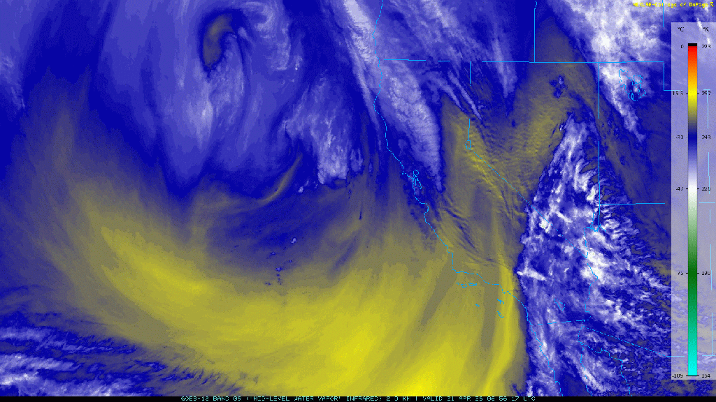
IR mid-level water vapor satellite imagery this morning shows the storm spinning away and slowly advancing towards the Sierra. (Blues and whites denote greater moisture whereas yellow signifies drier air.)
And underneath those clouds and moisture, a north-south band of concentrated precip is nudging its way into the Sierra.
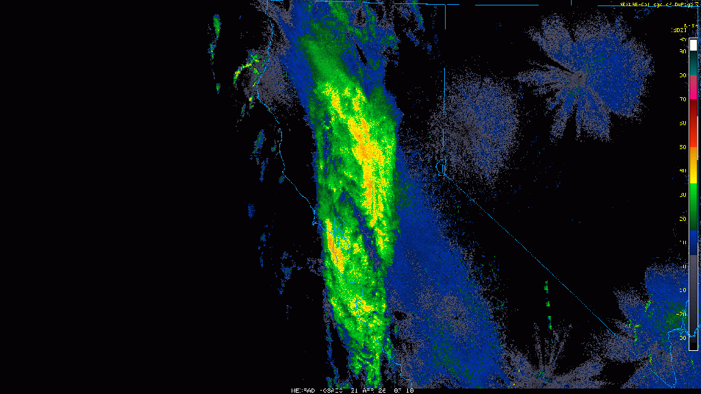
Worth noting is the N-S flow in both images this morning. This wind flow isn’t conducive to efficient spillover east of the Sierra Crest because it’s hitting the Sierra at an oblique angle, rather than closer to 90°. Expect rain and snow to “hang up” on the crest before finally moving in later this morning.
Throughout the day, the storm will edge eastward into Tahoe, bringing rounds of rain and snow into the mountains with snow levels falling throughout the day. Precip rates will likely increase later today as afternoon warmth and peak dynamics of the low combine, embedding convective showers and thunderstorms into the mix, especially near the Sierra Crest. Afternoon instability will also promote thunderstorms to fire across the Central Valley (some potentially severe), then push eastward into the mountains, bringing locally heavy bursts of snow and pellet showers.
Tonight snow showers will continue before tapering off around daybreak tomorrow (4/22) as the bulk of the moisture and dynamics moves eastward. Lingering instability will likely create a buildup of clouds and occasional snow/pellet showers throughout the day on Weds, before clearing out Weds night. Temps on Weds. will range from the upper 20s-mid 30s above 8000′, before cooling off into the low 20s on Weds night.
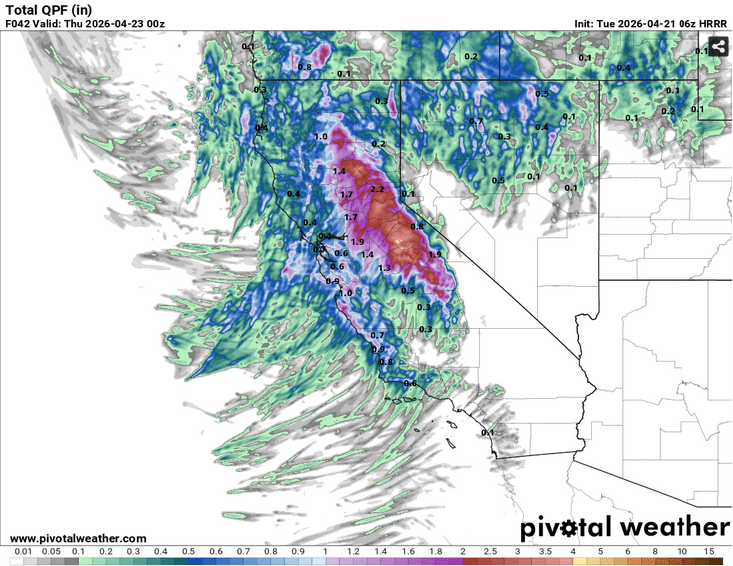
High resolution models indicate highly variable total precip amounts due to the convective nature of this system, in addition to the S-N flow favoring areas along and west of the Sierra Crest. Notice the steep drop off in precip in this morning’s HRRR model for total liquid precip through late Weds afternoon.
Snow conditions in the backcountry will rapidly change throughout the storm and immediately thereafter in the dynamic spring environment. Cold powder on Weds AM will quickly warm and transition to mashed potatoes and “hot pow” on all but the shadiest north aspects throughout the day. Once the sun sets on Weds, any sun-softened snow will quickly refreeze into breakable crusts by Thurs AM, initiating the melt-freeze cycle and journey back to corn snow.
Thurs (4/23) looks to be cool and largely sunny with highs above 8000′ ranging between the upper 30s to mid 40s depending on elevation. Lows Thurs night will drop well below freezing under mainly clear skies. Inversions may develop, but the return of dry air and clearer skies will promote overnight refreezes and potentially, another weekend corn cycle.
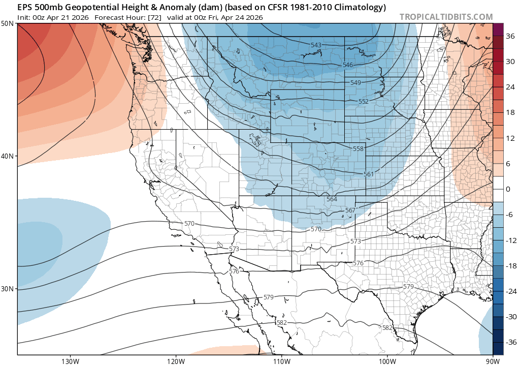
For the coming weekend, model ensembles suggest the potential for more unsettled spring weather starting on Fri and lasting through Sun (4/24-4/26) as a trough of low pressure develops over the west.
While confidence in any given outcome is low, chances for showers over the mountains and near to below normal temperatures in the 30s and 40s above 8000′ looks like a good bet the upcoming weekend.
Despite a lackluster winter and low tide conditions this spring, the corn cycle is on and about to get another refresh. Backcountry season chugs on.
