0400 wx. at 6350′ in Carnelian Bay: 26.1° / 22.1° dew point / 84% RH/ 2″ new snow.
0515 wx. at 7140′ west shore TH: 23°/ 4″ new snow
0630 wx. at 8640′ pinnacle along the Sierra Crest: 18.3° / dew point 16.2° /relative humidity 95% / over cast with light freezing fog / SW winds at 7 mph, gusting to 10 mph
Backcountry obs.:
The backcountry is in transition back to winter! This weekend, a morning tour on southerly aspects in the Mt. Rose area revealed very springlike conditions with refrozen melt freeze crusts at dawn, softening to smooth corn by mid morning. By afternoon on Sat. (3/1), warm temps. baked solar aspects into thick, over ripened corn, sliced and diced with deep trenches by snow sliders.
Rapidly falling temps. associated with the arrival of a weak storm late Sat. refroze all old snow surfaces into hard crusts by evening. On Sunday, the system dropped a light refresh of dust on crust, mainly near the Sierra crest, with lower elevation and eastern zones receiving barely a trace.
This morning (3/3), a predawn tour along the west shore up to the Sierra crest revealed 6-8″ of new, moderate density snow resting atop frozen crusts from the recent warm period. Some wind affected surfaces existed near treeline along ridges, but coverage was minimal and confined to only the most exposed ridge features. Animal tracks left from the overnight hours remained fresh and unaffected by wind throughout forested areas in the new snow.
The new snow felt generally right-side up and did not evidence any obvious instabilities. Turns on sheltered, NE aspects were mainly fluffy, bouncy and smooth with only a few scrapes along underlying crusts on wind-exposed features. A sneaker pow morning, indeed.
Weather and forecast thoughts:
The weak storm that began impacting the area on Sunday (3/2) has departed this afternoon (3/3), leaving cool temps., clearing skies, and a few inches of new snow across the Tahoe backcountry.
Tonight will be clear and cold with lows in the teens and low 20s above 7000’.
Tomorrow (3/4), skies will start out mostly sunny, before a weak frontal system ushers in SW breezes, increasing clouds and chances for snow showers into the afternoon and evening. Any accumulations will be an inch or less tomorrow. Highs above 7000′ should top out in the mid 30s.
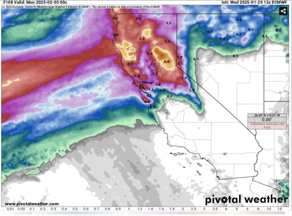
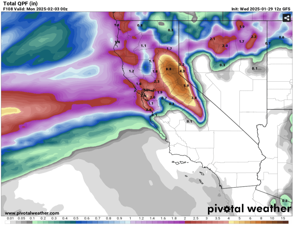
Another weak to moderate system is poised to move into the area later Tues. pm through Weds. and into Thurs., bringing chances for more snow, especially from Tahoe southward. Models as of this afternoon indicate growing confidence in the development of a cold Tonopah low, which, with a little luck, can bring surprising amounts of cold snow to the Sierra, especially to the Carson Range. 6-12” of cold, light snow looks very possible for the Tahoe backcountry Weds.-Thurs. afternoon (3/5-3/6). Locally higher amounts could materialize depending on the strength and positioning of the low.
Another break in the action rolls in for the weekend with mostly clear skies, light winds and cool temps across the backcountry for Sat. and Sun. (3/8-3/9). Temps. will warm on Sun. approaching the low 40s for backcountry areas near and above 7000′.
As the weekend winds down, models show another parade of storms rolling through next week, potentially more significant than the modest refreshes this week. While timing and specifics still vary from model to model, the overall trend across is for wetter and cooler than average conditions. Additionally, signals for stronger, cold storms throughout the week are consistently showing up across model runs. Confidence in at least one significant storm is growing, but clarity on specifics remains elusive. Winter has more to give.