Backcountry obs:
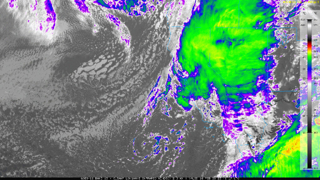
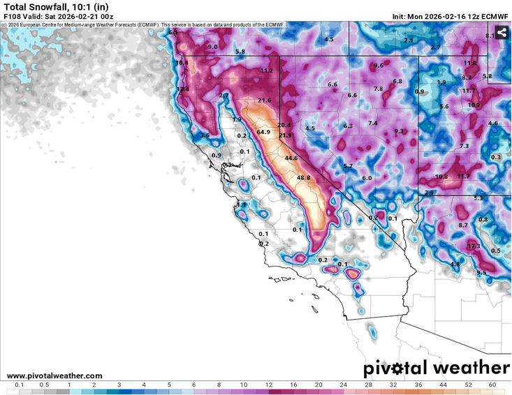
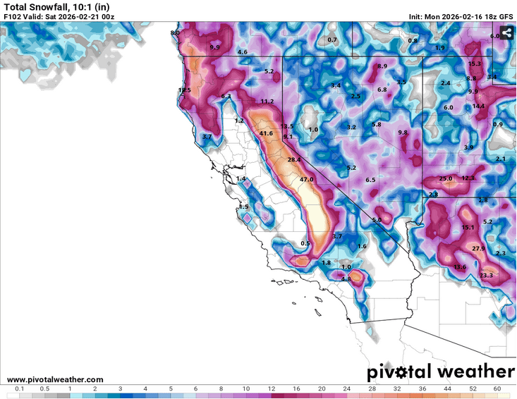
What a storm cycle! Throughout the region, the backcountry picked up anywhere from 4-6’+ of snow from Mon – Fri AM (2/16-2/20). In Carnelian Bay at 6350′, I measured a storm total of 60″ on my home snow plot, clearing the table every 12 hours. On Tues (2/17) from 0700-1900, 23″ of snow fell — nearly 2″ per hour for the period! The storm obliterated my forecast of 2’+ for lake level communities. The cold air and intense lifting dynamics of the system aligned to dump out every bit of moisture onto the mountains as snow.
During the storm cycle, the backcountry felt spooky, vengeful, dangerous. I headed out on a few short-lived sojourns into the Mt. Rose wilderness to sample conditions as the storms wound down. A deep, cold, powdery snowpack had replaced weeks of crust, comprised of various layers that collapsed underfoot whilst breaking trail. A tour near Incline Peak on Thurs (2/19) at dawn revealed 108cm (42″) of new settled snow above the antecedent crusts. The new snow depth made travel strenuous and descents rather slow on mellow, non-avalanche terrain.
This morning (2/20) the day broke cold, crystalline, and brilliant as the sun poked through a few low clouds and precipitating flakes, filling the atmosphere with glistening pixie dust at first light. New snow on south aspects from 7600′-9200′ above Incline Village showed signs of consolidation. Gone was the stepped, trap door sensation under foot while breaking trail, replaced by a right-side up feeling snowpack allowing skiers to sink only up their shins while plodding through the fresh powder. Wind effect was mostly absent except on the highest ridge tops. Pristine was the word of the morn’.
But change is afoot.
Weather and forecast thoughts:
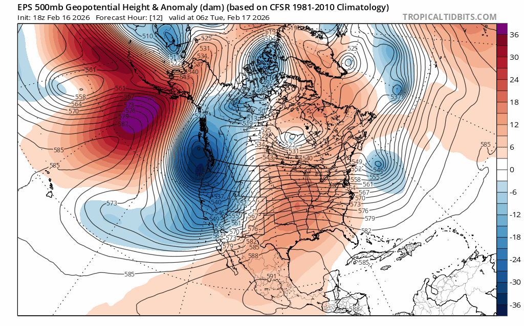
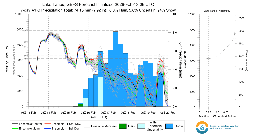
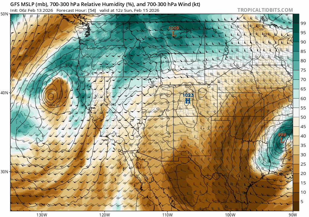
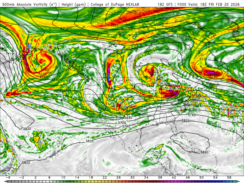
The coming weekend is going to be mostly sunny and cool, with temps moderating on Saturday and Sunday (2/21 – 2/22). Above 7000′, highs on Sat will reach the mid-upper 20s with lows plunging again to the low 20s to upper 10s on Sat night. Sun will be a bit warmer with highs cresting freezing between 7000-8000′ under sunny skies. Winds will also begin increasing out of the SW on late Sun heralding the arrival of a new storm system for the beginning of the week. Currently models show precipitation arriving into the Sierra around late Mon (2/23).
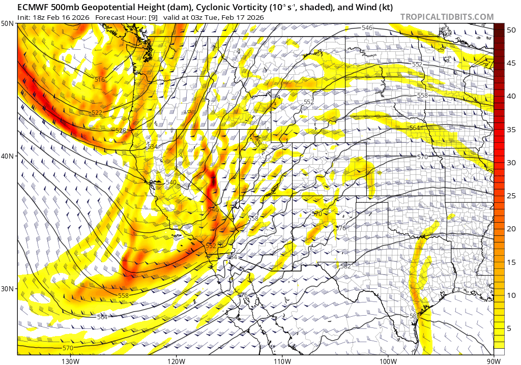
Unfortunately, models are in good agreement that the coming storm system will be warm and wet, with high snow levels 8000’+ as it taps into a subtropical AR (atmospheric river).
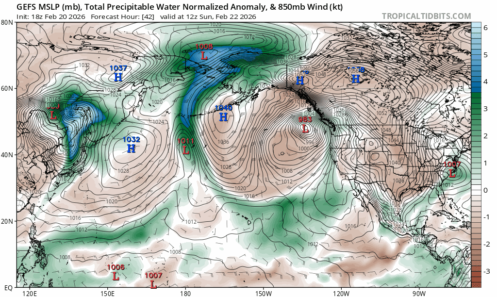
While there will be ample subtropical moisture, current models show that the parent low feeding moisture into CA will remain far offshore, limiting forcing dynamics over the Sierra.
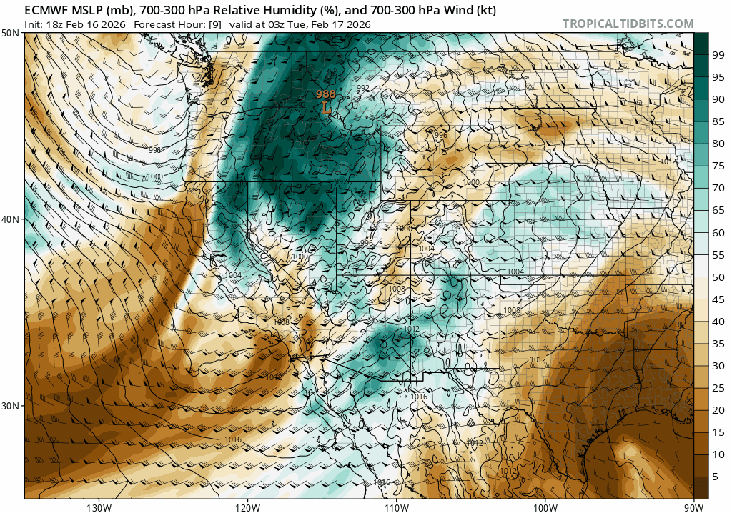
Record breaking rainfall doesn’t look likely, but a solid soaking of rain on snow does.
Freezing level guidance concurs, showing mostly rain for the Tahoe Basin as freezing levels approach 11k before slowly dropping past 8000′ by Weds morning.
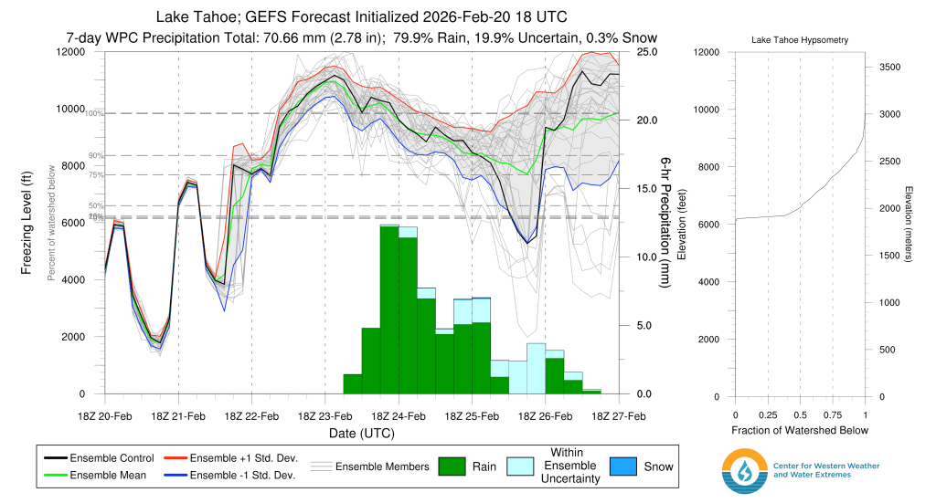
As noted by the wide spread in the lines, which represent each ensemble member forecast, there’s still quite a bit of uncertainty as to whether snow levels will fall or remain high on the back end of the storm around the end of the work week.
So if you have waited all winter for deep, cold powder, this is your moment. Seize it! By next week, the picturesque invernal forests, floaty turns, and soft pillow drops of this weekend will be replaced by soppy, rain soaked snow and fresh anxieties surrounding the remnants of winter.