Backcountry obs.:
Over the past week, I observed the snow in the Mt. Rose area primarily on foot, running newly uncovered trails all the way up to and just above snowline. As of Fri (3/27), usable snow doesn’t begin until around 8500′, just below Tahoe Meadows. As expected, snow surfaces are heavily textured with pocked, pre sun-cupped divots and forest debris, more reminiscent of late spring and early summer.
The highest Tahoe trailheads above 8500′ still have snow, but patches of dry ground grow larger each day. Tree wells now expose bare ground and solar aspects are dry, even up to summits, limiting skiable terrain to N-E aspects in what will soon become summer patch skiing.
Where snow remains, there is still fun to be had. Refreezes above 8000′ returned this week, with increased winds and cooler temps aiding radiational cooling to firm up snow surfaces overnight. Touring from 8650′ to 9300′ at dawn on 3/27, I found supportable, refrozen crusts making travel quick and at times slippy. Below 9000′ in heavily forested areas, snow surfaces hadn’t refrozen as completely, yet were still supportable, while open areas had frozen hard. With temps climbing into the mid 40s each day, mid morning snow surfaces should soften into corn or summer schmoo, making for buttery-fun last turns.
It’s been a fun, yet short ride this season, Señor Snowpack. Thanks for your efforts, but please do better next year. You came late, doddled for a bit, then peaked with a flash, before quickly disappearing out the back door. You’re always invited, but next time, make yourself comfortable and hang out for a while.
Weather and forecast thoughts:
Today and tomorrow mark the end to three weeks of anomalous heat as more seasonal temperatures and showery weather return for the coming work week. Today (3/29) high temps above 7000′ will make one last return to the low-mid 60s under sunny skies, while lows tonight fall into the mid to upper 30s. Light to moderate zephyr-like winds will pick up out of the S and SW this afternoon.
Monday (3/30), increasing cloudiness and cooling temps will kick off the week presaging the arrival of a more unsettled, showery spring pattern as the dominant ridge of high pressure responsible for weeks of warmth, finally decamps. Highs will reach the low to mid 50s on Monday under a mix of clouds and sun, eventually becoming overcast. Clouds build in Mon night and by Tues (3/31) rain and high elevation snow showers look likely, lasting into late Thurs (4/2). Lows Mon night should fall into the mid 30s above 7000′.
As the ridge of high pressure moves off, a trough of low pressure will drop down from the Gulf of Alaska, with its parent low likely coming ashore near Columbia River late in the work week.
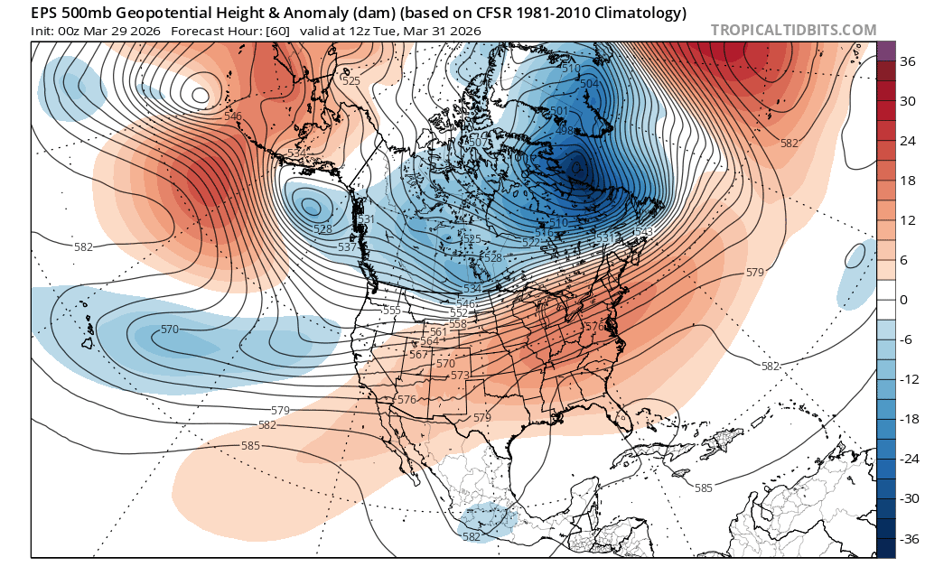
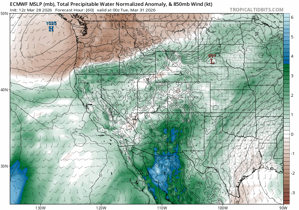
While the pattern will turn cooler and showery with snow levels falling to near lake level by midweek, this system doesn’t appear to have the dynamics and moisture to put down any significant snowfall that could hold or reverse the fortunes of the backcountry.
Upper level dynamics through the period (Tues-Fri) show weak shortwaves passing through the Sierra on Tues and Weds (3/31 and 4/1), followed by the main low coming ashore in the PacNW on Thurs (4/2). In both cases, the main lifting dynamics look weak to moderate over the Sierra, lacking the driver for any long lasting, heavy precip.
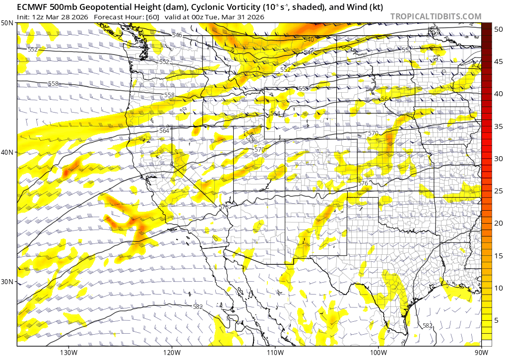
Available moisture for the above dynamics to interact and precipitate out doesn’t look very impressive either. While there will be enough to create generally spring-like rain and snow showers, models don’t currently depict any deep moisture feeds that align with the strongest dynamics, a recipe for more prolonged, heavy precip.
Model ensembles for total precip. through Fri evening (4/3) follow the same script. Modest amounts likely fall throughout the week, renewing soil moisture and keeping lower elevation trails wet and tacky, while putting down a few inches of snow for the upper elevations.
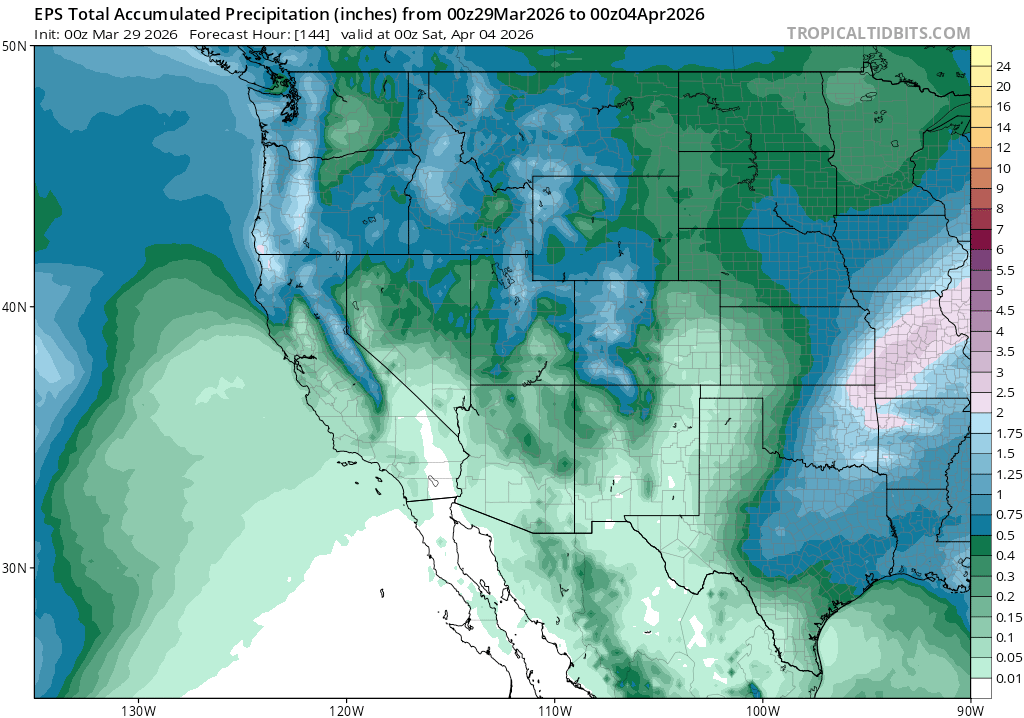
But a few inches of snow atop dirt won’t do it. Some of the highest zones above 8000′-9000′ might see up to 6″ of new snow through Fri, which could make for a few fun, end of season powder turns for the most motivated.
Looking into next weekend, skies clear out and temps look to rebound to above normal as another ridge of high pressure likely rebuilds in the Eastern Pacific.
Winter’s probably gone, but the glories of trail season await!
