Backcountry obs.:
This has been the week of the corn cycle. Warm sunny days and nights just cool and dry enough to refreeze the snowpack have thrust the backcountry season into peak spring skiing.
I poked around the NE corner of the Basin at dawn on Tues and Thurs (3/10 & 3/12) and found the usable snow line quickly retreating up to near 8000′, especially on S and W aspects. The snowline on N and E aspects is around 1000′ lower.
Inversions have been setting up each night pulling lows near freezing at lake level–and a few degrees below in valleys and hollows away from the warming influence of the lake–while upper elevations have only bottomed out in the upper 30s to low 40s.
Despite the warm lows in the mountains, clear skies, light breezes, and very dry air have helped to refreeze snow surfaces via evaporational and radiational cooling. Because of this setup, mid elevation, forested zones haven’t been refreezing well as radiation from the snow and trees gets reflected back onto the snow surface, heating the snow just enough to inhibit the refreeze. However, open areas with a clear line of sight to space have consistently refrozen each night, providing a supportable, frozen surface to climb early in the morning.
Superficial refreezes demand alpine starts for the best skiing. Early morning sun has been baking E aspects as soon as the first rays touch the snow, softening frozen surfaces into smooth, buttery corn by mid morning. Beyond 10am, intense sun angles and high temps have begun overcooking snow surfaces into wet mush. It’s all about timing.
Weather and forecast thoughts:
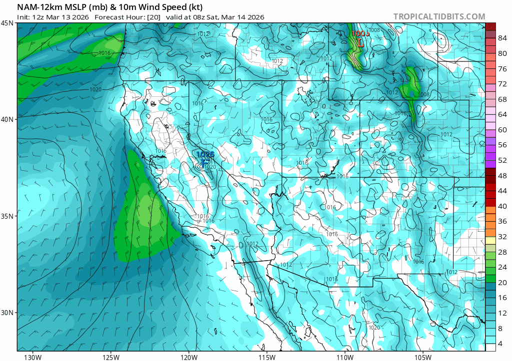
Warm and dry weather will continue for the foreseeable future with no real prospects for snow through at least the next 10 days. This weekend (3/14-3/15), a weak cold front will bring an uptick to winds and cool daytime highs by a few degrees from their peaks yesterday and today (3/12-3/13). Even with the cool down, temps will still be 10-15 degrees above average for mid March. (Average highs in Tahoe City this weekend are around 45°F). Expect highs in the backcountry above 7000′ in the low 50s both Sat and Sun with occasional high clouds streaming across the area.
Light to moderate winds from the west on Sat (3/14) will shift around to the N and NE on Sun (3/15) bringing a subtle chill to the air, likely delaying the daily surface melt. If any clouds do end up lingering about overnight, they could keep temps a bit higher, thus inhibiting or blunting the strength of the nightly refreeze.
Warm, dry weather continues and intensifies into the coming week (3/16-3/20) with heat reaching all time record highs for mid March. By mid-late week, high temps in the Tahoe Basin could flirt with or surpass 70°F on consecutive days! Despite the clear skies and dry air, lows, even on the snowpack, are unlikely to fall below freezing each night, putting an end to the current corn cycle and dealing a major blow to the remaining snowpack.
Looking at the climatologically normalized pressure anomalies, ensembles are in good agreement that this event will likely crush records for March heat across the region. These maps show just how anomalous the pattern will be compared to average. This coming week will fall within or above the 95th percentile. That’s big high pressure!
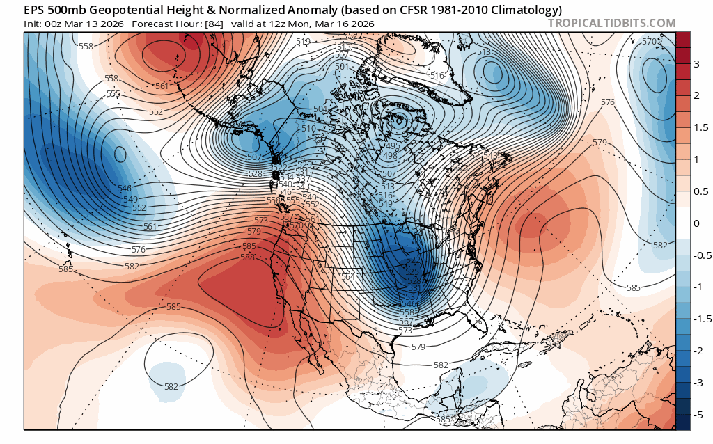
And because high pressure causes the air mass to sink and heat as it descends, the strength of the high correlates to the strength of the heat it generates. Temp. anomalies across the SW will be at the top of the charts for the coming week with highs more akin to early summer than the last full week of winter.
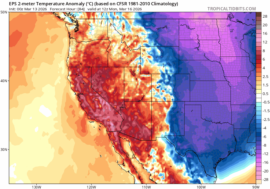
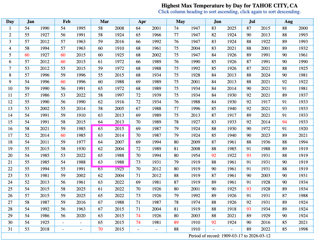
Taking a look at climatology at Tahoe City, highs near or just above 70°F would far surpass current records for the middle of March, which are in the low to mid 60s. And surpassing 70°F would set a new all time record high for the entire month, last set on 3/31/15.
There’s no escape from heat of this magnitude. Even the highest, most protected zones of the Tahoe backcountry will get cooked.
Peering way out beyond next week, warm and dry signals continue into third week of March. More warmth after such an extreme heat event on a below average snowpack may spell the end of the 2026 season for most Tahoe locations.
Now, more than ever, it’s time get what’s left and enjoy the remaining days of the current corn cycle and backcountry season.
