Backcountry obs.:
Despite the apparent end to winter 6 weeks ahead of schedule, there’s still plenty of great snow to be had at upper elevations if you shift your expectations from powder to corn. In addition to being known for big dumps, Sierra skiing’s number two claim to fame is spring corn, and right now there’s plenty of it ripe for the taking.
Recent cooler weather and dry NE flow has refrozen and tempered the rapid melt of late February. A tour above Incline Village on 3/8 revealed firmly refrozen melt-freeze surfaces from 7400-9600′ on all aspects. At dawn, southerly aspects hosted edgeable, supportable, refrozen corn that began softening in direct sun by 0800. By mid morning, southerly aspects skied fast and creamy: quite frankly some of the best and most enjoyable skiing of the season.
Get it while it’s here. The snow pack is quickly melting away. Below 8000′ patches of dirt and pine needles made for tricky route finding and occasional log hopping. Even at higher elevations, tree wells now show rocks and dirt as the snow slinks away ever more with each passing day.
Weather and forecast thoughts:
Well above average temps and dry weather will dominate the coming week (3/9-3/15), further hastening the demise of the 2026 snowpack. Highs look to reach the upper 40s to low-mid 50s above 7000′, especially around midweek and into the coming weekend. Inversions return each night with lows in valleys and depressions dropping to near or just below freezing, while upper elevations remain well above freezing. Upper elevation snow surfaces should refreeze through midweek due to evaporational cooling in the drier, high elevation air. Warmer air arrives towards the end of the week likely signaling weaker refreezes, if at all.
The culprit is the return of the big, blocking ridge over the eastern Pacific. This time it’s positioning itself in a prime spot to deflect any moisture and cooler weather north into the PacNW.
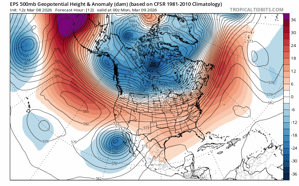
The low responsible for cooler, NE flow at the end of last week will eject off to the east via Mexico by the middle of the week, taking any northerly flow along with it.
As a result, temps will warm to well above average yet again, as noted by 2m temp anomalies from 3/8-3/15.
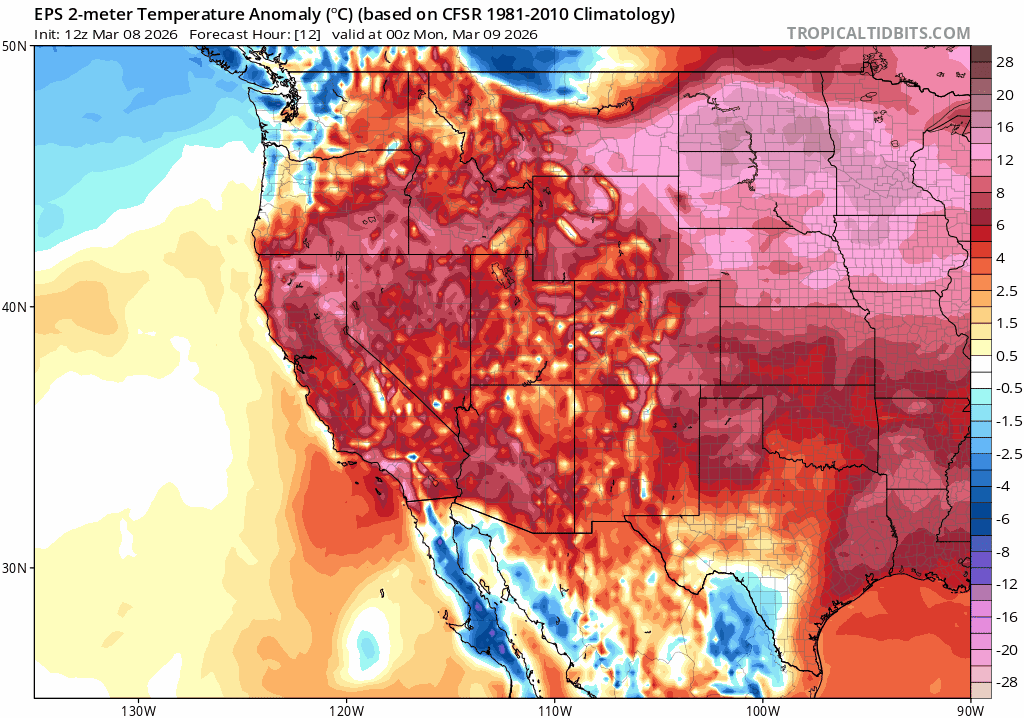
With a flimsy existing snowpack and higher spring sun angles, this renewed bout of well-above average temps will quickly degrade the Tahoe backcountry snowpack. Higher elevation zones above 8500′ on cooler, more-protected aspects will fair be better, but there’s really no escaping the melt, especially when temps don’t recover below freezing each night. Even if cold and stormy weather returns for the latter half of March, snow will likely fall on bare ground in all but the highest elevation zones, as most of the existing base will have melted off.
Now’s the time to harvest whatever spring turns are out there. There will be more today than tomorrow. Carpe diem.
