Backcountry obs.:
The coldest and most robust storm cycle of the season is here and has already dropped several inches of new snow to all backcountry elevations across Tahoe. As of this writing, just about 4″ of new snow has fallen at lake level in Carnelian Bay, with higher amounts above 7000′. Remote sensors as of 1830 on 2/16 indicate between 5″-10″ of newly fallen snow, with the highest amounts along the west shore and Sierra Crest.
Steady, light-moderate snow fell throughout the day today with freezing levels holding at around 7000′ through most of the day, before plunging well below lake level in the late afternoon. As such, today’s warmth contributed to higher density snow at all elevations from the storm’s onset that is now being buried with colder, low density snow. This is generally a recipe for a right side up snow pack, but layers of varying density storm snow are likely throughout the multi-day event.
While winds started out fairly moderate around dawn in the 10-20 knot range, they dropped off around midday, before picking up out of the southwest towards late afternoon. Expect SW winds to ebb and flow with each successive wave of snow this week, especially in higher terrain.
Weather and forecast thoughts:
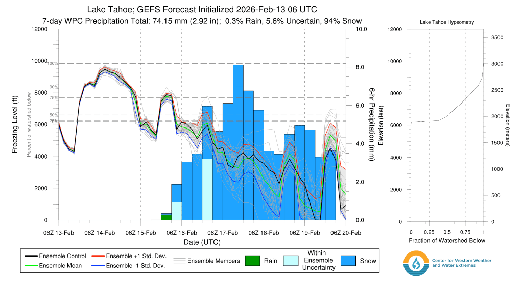
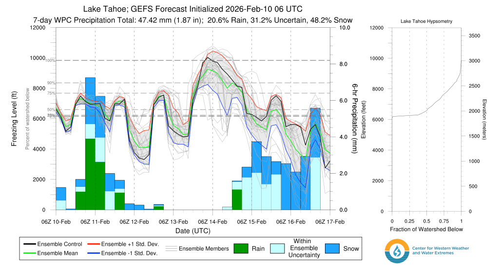
This cycle is just getting started. While today’s accumulations around the lake were fairly light by Sierra standards (2-5″), they will continue to stack up as multiple pulses of energy crash into the area over the course of the work week. Temps will also cool, pulling snow levels down to lower elevations and boosting snow totals in the mountains with progressively higher SWE (snow to water equivalent) ratios through Weds (2/18). By Friday (2/20) Tahoe communities are on track to receive 2’+ of new snow, while backcountry zones could gain 3-5’+ of new snowpack. Temps will hover in the low 20s through Thurs (2/19) above 7000′, with teens above 9000′. No need to fret about snow levels with this round.
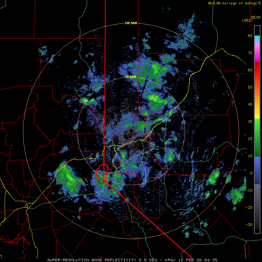
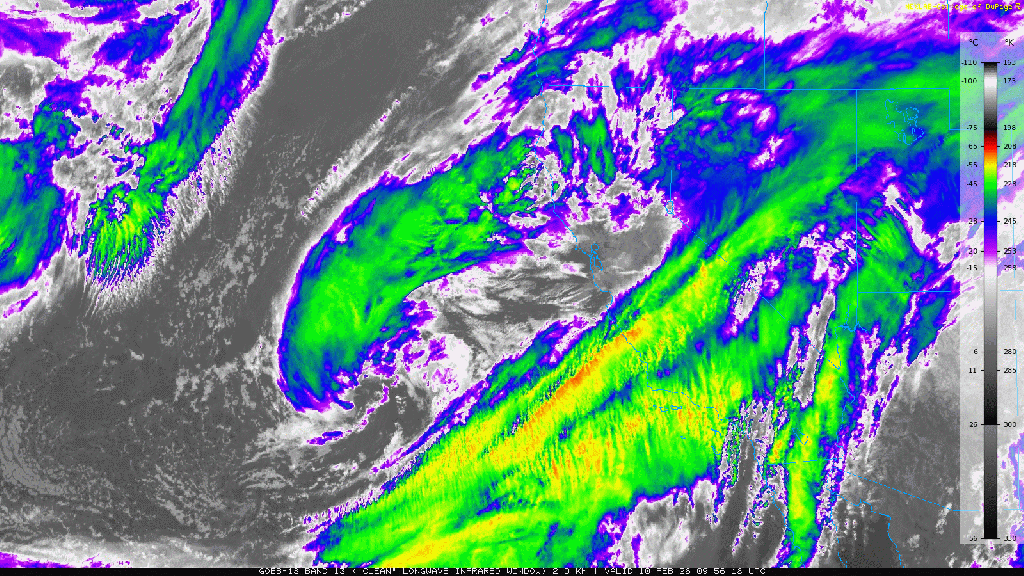
Current IR satellite imagery shows that the bulk of the upper dynamics from today’s system have moved into the Great Basin. In its wake is cold, highly unstable air, eager to lift up the western slopes of the Sierra keeping nearly constant snow showers going through the evening.
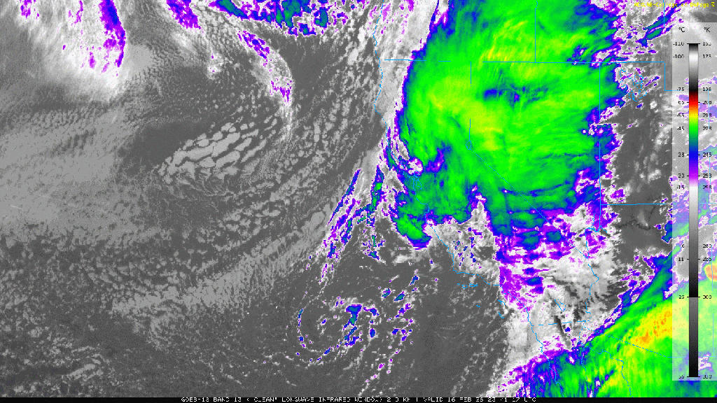
Cold snow showers will continue through the overnight and into tomorrow morning with the greatest accumulations occurring along the crest and over higher terrain.
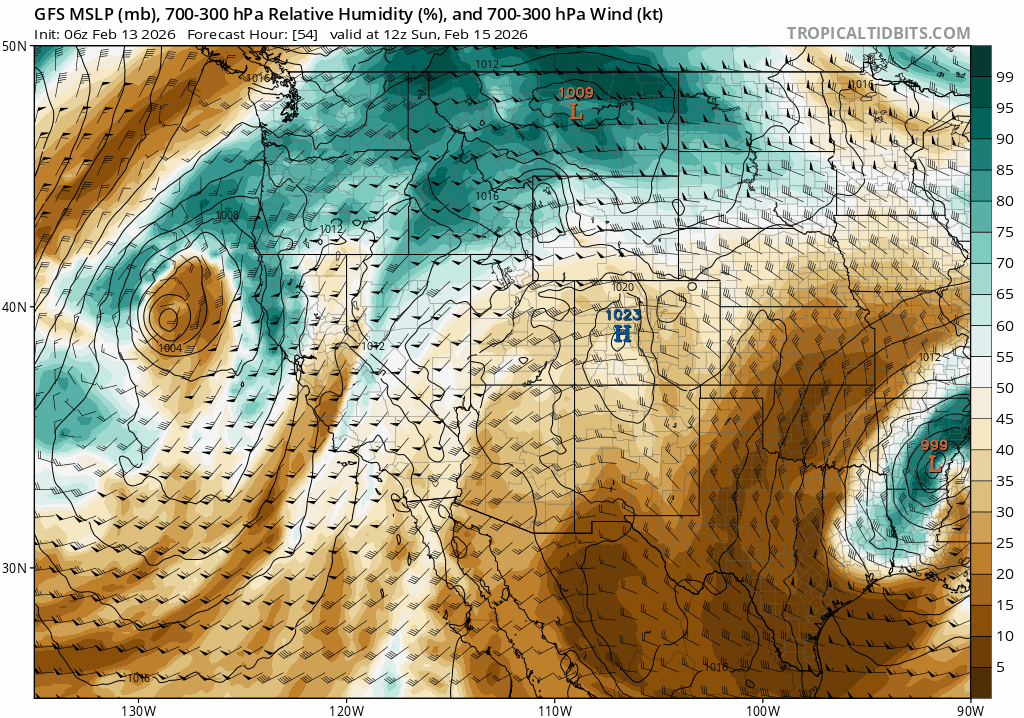
The pattern keeps going. Tomorrow (2/17) an even colder and more potent low drops in from the Gulf of Alaska triggering another 24 hour round of heavy snow for Tahoe from mid morning through mid morning Weds (2/18). And the gravy train just keeps on coming with additional pulses through Friday evening and possibly into late next weekend.
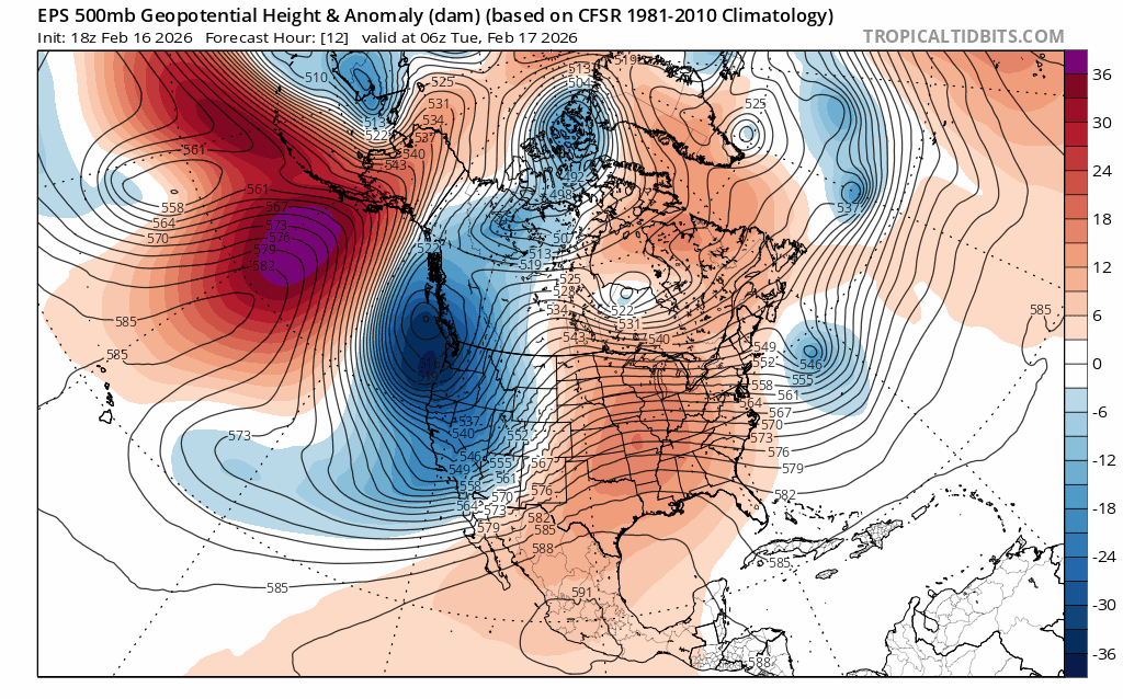
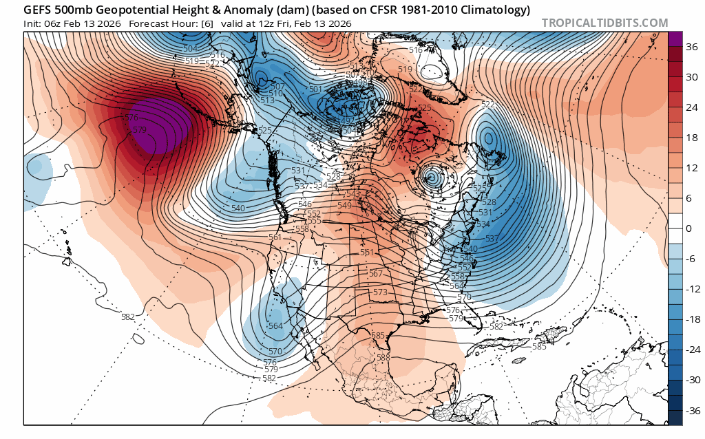
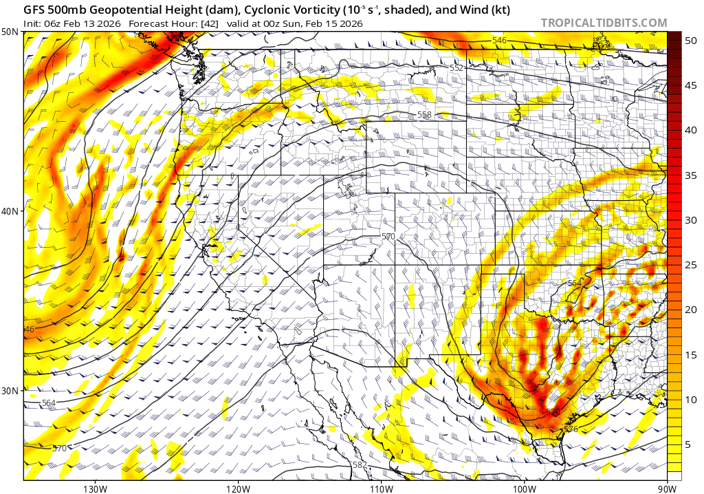
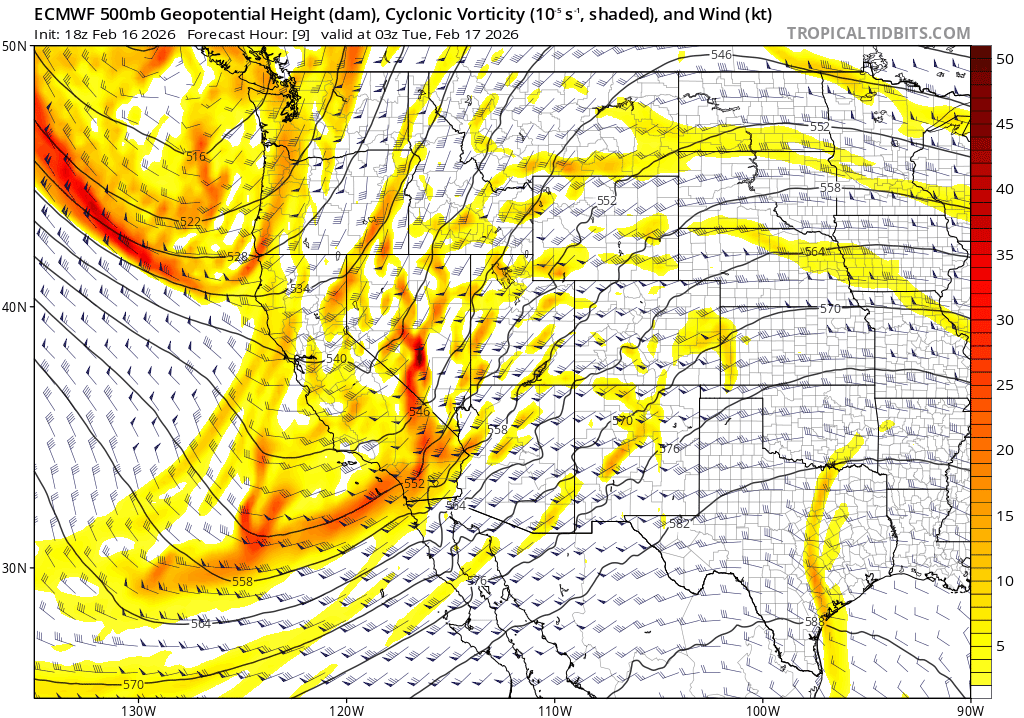
While the long wave trough pattern opens the door to storms, each individual pulse that drops in will have solid lifting dynamics as noted in models depicting mid level (500mb) vorticity, aka. atmospheric spin. Additional terrain-enhanced lift (orographics) will help to further enhance snowfall rates and totals.
Notice the yellow and orange vorticity values associated with the curved height lines. The areas just ahead of the highest vorticity values and curves tend to harbor the strongest dynamic lift, and resultant precipitation.
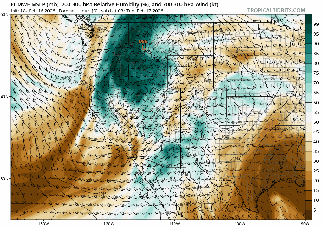
While dynamics with this storm sequence are robust, the biggest limitation to giant snowfall totals is the available moisture with this system. Earlier storms this season had a subtropical moisture source delivering copious moisture, but also warmth, translating to stubbornly high snow levels and dense, thick snow. This go around moisture is more limited and not associated with any subtropical AR’s as noted in the Euro model for atmospheric relative humidity through the week and into the weekend.
However modest this moisture might be, the robust dynamics and cold air mass of the pattern will conspire to make the most of atmospheric moisture, creating impressive multi-day snow totals of quality, low density snow.
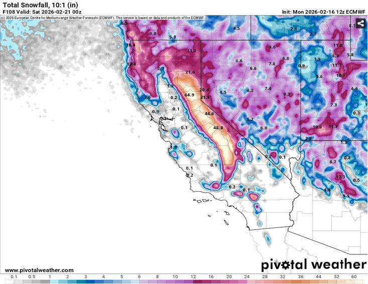
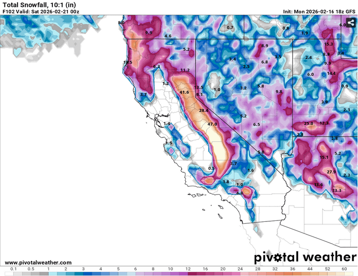
While there is some discrepancy in the current models on where the heaviest snow will fall, a solid cycle dropping multiple feet on Tahoe is the most likely outcome. By week’s end Tahoe communities will likely have 2’+ of fresh snow while backcountry zones above 7000′ could rest beneath an addition 3-5’+, especially along the Sierra Crest and points south of Tahoe. Mammoth and June, you’re in the sweet spot again…
And sneaking a peak beyond the week, models suggest the cold storm parade will march on into the weekend and the following week.
Winter’s back!