Backcountry obs.:
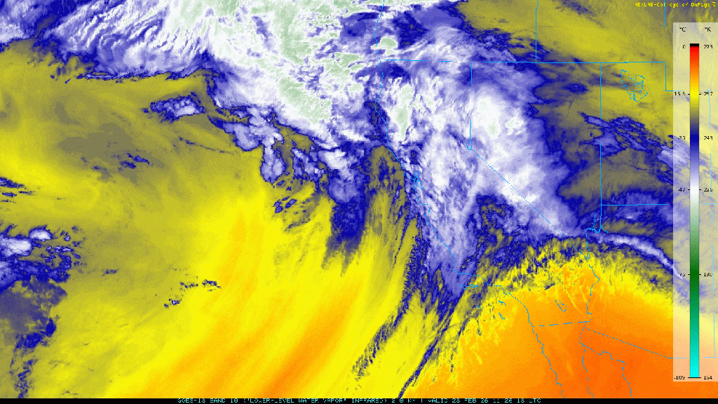
The backcountry snow pack has taken a big hit over the past week. Warm air more reminiscent of May, replaced the seasonably cold conditions earlier in the week, bringing rain as high as 11,000′ on Tues and Weds (2/24-2/25). Gone is the powder and refreshed snow pack from mid Feb replaced by soggy, saturated mush at the lowest elevations, and poorly refrozen rain/melt freeze crust above 8000′.
I toured in the Mt. Rose backcountry between 8650-9900′ at dawn on 2/27 and found a snow pack still greater in volume than pre-storm, but not by much. Rain and above freezing temps melted and compressed the snow pack over the past week. Luckily, efficient overnight cooling had refrozen the snow surface in most areas above 9000′, creating a supportable, 1″+ thick melt-freeze crust, making skinning and skiing quick and efficient. Runnels, beautifully smooth and curved, riddled the entire snow surface, even up to 9900′, evidence of liquid water percolating down through the snow, compressing and pulling its weight onto the topography below.
Skiing on the smooth, runneled surface crust was still fun and fast, scrapey and loud. East Coast-trained skiers will excel on these surfaces. In steeper, more consequential terrain, whippets are necessary to prevent an uncontrollable slide in the event of a blown edge. By mid-morning – early afternoon, soft, buttery corn is likely on offer courtesy of solar surface softening, but only in open areas receiving sufficient overnight refreezes. Forested and lower elevation zones not benefiting from overnight refreezes are soft, rotten, and unsupportable, especially after mid-morning.
And just like that, it’s feels like late spring in the backcountry.
Weather and forecast thoughts:
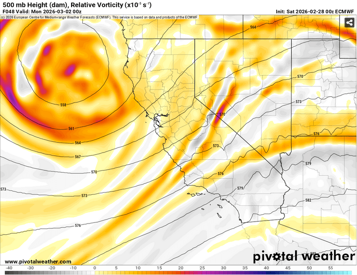
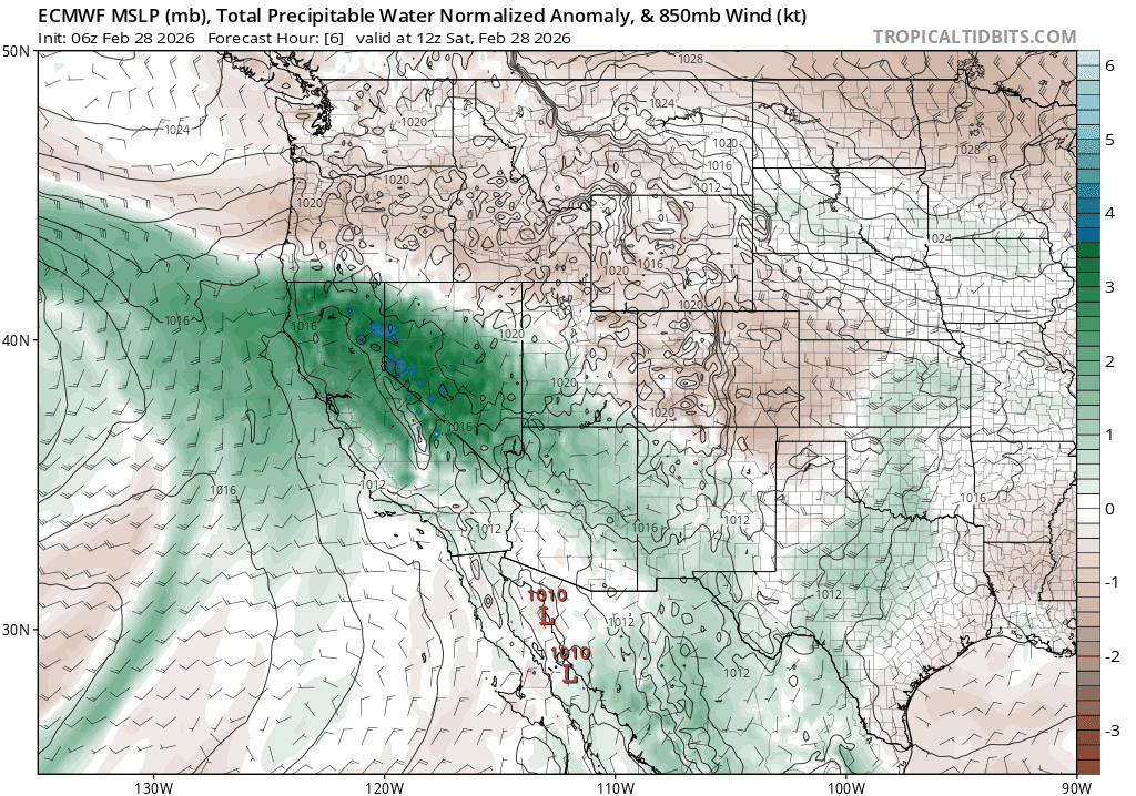
Anomalously warm, moist air will continue to be a feature of the backcountry over the weekend and early work week (2/28-3/3). The ridge of high pressure left in the wake of last week’s AR responsible for continued warmth, will flatten over the course of the weekend as a cut off low approaches CA from the Eastern Pacific. The low will bring more clouds, muggy air, and the chance of afternoon rain/snow showers–and even the chance of a few rumbles of thunder–to the backcountry.
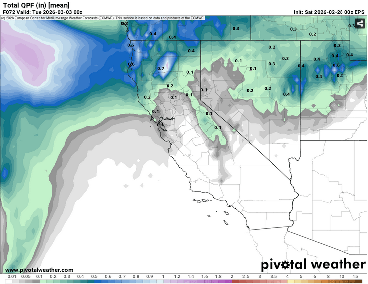
Highs this weekend will be in the low 50s on Sat (2/28) above 7000′ under a mix of clouds and sun, cooling to the 40s on Sun (3/1) with mainly overcast skies. Lows each night will cool into the mid to low 30s. Refreezes will be weak at best, but improving each day especially over higher terrain. Chances for scattered showers increase each afternoon through Mon (3/2), but rain/snow accumulations will likely be generally light and localized.
Snow levels this weekend will start near and above 9000′, before falling to around 6500′ by Mon morning as the low begins to depart the region and chances for precip fall.
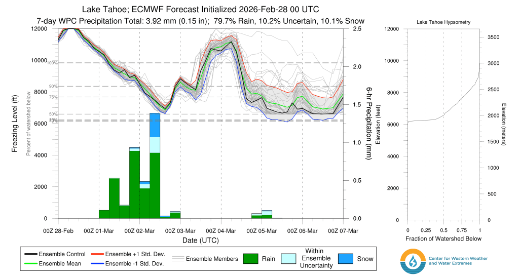
There are modest lifting dynamics with the weekend system which will likely ignite a few showers, especially in the afternoon with the added energy of late winter solar heating.
Despite the dynamics and afternoon instability, total available moisture looks to wane through the weekend, just as the best dynamics arrive late on Sun.
The result will be light and spotty precip with most areas receiving less than .10″ rain or a few inches of snow, at most.
Once this weekend’s system moves out, high pressure returns bringing sunny skies and mild temps through midweek.
There’s some indication of another weaker frontal passage around mid week that would further cool temps and bring back chances of rain and snow above 7000-8000’. Total amounts look light (a few inches at best). Models still disagree significantly, keeping forecaster confidence low.
Longer term models show signs of another modest system reaching the Sierra by next weekend, followed by cooler temps closer to seasonal averages.
Despite the unsettled pattern, what doesn’t appear into the first days of March are signs of prolonged cold and storminess: a full blown return to winter. It might not be official on the calendar, but springtime weather is here way ahead of schedule.
