Backcountry obs.:
I started the week yesterday (2/23) at dawn with a quick north facing tour in the Mt. Rose backcountry between 8400′-9200′. Despite the warmth late last weekend, cold, soft powder had held on in shady, north facing protected areas. Leaving the shadows, snow quickly turned transitional with every variety of breakable crust imaginable on offer: thin and zippy to thick and deadly to stuffed crust! One lap on the bipolar snowpack was enough to start the week off right.
As of this writing (2/24), any remaining cold powder from yesterday has likely been soaked with warm rain at all elevations, even above 10,000′. Much like the endangered pika, there’s no more mountain to climb to escape the warmth of this system.
Weather and forecast thoughts:
Fresh on the heels of the coldest cycle of the season, the warmest cycle of the season is now impacting the Tahoe backcountry with rain for Tues (2/24), tapering off tomorrow (2/25). A subtropical moisture feed has already pushed snow levels with this system to around 9000′ and these will continue rising throughout the day as rain intensity increases. At the storm’s peak this evening, snow levels will likely be above 10,000′! Rain tapers off tomorrow (2/25) and in its wake, warm temps and sunny skies for the rest of the work week will make memories of cold powder feel like a fever dream.
Taking a look at the big picture, the pattern responsible for the glorious, cold snow from last week has flipped completely, replaced by a ridge of high pressure over the west and a fetch of warm, moist air pumping in from the subtropics. 500mb height anomalies tell the story with the black lines pointing out into the Pacific SE of Hawaii.
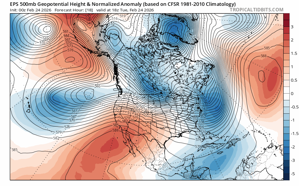
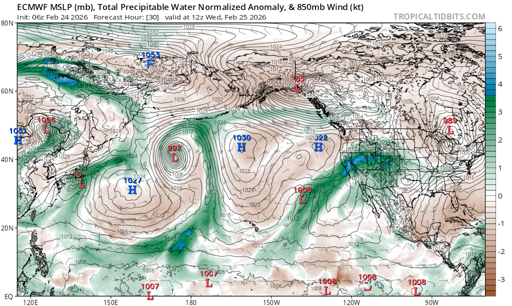
NE of Hawaii is an area of low pressure, spinning counter clockwise and funneling moisture into the west in a weak-moderate AR (atmospheric river), as noted in the normalized precipitable water (PWAT) anomaly analysis. This shows how much more precipitable moisture is in the total atmosphere than the climatological norm.
The result of this warm, wet connection is rain for all elevations of the Tahoe backcountry. Models are in good agreement for freezing levels topping out above the terrain between 11,000′ – 12,000′ later this afternoon, before falling to between 10,000′ – 11,000′ this evening and into tomorrow (2/25).
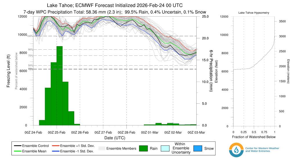
The one saving grace is that the rain will likely not be too heavy in the Sierra, with only a few inches of liquid (1-3″) falling, with the highest amounts N and W along the crest.
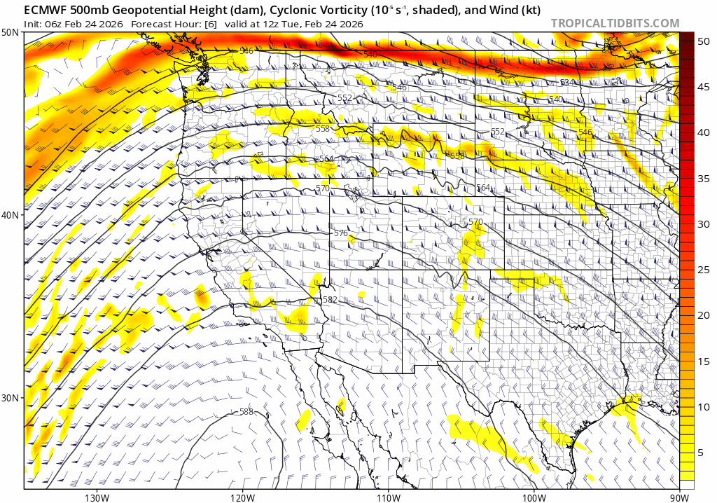
Despite the robust moisture, the location of the low pressure way out in the Pacific tempers the dynamic forcing of the system, which in turn limits the strength and amount of precip that the Sierra will receive. If the low were closer to the coast, rainfall would be heavier, potentially creating flooding concerns with more rain on snow melt. Note the lack of strong vorticity (atmospheric spin) which favors dynamic lifting in the atmosphere.
In this case, we just get to contend with a significantly degraded backcountry snow pack.
Behind this week’s system, warm and dry weather returns going into next weekend (2/28-3/1). The low responsible for spinning the subtropical moisture into Tahoe today may eventually trek into the Sierra late this weekend, bringing somewhat cooler temps and chances for rain and high elevation snow Sun into Mon (3/1-3/2). But at this point, backcountry impacts look to be modest.
Looking way out into the beginning of March, models agree on a return of warm and generally dry conditions with no big, cold systems yet in sight.
