Backcountry obs.:
It finally snowed over the past two days. Not a lot, but enough to refresh the snow pack (if only modestly) and inject some needed optimism into the hearts of local backcountry skiers.
Dawn patrol tours in the Mt. Rose backcountry on both 2/11 and 2/12 between 8450′ – 9500′ revealed 3-8″ of fresh, fluffy snow, poorly bonded to the haggard surface crusts below. Skies both mornings were mainly overcast with light snow showers and cold temps in the low 20s. Winds remained light for most of the storm, but by Thurs morning a pronounced northerly flow had taken over, creating light orographically-enhanced snow showers over the Mt. Rose complex.
High temps across the Tahoe Basin remained below freezing above 8000′ on both Weds and Thurs (2/12 & 2/13), helping to preserve the new snow. Between 7000-8000′, highs reached the middle 30s on both days, especially during peeks of sunshine. High humidity throughout the system made for hot, sweaty ascents and quick melting once temps crested freezing below 7000′.
While the new snow definitely lifted spirits, its contributions to quality skiing have been modest at best. Low angle terrain skis fast and 50% smoother than the start of the week, but be ready for plenty of bumps. That’s improvement! Steeper pitches are quite prone to small sluffs and still ski with plenty of scratch and chatter.
More snow is most welcome.
Weather and forecast thoughts:
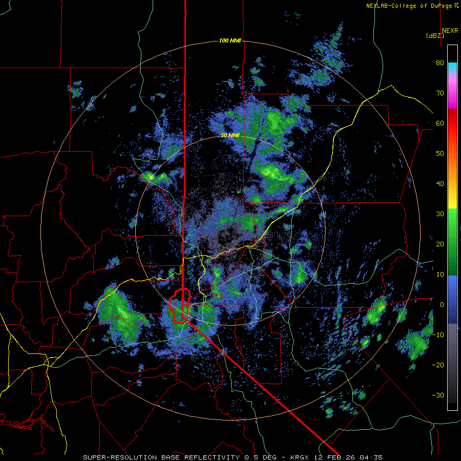
Despite two days of on again off again snow that never seemed to arrive any gusto, 8″ accumulated over 48 hours at 6350′ in Carnelian Bay. The snow arrived in two rounds: 2″ of wet and heavy above freezing snow on 2/11 and a surprise 6″ during the wee hours of 2/12.
The surprise band on 2/12 came in as the surface low moved south and east of Tahoe, changing the low level wind flow from S to N. Just enough low level moisture, already in place from the day before, combined with colder air and additional orographic lift from local topography to produce a brief band of heavy overnight snowfall. By dawn, 6-8″ had fallen at lake level from Incline to Kings Beach to Tahoe City, while many local backcountry zones barely received an inch.
The system wrapped up last evening (2/12) as the low trekked south and eastward across the continent. In its wake, a ridge of high pressure builds in for today and most of the upcoming weekend (2/13-2/15). Skies will be generally sunny with high temps reaching anywhere from the low 30s to low 40s across the backcountry above 7000′. Lows through Sun (2/15) will drop into the 10s and 20s with some inversions setting up, especially if skies clear and winds remain calm. Freezing fog could also enter the picture in colder valleys and depressions across the area.
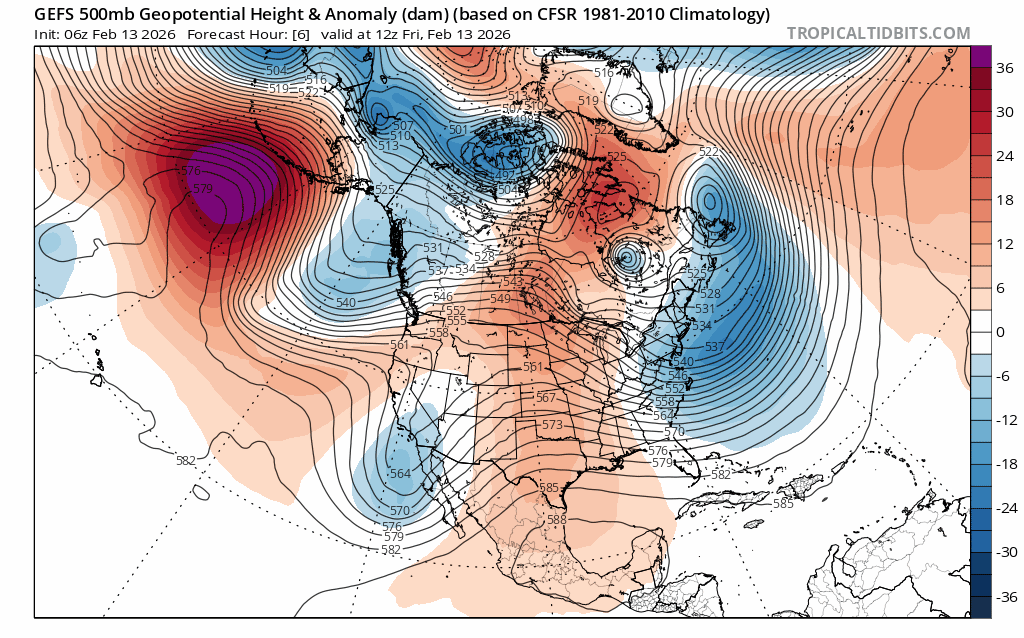
Despite the lackluster performance of the 2/11 system, it served as a primer for what could be the most productive storm series of the season to date. Starting during the overnight hours of late Sun (2/15) into early Mon (2/16) models show a series of cold storms impacting the Sierra through mid to late next week (2/15 – ~2/19). The storm series arrives in concert with a deepening trough of low pressure out of the Gulf of Alaska, a classic pattern for cold, productive Sierra dumps.
With the storms still 3 days out, models will evolve on timing and exact snowfall amounts. However, there is good agreement for cold air, efficient moisture transport and a strong, dynamic lifting environment, all essential pieces for prolonged, heavy snowfall. Before even entertaining any preliminary snowfall forecasts, it’s worth noting how these essential ingredients are lining up.
Different from the previous storms this season whose fetch of air originated in the subtropical east Pacific, these systems are dropping into the eastern Pacific from the Gulf of Alaska, pulling in copious cold air. GEFS ensembles reflect this with freezing levels starting out below lake level Sunday night as precip starts, then falling and remaining well below 6000′ in the storm.
The storms also look to combine low level moisture with the cold air. Models depict the flow of wind traveling down from the north, around the low pressure and across the warm, moisture rich waters off the CA coast. The green shading below translates to mid level relative humidity values.
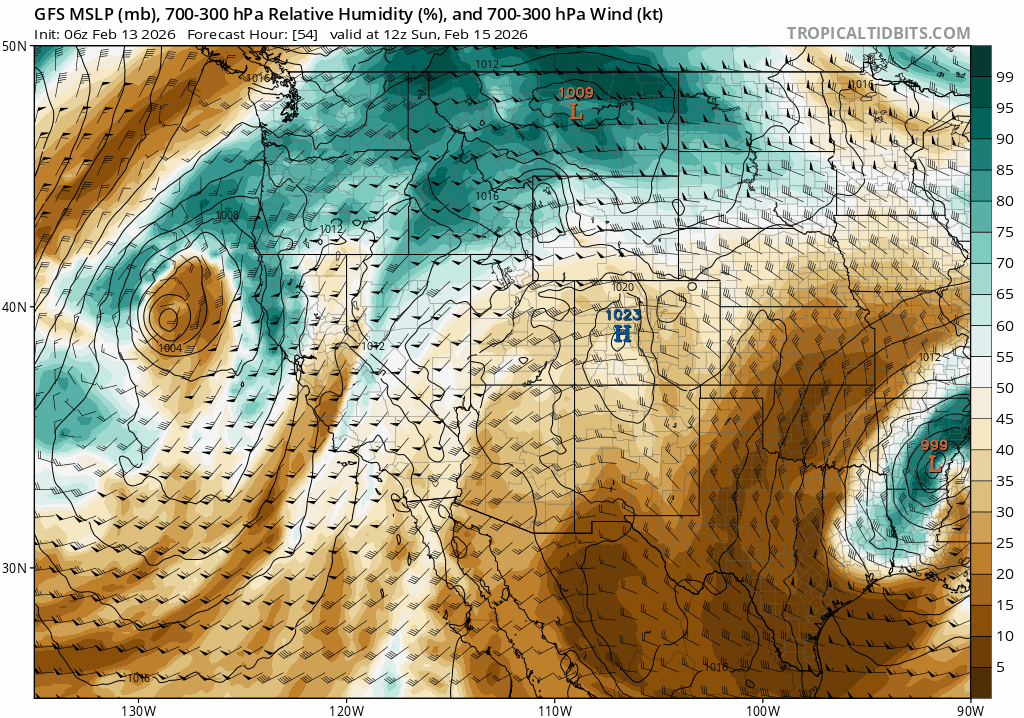
While there is abundant mid-level moisture, it’s not nearly as high as it would be in a warmer AR scenario pulling in subtropical moisture from across the Pacific. However, the cold nature of the storm and its dynamics will act to more efficiently precipitate out any available moisture as heavy snows in the Sierra.
Taking a look at the mid level dynamics of the storm series, there will also be plenty of vorticity (aka atmospheric spin) which acts to lift air columns, an essential for creating precipitation.
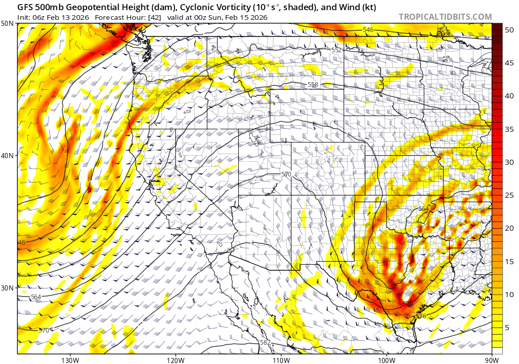
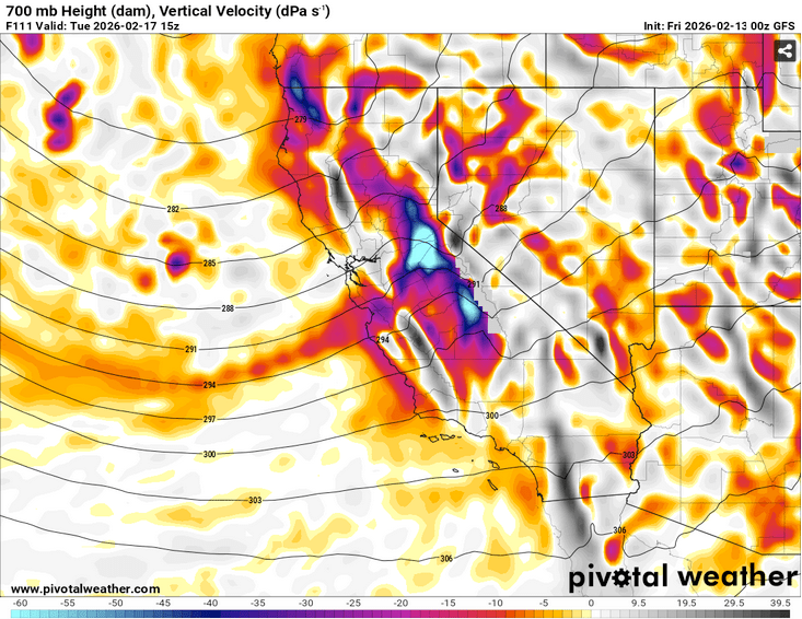
Add this to the upsloping flow off the ocean and into the Sierra, and the air will most certainly rise, as noted in this image of vertical air velocity in the low-mid levels for Tues (2/17) around 0700 PST.
While not record breaking, the ingredients are all coming together for a prolonged, cold Sierra storm, an ole’ fashioned Sierra dump. It’s about time.
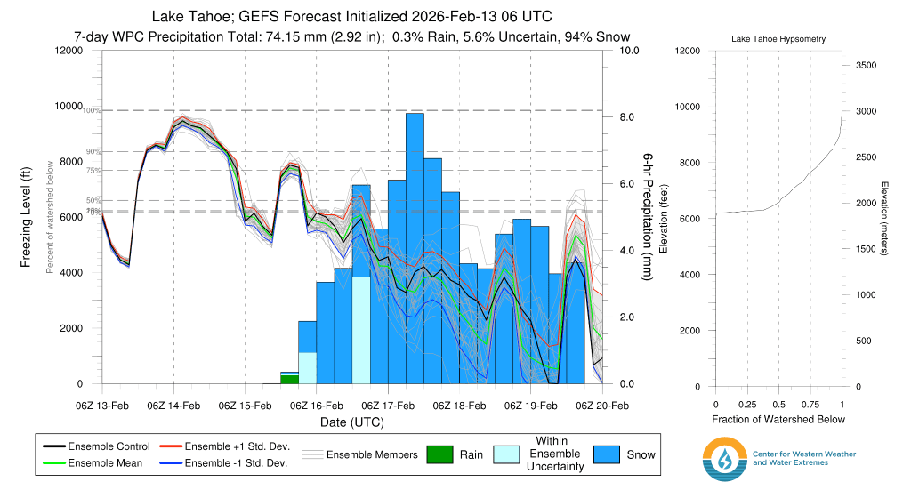
At this point, ensemble models are hinting at totals through the work week of 3-5+’ of new snow above 7000′. These will continue to change as the storm approaches and a clearer picture emerges for how all the ingredients actually align.
For now, it’s time to dust off and wax the powder skis. The biggest cycle of the season to date is on its way.
