Backcountry obs.:
Conditions in the backcountry remained largely stable throughout the week with no new snow under the continuation of the recent warm, dry pattern. Obs from tours on the East Shore near Diamond Peak on Weds (2/4) and Fri (2/6) showed supportable, well-worn surface crusts on most aspects, making made for chattery descents, while zones with pure southerly exposure and sufficiently deep snow pack hosted creamy corn snow, if timed correctly. Non supportable, cold, crispy crust with a few inches of old, cold snow still held on in isolated high elevation, sheltered N-E facing terrain.
Evidence of the changing pattern arrived on Fri AM with a blanket of persistent high cloudiness and moderate SW winds. By afternoon, an inch+ of new snow fell across the highest elevations (8500’+), while a few rain showers spritzed lower elevations. .06″ of rain fell at 6350′ in Carnelian Bay.
Still skiing? Good on ya! It’s been a rough go for those wanting fresh turns on smooth, fluffy snow. But dry spells do bring opportunities for backcountry exploration, resort training laps, or dabbling in other sports. Luckily the big pattern shift shown in model guidance from earlier in the week has held on. Change is in the cards.
Weather and forecast thoughts:
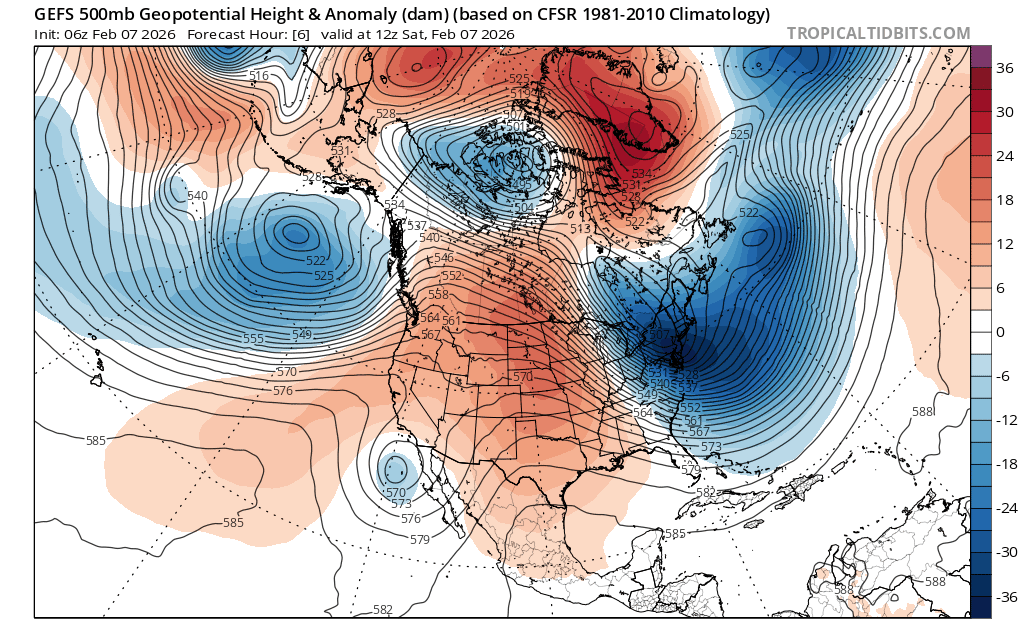
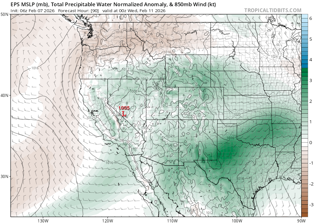
A month of Ullr Fests, snow dances, and screaming at the sky will finally pay off in the coming weeks as the pattern shift from warm and dry to cool and wet finally returns to the Sierra starting early next week (2/9) and continuing into the week after the holiday weekend. While cold and beneficial storms do return, none jump out as overly impactful, at least for the coming week. Substantial refreshes with snow down to lake level look most likely, while massive dumps seem less likely, at least initially.
For the coming weekend (2/7-2/8), warm dry conditions return after the cloudy, spritzy interlude yesterday and early today (2/6) as a shortwave ridge of high pressure returns. Expect highs across the backcountry to again reach the low to mid 40s above 7000′ on both Sat and Sun with lows dropping to near or just below freezing over ridges and summits each night, while valleys and depressions cool well into the 20s under a modestly inverted air mass. After sun returns on Sat, expect high clouds to stream into the area, increasing in coverage on Sun.
Changes really start to work in on Mon and Tues (2/9-2/10) as the first decent chance for accumulating snows returns to the Sierra with the pattern shift from warm ridging to cool troughing. As noted below, one system takes aim for the late Mon-Weds time frame with another arriving for the coming weekend (2/14).
Models will evolve with details coming into focus as time progresses with each storm.
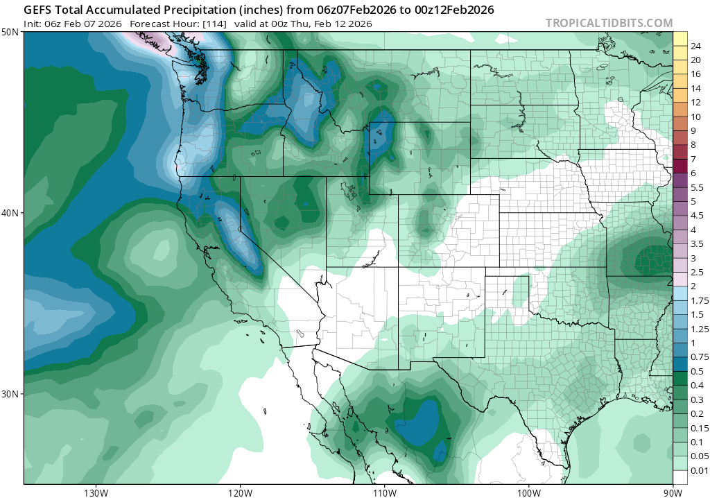
Looking more closely at the early-midweek storm, models initially suggest a decent refresh of the snow pack for all elevations. Snow levels will start between 7000-8000′ as precip arrives late Mon into the lingering warmth, but will then fall to below lake level overnight and into Tues (2/10) as a new, colder air mass overtakes the region.
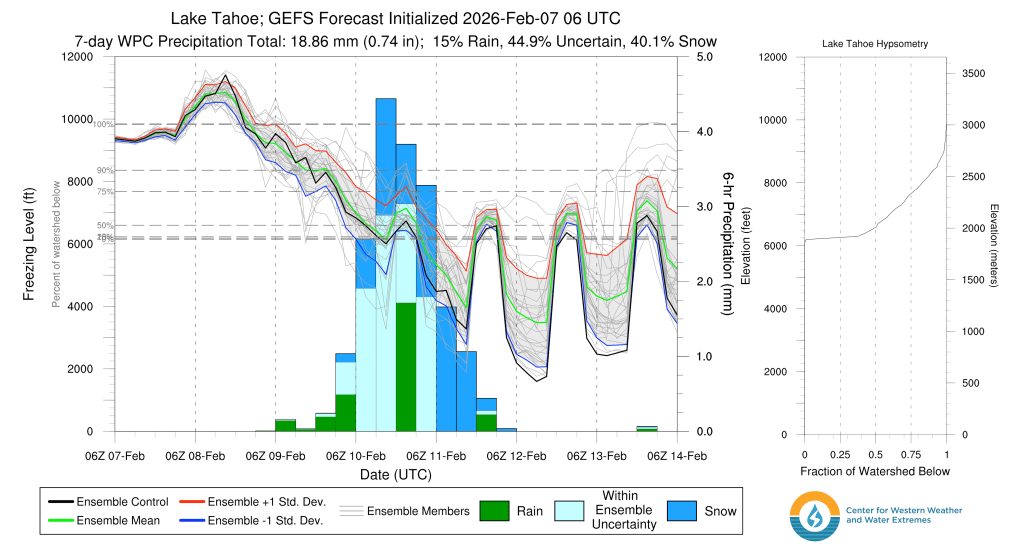
Snow looks to start out on Mon evening, falling through Tues and into early Weds before tapering off. By storm’s end, model ensembles suggest around 1-1.25″ of liquid could fall across the backcountry with highest amounts favored along the Sierra Crest. This translates into roughly 6-12″+ of new, well-deserved snowfall.
Diving a bit deeper into the first system, 500mb vorticity indicates decent dynamics with a nearly perpendicular upper level flow to the Sierra, ideal for maximizing orographic lift, which helps to squeeze moisture out of the atmosphere.
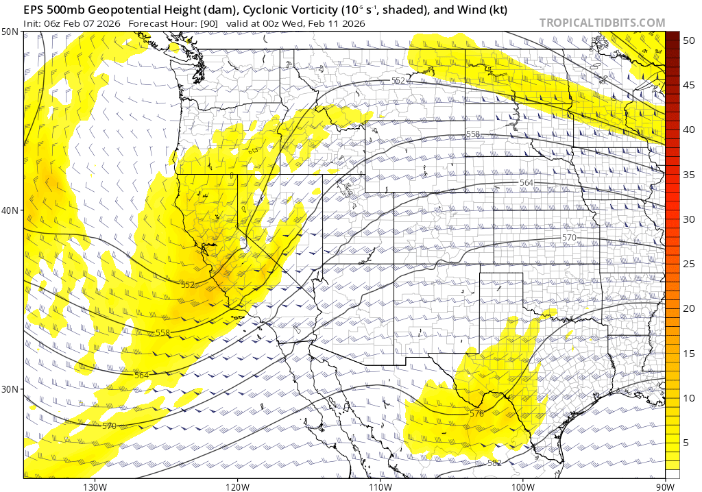
The main limiting factor with the system will be the total available moisture able to be wrung out of the sky. There’s not a ton of moisture with this first system, but enough given the favorable dynamics.
Beyond the early to midweek system, another, more significant storm could impact the Sierra through the holiday weekend along with continued cold temperatures.
Finally, the return to winter is upon us. Bring on the cold, fluffy turns!
