Backcountry Obs:
After receiving only 1-3″ of snow on 1/28, the only snow since 1/8, backcountry snow surfaces are in the exact condition one might expect in a snow drought situation. Melt freeze snow and mostly supportable, dense, old crusts cover all but the most sheltered N and NE aspects. Cold, protected zones host areas of wind buffed vintage powder, mostly remnants of the 1/28 disturbance sitting atop cold and decaying windboard and crust. Solar aspects have decent mid-winter corn snow, ripe for carving during the midday hours.
A predawn tour of the Mt. Rose backcountry between 8650′-9820 on 2/2 revealed a still skiable, yet athletic and chattery snow pack hammered by weeks of use with nonexistent natural improvement. I was delighted to find that upper elevation coverage remains excellent thanks to the feet of dense base deposited in the last weeks of 2025. Even after weeks of warm, dry weather, low sun angles prevented the catastrophic melt out one might expect given the recent weather. Below 8000′ where the holiday storms dropped more rain than snow, melt-out concerns are very real, especially on solar aspects.
While the season has felt grim for weeks, I believe it’ll be remembered as the year with two springs: mid-winter and actual, interrupted with stormy intervals providing just enough snow to create a backcountry season. After weeks of dread, model guidance looks to finally hint at a pattern change and return to winter in weeks ahead.
Weather and forecast thoughts:
Mid-winter spring holds strong for the remainder of this work week as high pressure rebuilds over the area Tues-Thurs (2/3-2/6), before beginning to erode away later in the week and into the coming weekend (2/7-2/9). In the Sierra, this translates to more warm, mostly sunny days and clear cold nights. Above 7000′, high temps will easily hit the mid 40s through Sat (2/7). Inversions will remain persistent with valleys and depressions quickly cooling each night into the 20s, while ridge tops and summits stay above freezing, but locked in a bone dry atmosphere. For example, as of this writing at 0515 on 2/3 it’s 41°F on the 9650′ summit of Slide Mountain, but with a -11°F dew point! Despite the warmth, such dry air keeps snow surfaces frozen via evaporational cooling.
Models suggest some high cloud cover returning by Thurs (2/5), lingering about into the weekend under a “dirty ridge” scenario as the recent dry pattern slowly begins breaking down into something resembling a stormier pattern for the Sierra.
Over the past few days, model ensembles have fallen into decent agreement showing the warm, dry pattern transitioning towards a more sustained, stormy pattern in the coming weeks. A big picture look at 500mb heights helps tell the story.
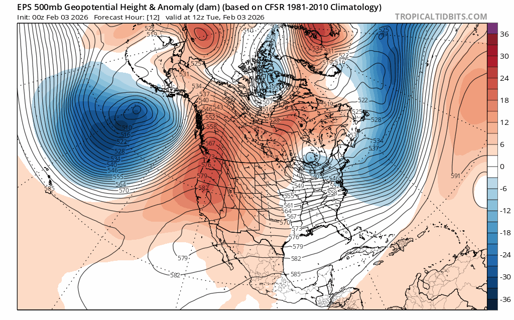
The ridge of high pressure (oranges and reds) hangs on across the west early in the week, but by Thurs (2/5), its axis begins leaning back towards the west. (Notice the bend in the black thickness lines.) This is known as a negative tilt, often indicative of weakening. Underneath the ridge, a weak cutoff low begins to form as noted by the closed 576 line off Baja, Mexico.
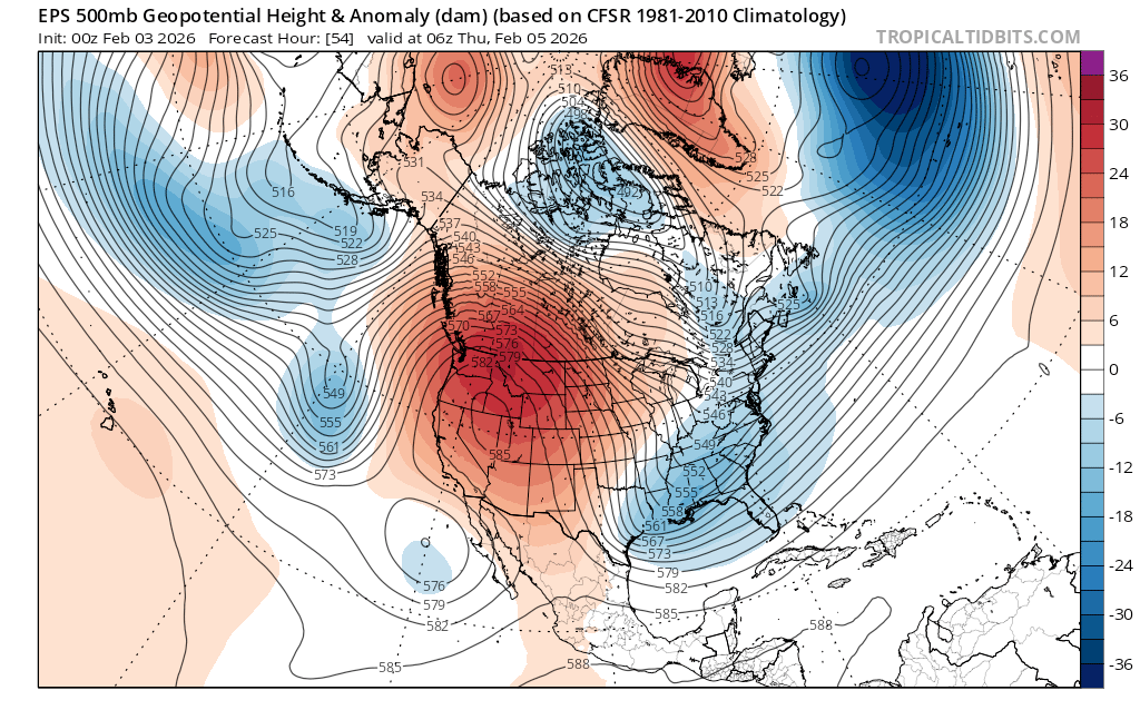
And concurrently, another trough of low pressure develops over the Pacific as noted by the dip in thickness lines and blue shading about 800-1000 miles due west of San Francisco Bay. While these features will not bring any precip. to the Sierra, they do suggest a breakdown of the persistent ridge responsible for weeks of warm, dry weather.
Right on the heels of these disturbances, a modest shortwave ridge rebuilds and swings through northern CA on Sunday.
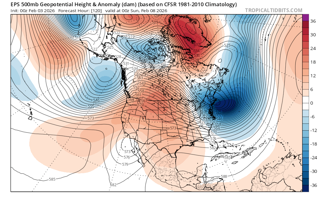
But right on its heels, a trough of low pressure drops in on Monday, signaling the next chance for snow in the Sierra.
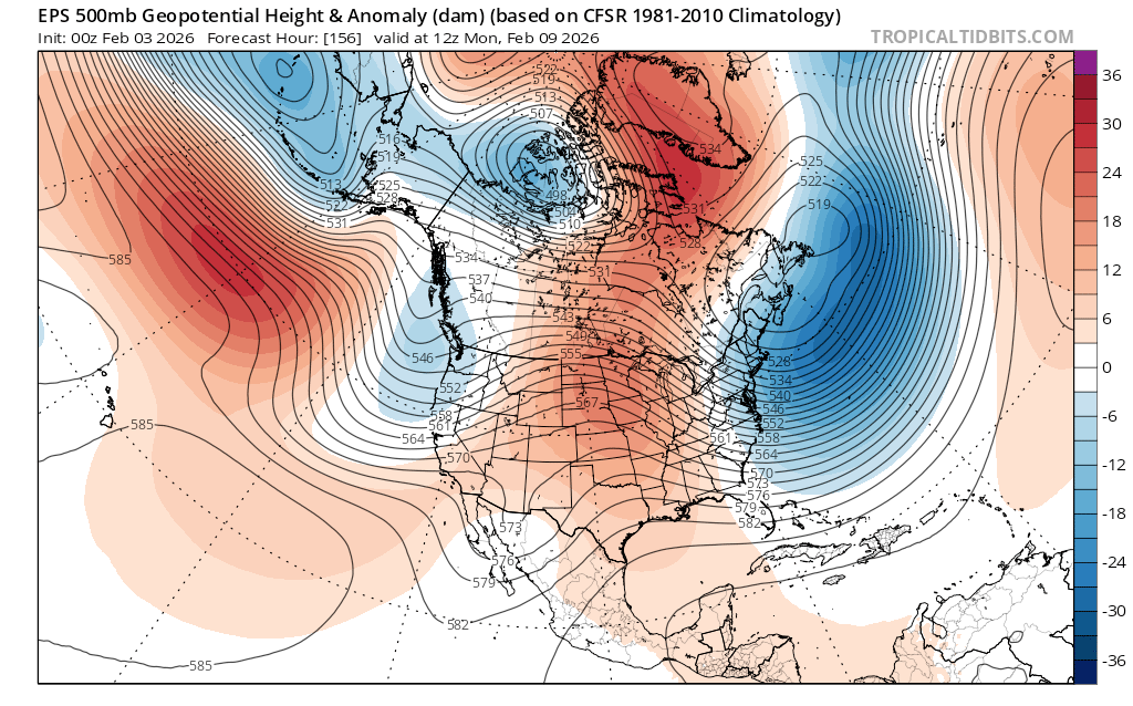
Precip. models going into the beginning of next week largely agree on the return of rain and snowfall across northern CA and the Tahoe Sierra. And storminess could continue through the coming week.
While precip. amounts don’t appear particularly noteworthy, considering the state of the winter for the past month, they could provide a meaningful refresh to the snow pack and backcountry skier outlook for the remainder of the season.
