Backcountry obs.:
Heading out Tuesday (1/20) on tour in the Mt. Rose area revealed a largely thrashed snow pack, severely degrading morale. Weeks of high user traffic, coupled with melt-freeze crusts on all but the shadiest N and NE aspects, have created firm, chattery, and sometimes breakable surface conditions not good for much more than honing survival ski skills. Due southerly aspects do host supportable melt-freeze surfaces, softening on sunny, warmer days providing buttery corn to relieve those weary of the snow drought blues.
Since midweek high clouds and increased humidity in the middle elevations likely baked any remaining soft surface snow on N and NE aspects, which has since refrozen into breakable crusts now that cold air has returned to the Tahoe Sierra. Lower humidity on the snow pack at the highest elevations could have potentially preserved a few sheltered pockets of cold snow on N and NE aspects, but whatever does exist is likely small and worth no more than a few turns. Good luck finding the pot o’ gold!
Weather and forecast thoughts:
The last measurable snowfall in Tahoe was on Jan 8. Looking at the coming week it’s increasingly likely that January will close out without additional measurable precip. Expect the cool NE flow over the area this weekend to moderate early in the work week (1/26-1/27) under mostly sunny skies as a ridge of high pressure restrengthens overhead. Late Tues and into Weds (1/27-1/28), a system tries to nudge into the area, but looks to be largely blocked by the resident high. The result may be an uptick in winds, especially over the higher terrain, cloud cover and potentially a few flurries, but without meaningful accumulations. Behind the shortwave, model guidance shows a ridge of high pressure rebuilding over CA holding into the coming weekend (1/31-2/1).
Expect high temps across the backcountry this week to be in the upper 20s to mid 30s on Sunday and Monday, climbing into the upper 30s to low 40s around midweek. Inversions are likely at the beginning of the week, so ridges and summits could be 10-15°F warmer than surrounding valleys in the stable air mass. Late week backcountry temps look to moderate well into the 40s each day as another ridge takes hold. Expect inversions to return, as well.
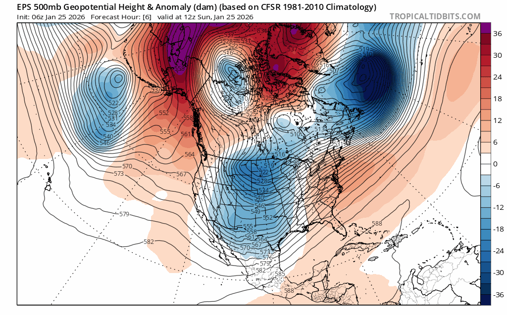
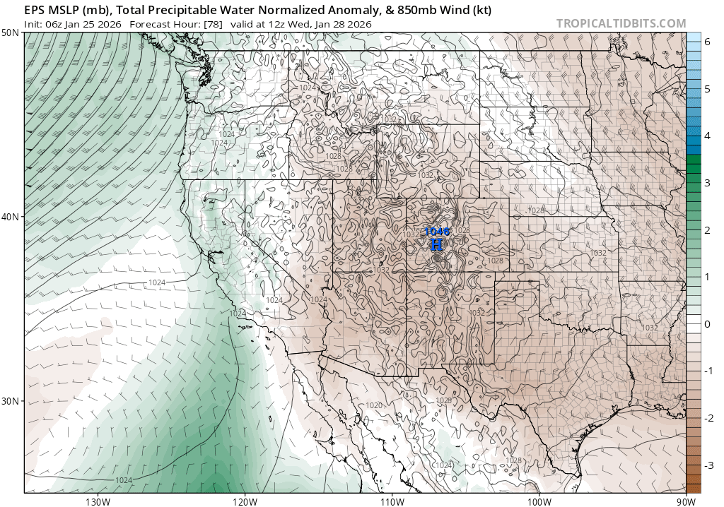
Here’s a snapshot of the big picture pattern for the week:
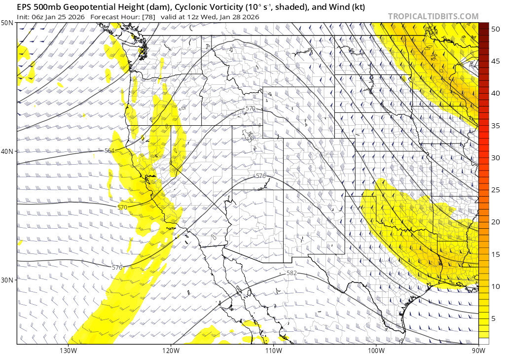
Diving a bit deeper into the midweek disturbance, models disagree on how much miniscule moisture makes it to the Sierra, further degrading confidence in the forecast. The Euro ensemble brings more moisture in while the GEFS retains a drier solution.
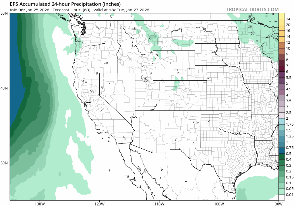
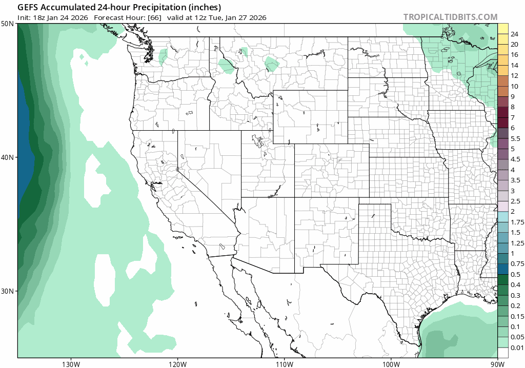
Where there is agreement is that any disturbance that does arrive will be little more than that: just a nudge to the airmass bringing some wind, clouds and maybe a flurry or two. The dynamics (mid level vorticity) to wring out moisture are very weak.
And there just won’t be much moisture to wring out.
So on the midweek storm, an amazing surprise of good fortune might be an inch or two in the backcountry, but such an outcome looks highly unlikely.
After the midweek disturbance, another ridge of high pressure builds in setting the stage for more sunny, dry weather.
Looking out into February, models have recently been quite inconsistent between runs. The strong ridge from earlier this month doesn’t look to return with the same strength as in January, but a trend towards high pressure and above average temps looks more likely than not, at least for the first week of the month. There are some hints at a pattern of undercutting lows that could bring precip to the Sierra. But strong signals of a significant pattern change yielding impactful storms just haven’t appeared.
Meanwhile, the days of winter keep slipping away.
