Backcountry obs.:
Tours around the Tahoe backcountry this week, both on the West Shore (1/13) and in the Mt. Rose area (1/15) revealed surprisingly resilient snow conditions, despite the recent dry, warm weather. Low January sun angles and very dry air are helping to preserve surface snow on shady, sheltered N and NE aspects. Above treeline, recent NE winds have hammered any unconsolidated snow into firm, frozen wind board, both supportable, and at times breakable.
Lower elevations and any aspect that receives sun has now crusted over into breakable solar crusts. Treed solar aspects also have breakable firm surfaces from refrozen tree drippings, while true, open, southerly aspects now hold supportable melt-freeze conditions.
Combine this grab bag of surface snow conditions with a week’s worth of skier traffic since the last snowfall (1/8), and you have truly sporty ski conditions varying from a downright hootenanny good time, to death crust, to slide for life, to “was that a corn turn?!” all within a single lap. It’s ideal for building character and encouraging exploration out into the deeper reaches away from the masses.
Weather and forecast thoughts:
Going into the MLK weekend, “persistence” jumps out as the weather theme of the holiday weekend. Clear skies, light winds, and warm days will prevail through the coming weekend and into the coming week, potentially lasting through the end of January. Peering way out towards the close of the month, there are some hints of change in the pattern, but specifics are impossible to foresee.
Today (1/15) through MLK Day (1/19) expect mostly clear skies, light winds and daily high temps into the 40s across the backcountry, with lows near to well-below freezing in drainages and depressions. Along ridge tops and in mid-slope areas, warmer overnight lows will struggle to drop beyond the upper 30s to low 40s and nightly light to moderate easterly winds could continue to expand wind board across open slopes and bowls. For example, this morning at 0607 at 9200′ in the Mt. Rose area it was 45.2°F with an 11.6°F dew point and 24% RH under clear skies and light easterly winds! Meanwhile it was 30°F at lake level. These classic, high pressure inversions will continue through the weekend and likely well into next week.
The culprit is a blocking ridge of high pressure that continues its big sit over the west.
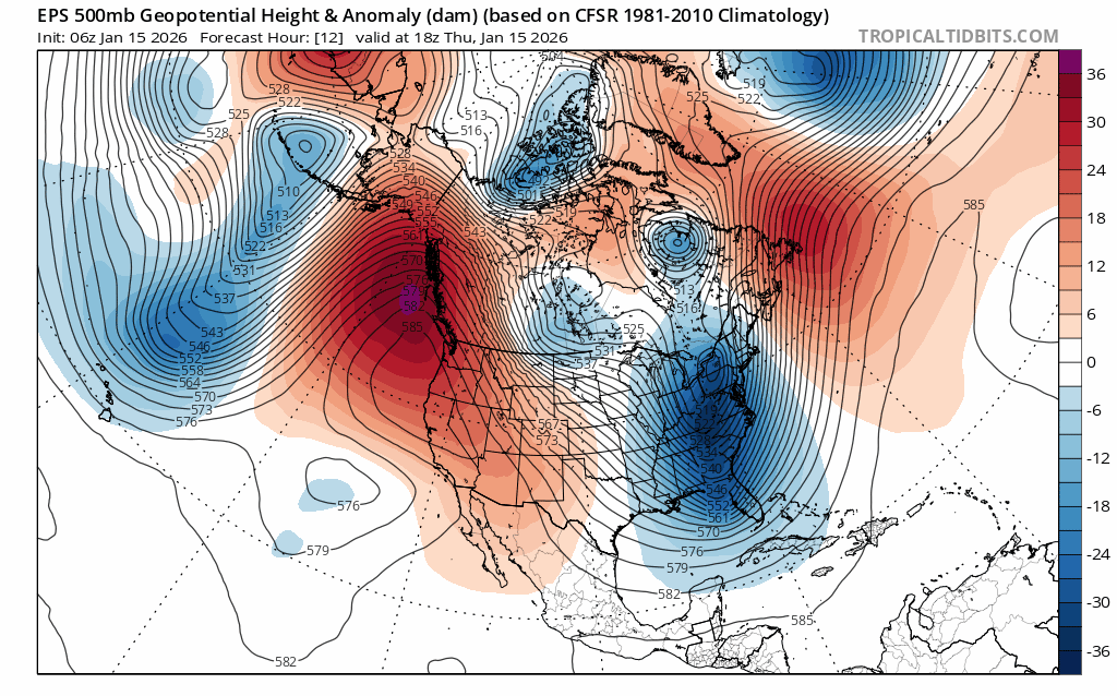
The ridge does show signs of migrating NW into the Gulf of Alaska later next week, which could allow some energy to under cut its influence, but anything that does arrive looks starved for moisture. An uptick in winds and cooler temps would be the most likely result, but any appreciable backcountry refresh appears unlikely through next week (1/19-1/23).
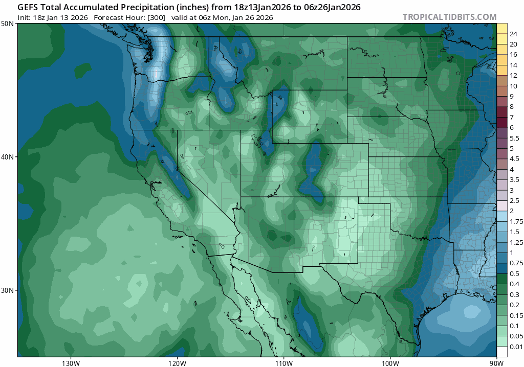
Some ensemble guidance does pick up on some light precip. and cooler temps reaching the Sierra by next weekend (1/23-1/25), but it’s inconsistent and recent model runs have pulled back on the already light total precip. amounts, inspiring little, if any, confidence.
Looking way out towards the end of month and first few days of February, climate models do suggest changes in some key teleconnections that could favor a pattern change for the western US. The MJO (Madden Julian Oscillation) shows signs of potentially re-energizing and entering a phase favorable for unsettled weather in CA. Additionally, the weak La Niña in the equatorial Pacific appears to be breaking down and will continue to do so going into the spring. Changes are afoot. How and when they play out remains an open question.
So get used to the sunshine, warm days and increasingly spring-like snow conditions on southerly aspects. Juneuary is here for a while.
