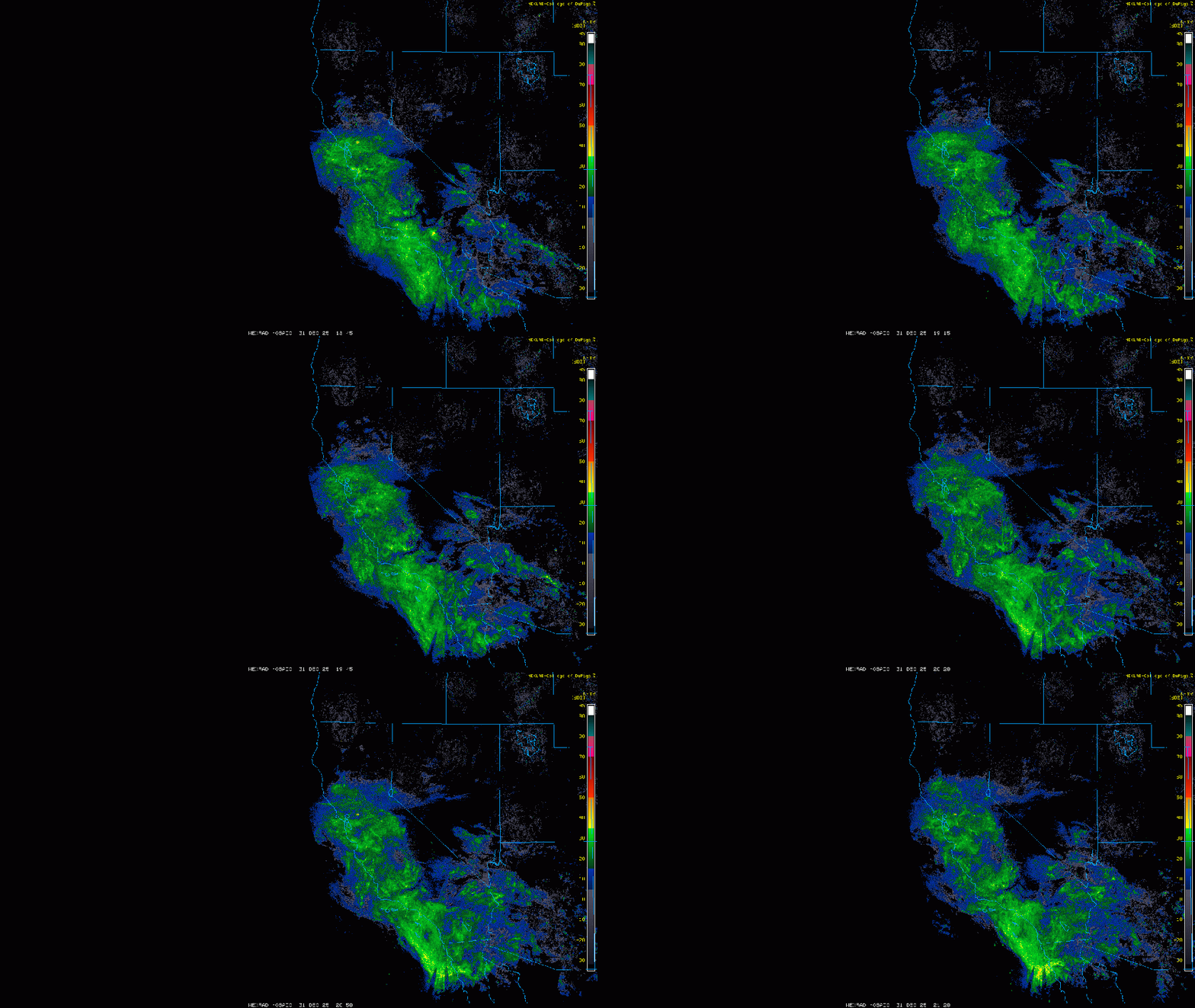
Backcountry obs.:
While beneficial snowfall and abundant powder graced the final week of 2025 across the Tahoe Sierra, the last day of the year featured warm, cooked snow and generally sloppy conditions in the backcountry.
Dawn broke this morning with overcast skies, inverted temps, warm winds, and cooked powder on the West Shore. Ascending from 7000′, temps at 0530 hovered at or just below freezing and large surface hoar coated the snow surface in open areas along still-open creeks. Ascending out of the drainage on a north facing slope, temps quickly warmed into the mid 30s and the forest hissed with the sound of water dripping off tree limbs onto soft snow beneath. Topping out at 8500′, balmy temps hovered around 40°F with a 36°F dew point. I could almost taste the warm, salty air mass inbound from the subtropics.
The snow skied as expected: warm, grabby, and strenuous. Good early season training. Lingering lower elevation inversions held the best snow and fastest turns. Too bad they were only a few hundred feet above the car. Now come the rains.
Weather and forecast thoughts:
For the rest of the week, the backcounty will enter a reset period with warmth and rain reaching the highest Tahoe summits Thurs (1/1) and Fri (1/2) before cold air and snow return, deepening and refreshing the backcountry above 7000′. This weekend two pulses of moisture and cold air will likely drop between 1-2′ of new snow above 7000′, while lower elevations see a mix of rain and snow, eventually turning to all snow late Sat through the remainder of the weekend. Early next week models depict more cold storminess with additional impulses shipping more snow inbound to Tahoe.
Today through early Friday (12/31-1/2) a warm, wet low will bring light to moderate rainfall across all backcountry areas, spoiling whatever good snow remains.

While the current system is warm with snow levels above 10k’, its approach from the south, coupled with weak dynamic forcing will limit rainfall amounts to less than 1″ through New Years Day, with lesser amounts east of the Sierra Crest. Snow levels eventually fall on New Years Day, just in time for precip to end.
Friday (1/2) will be mostly dry and cool with a few errant showers possible across the mountains. Temps will be in the 20s to low 30s above 7000′ under partly to mostly cloudy skies.
By early Sat morning (1/3), another storm, this time much colder, approaches Tahoe from the NW with abundant moisture, dynamics, and a colder air mass. Snow levels will start around 7000′ with the Sat. storm, then quickly fall to near lake level by Sat. evening. A foot of snow could fall above 7000′, especially near the crest, erasing the damage done by recent warm temps and rain.
Snow showers, at times heavy, will continue into Sat. night and into Sunday (1/4), becoming steadier as the day progresses, as another impulse impacts the region, bringing more snow to all elevations. By Sun. night, another foot could accumulate in the backcountry above 7000′ with lesser amounts down to lake level.
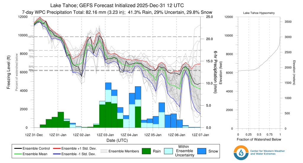
Here’s a look at GEFS ensemble guidance for freezing levels through Weds. (1/7). Colder air looks to filter in with time along with more chances for snow through early next week.

Worth noting is the significant model spread, ie uncertainty, from Fri. onward. Much could still change as it has over the past 36 hours. Recently models have been trending wetter for the weekend storms and pushing the heaviest precip to Sun.
Despite a bit of sloppiness on New Year’s Eve, the atmosphere looks to get its act together in the name of good snow going into 2026. Happy New Year!