Backcountry obs:
0545 Wx. at 8750′ in the Mt. Rose backcountry: 37.1°F / dew point: 7.4°F / RH: 30.3°F / calm winds / snow depth: 0-12″ depending on aspect
A tour of the Rose bc around dawn on 12/15 revealed a nearly unusable snowpack below 9000′ on all but the most northerly, shaded aspects. It’s grim, bottom of the barrel skiing out there. Above 9000′ coverage improves, but it’s very low tide after nearly 4 weeks of warm, dry weather atop a thin, early season snowpack. Surface conditions are highly variable and very skied out in popular zones. The most southerly, solar aspects at high elevations present some “baby corn” melt freeze surfaces, while mixed shade areas host breakable crust atop nearly 8-10” of loose, dry facets. True northerly, sheltered zones have soft, crust free, faceted snow down to the October storm interface.
Aside of the nearly unskiable nature of the current snowpack, the abundance of loose, faceted snow beneath surface crusts and across northerly aspects raises the alarm for future deep instabilities once snow does arrive.
Weather and forecast thoughts:
A pattern change heralding the end of steep inversions and warm, sunny days across the upper elevations is upon us. This week, rounds of very moist systems will begin impacting the Tahoe Sierra starting today (12/16) through Weds (12/17), and again late Fri (12/19) through the weekend into next week. The parade will continue on and off through at least Christmas, and likely beyond.
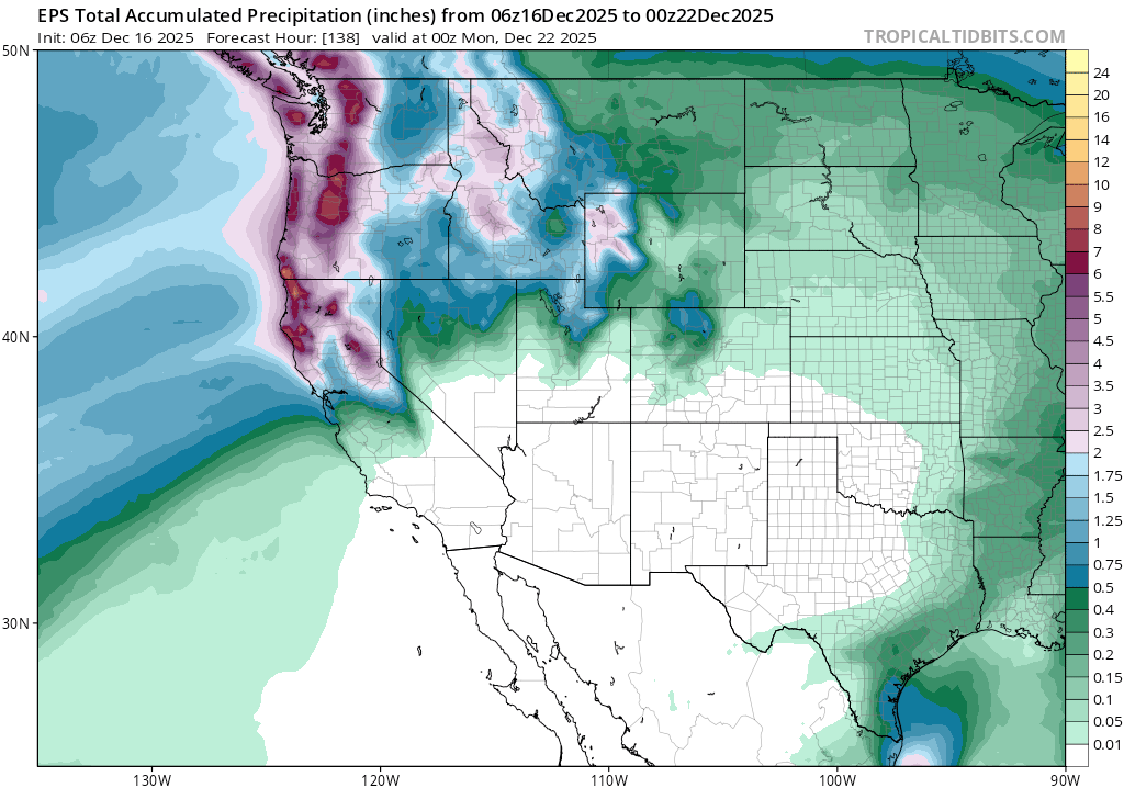
While current guidance favors high precip. amounts throughout the period, above average temperatures and stubborn warmth will likely plague each system into early next week. High snow levels, especially with the first two systems, will keep snow confined to the highest elevations: 8000′-9000’+. There’s not a ton of real estate in Tahoe at those elevations, so for most zones, this won’t be beneficial for the snowpack.
Models are in fair agreement on the positioning of precip. through Sunday evening (12/21). Here’s the Euro ensemble of total precip through Sunday at 1600 PST.
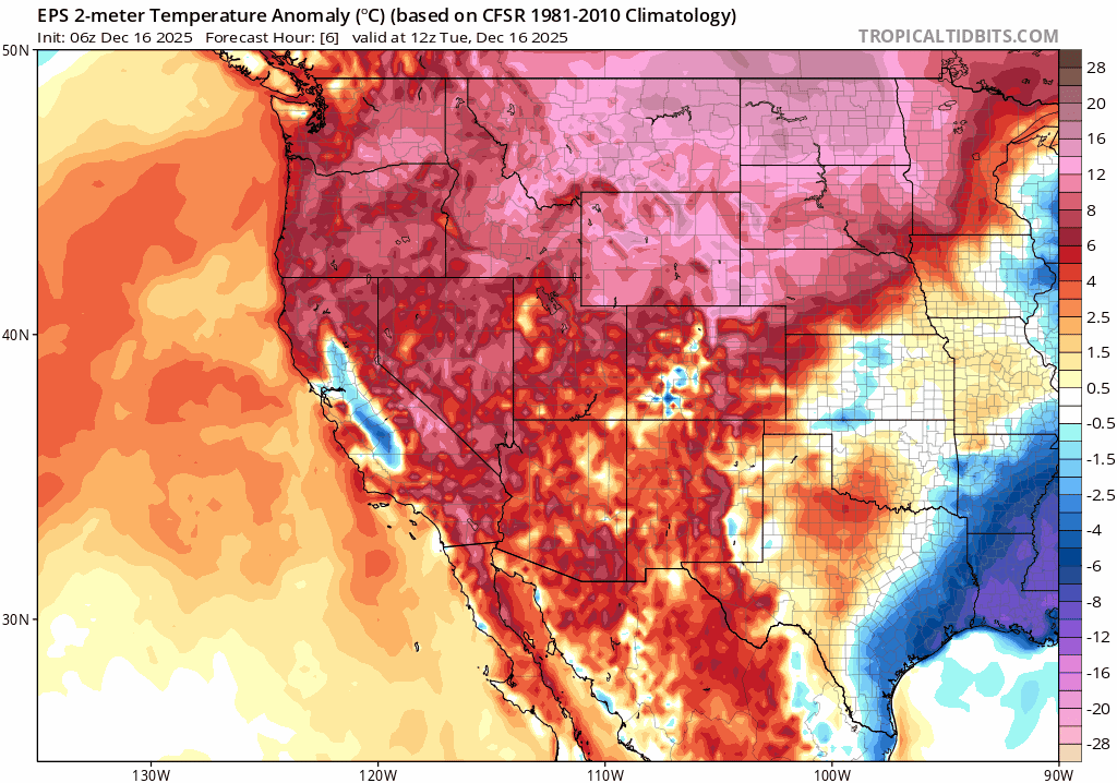
In addition to the agreement on precip., guidance continues to favor well-above average temperatures through the weekend.
Why so much warmth? Much of it can be attributed back to the stubborn ridge of high pressure from the recent pattern and its affect on the jet stream. Looking at the Euro forecast of the 500mb height anomalies, the ridge doesn’t depart completely. Rather, it flattens and sags south as the trough of low pressure to the north slowly nudges its way southward.
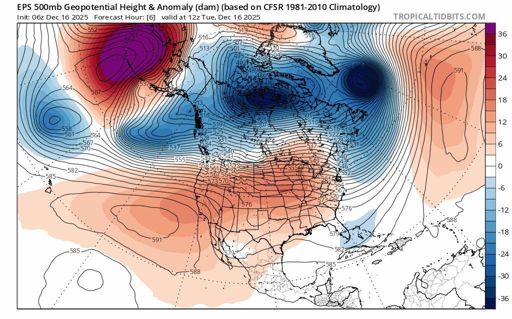
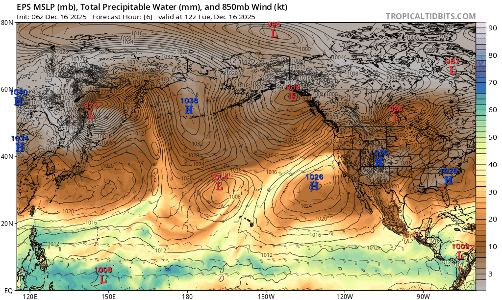
The the white area between the blue and red creates a direct alley to the SW, and that’s where the moisture feed for the storm parade originates for the coming week. Here’s a look at the precipitable water and low level (850mb) winds across the Pacific, showing the moisture fetch with a clear AR signature over the weekend.
Even though the ridge flattens and begins making way for the trough and its associated cold air, Tahoe remains on the northern periphery where the jet is able to funnel copious amounts of warm moisture from the subtropics.
What’s more, sea surface temperatures (SSTs) in the eastern Pacific continue to be well above average. These anomalies also align with the fetch of moisture for the coming week, imparting additional warmth for the systems.
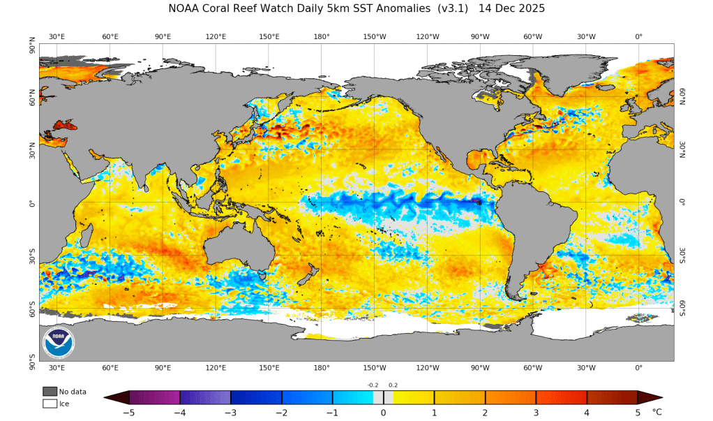
Unfortunately, warmer than average SSTs will likely act as a background warming influence for storms throughout the season.
Looking ahead into Christmas week, most models suggest that the trough progresses further south into CA, bringing colder temperatures, lower snow levels, and additional storminess. However, this is delayed from what models suggested a few days ago, so the arrival of cooler air might take some time.
So as an old fly fishing friend used to say to me as I grumbled through warm storms, “it’s good for the fish.” The mostly-rain event over the coming week will entertain the fish with higher flows, but continue to frustrate any skiers hoping for a snowpack before Christmas.
