Backcountry obs:
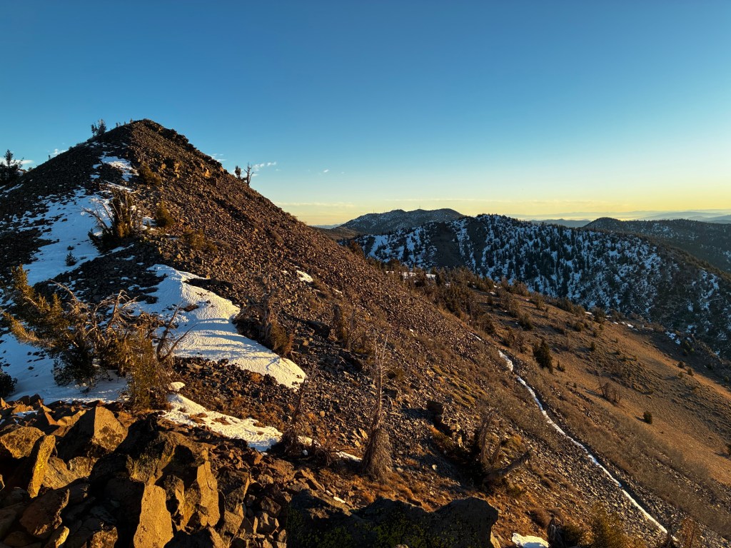
The unrelenting ridge of high pressure responsible for weeks of warm, dry weather in the mountains and cool, clammy conditions in the Tahoe Basin has taken a heavy toll on the snowpack. Snow has melted back to dirt across the area except on the highest, most sheltered N and E facing zones above 9000′. Non-snow sports have been the preferred source of outdoor fun recently.
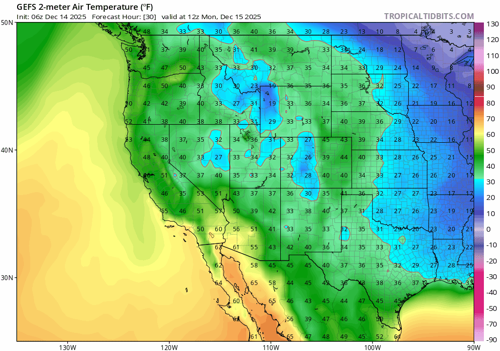
A morning run yesterday (12/13) along the Incline Village skyline revealed only scattered patches of snow on southerly aspects and steeply inverted temperature gradients. At 5:30am it was 31°F at lake level under dense fog and 44°F at the 7600′ TH beneath Rifle Peak!
Fortunately, a pattern change is in store over the next week that will kick out the inversions and usher in more unsettled weather and the chance of higher mountain snows towards week’s end. The peak of this early season low tide is in sight.
Weather and forecast thoughts:
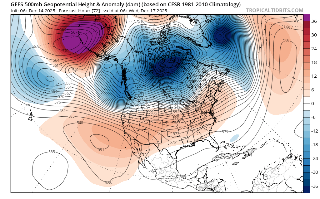
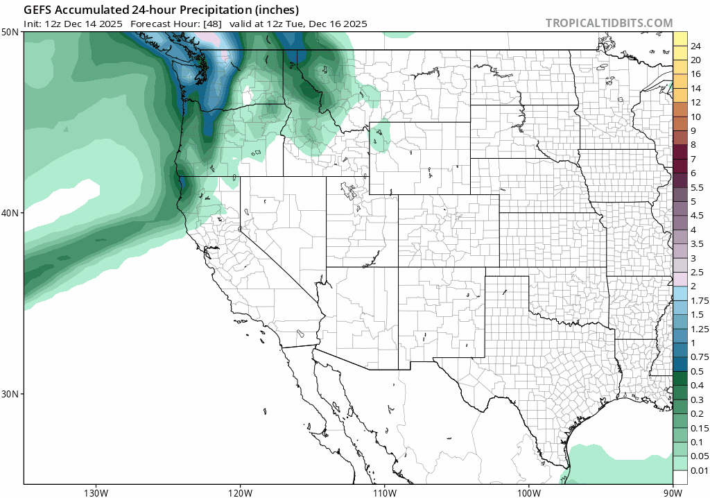
The coming week (12/15-12/19) will likely start out warm and dry through most of Tuesday (12/16) before rain filters into the region Tues PM through Weds, breaking Thurs, then returning Fri through the upcoming weekend. Temps in the mountains above 7000′ will start out warm with highs in the 40s early in the week, before cooling off into the 30s towards week’s end as cooler air slowly filters in from the north. Despite the new rounds of precip., models are in good agreement that high snow levels through the work week won’t provide much opportunity for the snowpack to rebound, except in zones above 8000′-9000′.
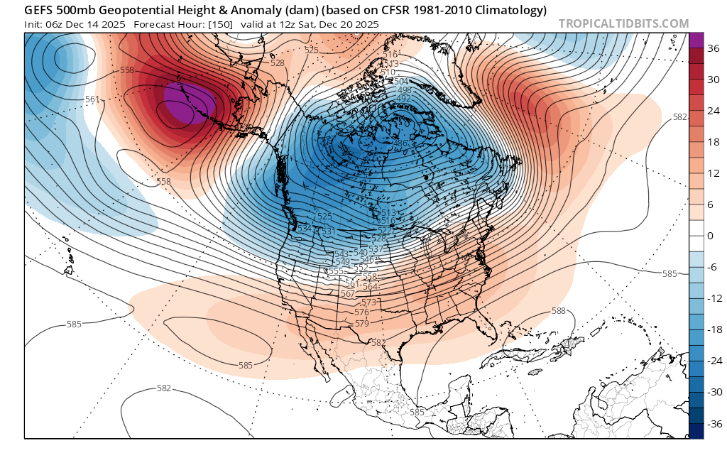
Looking into next weekend and Christmas week, models do suggest a trough developing off the CA coast which would bring more storminess, but with colder temps and lower snow levels, potentially setting up the backcountry for the season. Just like in the late fall, it’s a good idea to take note as to which areas have snow and which are snow free to help understand potential instabilities once a new snowpack finally arrives.
Here are some visuals depicting the changes afoot this week and into Christmas week:
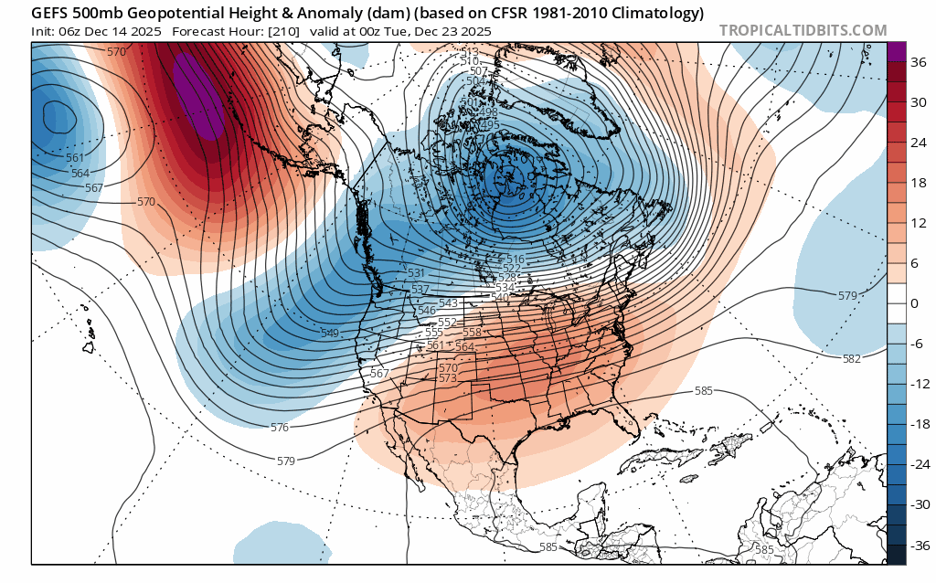
While the potential return of snow is still more than a week out, these are the most encouraging signs of winter’s arrival seen all season.
