1515 wx. at 6350′ in Carnelian Bay: 49.3°F / 24.1°F dew point / 37% RH
Weather and forecast thoughts:
The warm and wet parade of storms from November has long since passed and in its wake, Tahoe has been cool and dry with no measurable precipitation since Fri (11/21).
The pattern responsible for the recent dry spell is locked in and will continue for at least the next 10 days. A cool down from a dry inside slider is likely tomorrow and Thurs (12/3-12/4), but apart from NE winds and colder temps barely nudging 40° on Weds, it will be uneventful.
Temps rebound quickly towards the end of the week and weekend with highs around Tahoe returning to the low 50s under sunny skies. Inversions will reign each night as lows dip to near or below freezing in valleys and depressions while the upper elevations remain above freezing in a very dry airmass. Snow season remains on hold.
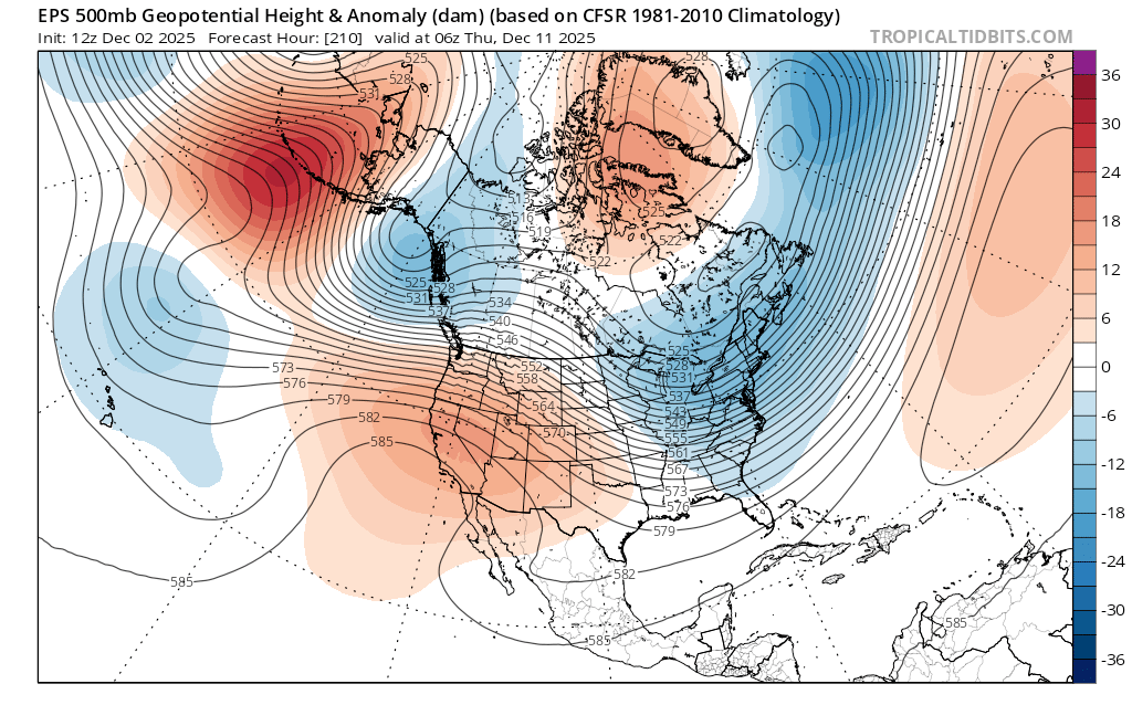
Models suggest a cut and paste forecast for next week (12/8-12/15), with ye olde ridge blocking any precip from getting anywhere near the Sierra. By midweek the ridge actually centers itself over CA:
But as the sage George Harrison reminds us, all things must pass. There’s noise in the ensembles by mid month hinting at a return to unsettled weather.
