14:14 wx. at 6350′ in Carnelian Bay: Clear skies / 54.3°F / 44.4°F dew point / 70% RH / weekly precip.: .51″ rain
Backcountry conditions:
Another fall storm passed through the Tahoe Sierra this past week breaking up a nice stretch of calm, clear weather with intense winds followed by valley rain and high elevation snows. Snow fell for most of Thurs (11/6) above 7500′, but due to high SWE values of around 5:1, only a few inches of thick, wet cement pasted backcountry peaks. Below 7500′ another wetting rain dropped anywhere from less than 1/2″ to over 1″ of rainfall, recharging the amazingly tacky dirt trail conditions. Fall foliage across the Basin is long gone, but pungent smells of decomposing leaves and vegetation still fill the air with fall flavor.
South facing peaks are devoid of any snowpack, but north faces have held onto snow along the Sierra Crest and in the Mt. Rose area since the first flakes fell back in October. This week’s storm added yet another layer of thick frozen paste to the superficial snowpack. Few zones hold enough snow to make turns, but the meager coverage is worth remembering: once buried by the first decent dumps of the season, these zones could harbor persistent, deep instabilities.
Weather and forecast thoughts:
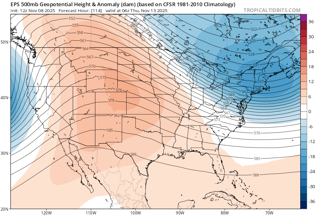
While Tahoe currently enjoys quiescent fall conditions with highs in the 50s and lows in the 30s under clear skies and calm winds, models are in good agreement for what could be the first snowpack inducing storm(s) of the season, at least for the mid to upper elevations, around mid to late week (11/12-11/14) and into the following weekend.
Model ensembles show good agreement in the upcoming changes through the end of next week as noted by the arrival of an upper level trough overnight Weds – Fri (11/12-11/14).
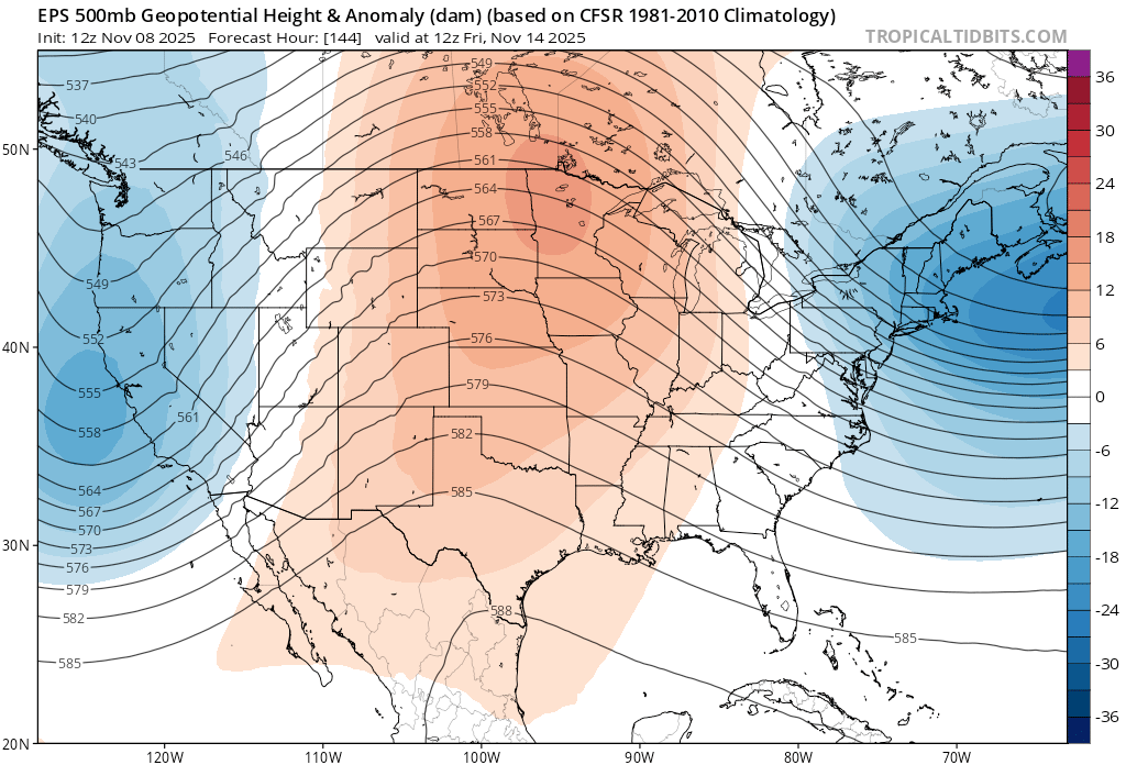
While models do largely agree on a significant storm mid/late week, the exact impacts are still somewhat hazy and changing with each model run.
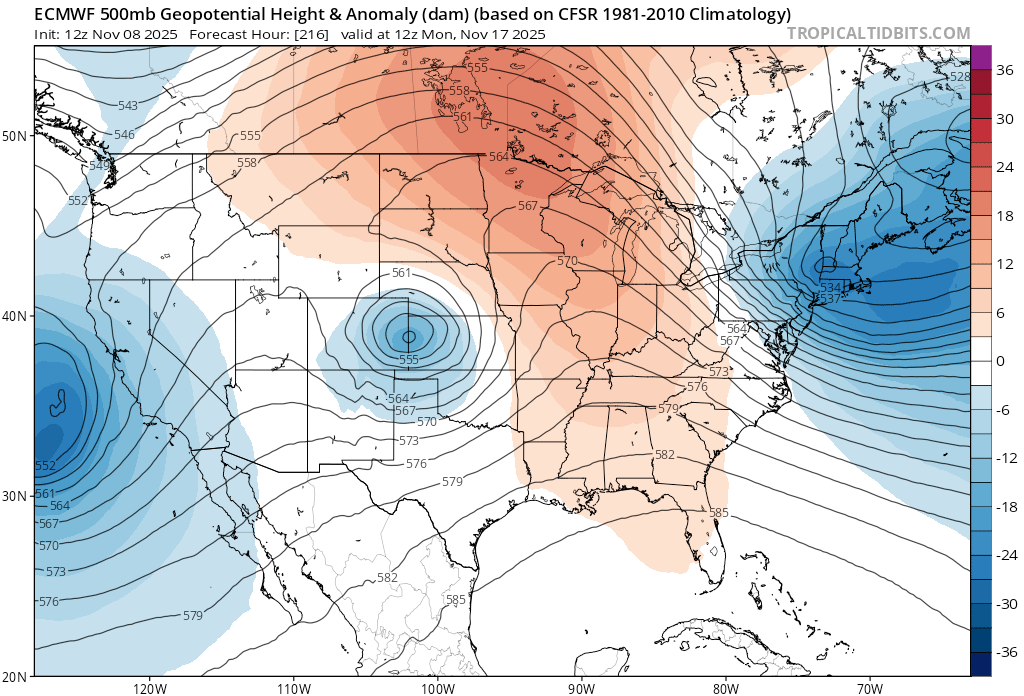
Looking at late next weekend, the picture becomes more muddled with the Euro model showing a cutoff low (notoriously difficult to forecast) dropping off the CA coast:
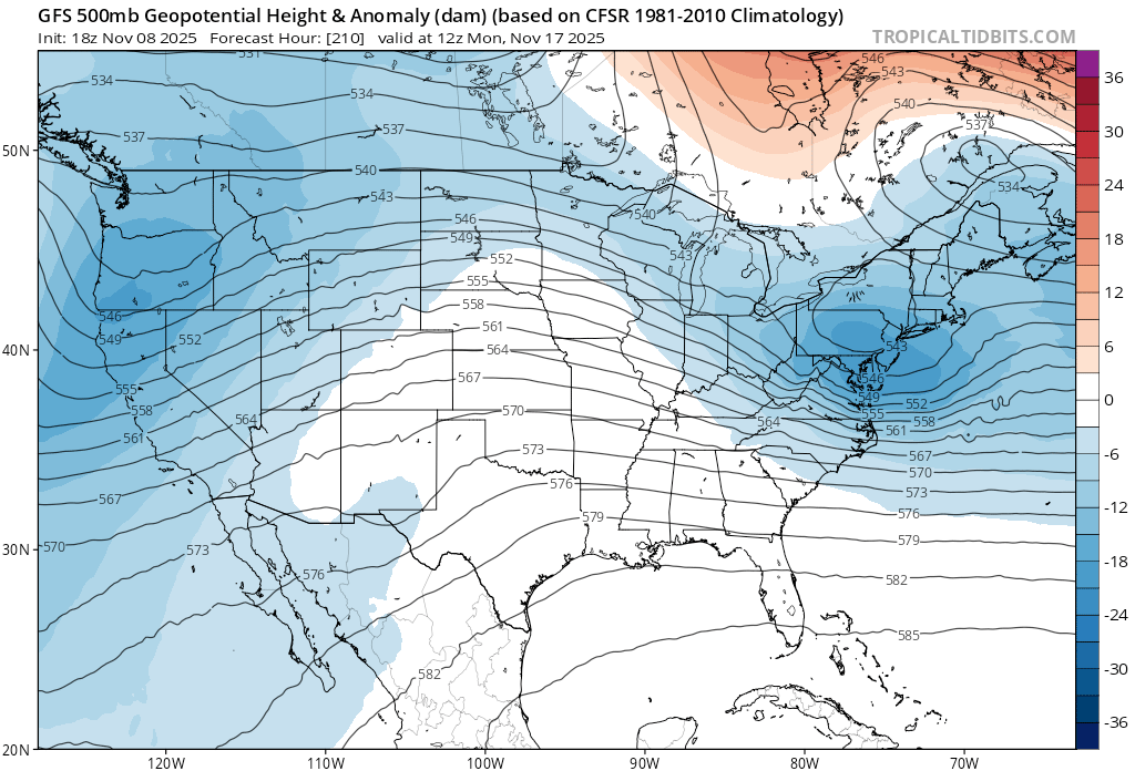
And the GFS showing a broader trough encompassing most of the west coast:
More details are sure to emerge in the coming days. Until then, the trails are still at their fall best, so get it while you can.
