4:49 wx. at 6350′ in Carnelian Bay: 41.7°F / 31.5°F dew point / 67% RH
Backcountry conditions:
Yesterday I headed out to sample trail conditions on Donner Summit. On all but the shadiest aspects above 8000′, bare ground prevails. Multiple rounds of fall rain and melted snow have maintained tacky trails and running water, making for delightful biking and running. When the snow does finally fall, it’ll encounter highly saturated ground, a plus for bonding. N and NE aspects above 8000′ still host limited, lingering snow from previous storms.
Warm days and cool nights, especially in valleys and depressions, have dominated the weather recently. Lows in the mountains have struggled to approach freezing, while colder temps and freezing fog settled into places like Martis and Olympic Valleys. This relatively warm, quiet pattern is all about to change and so too will the mode of transport for accessing the backcountry: goodbye running shoes, hello ski boots.
Weather and forecast thoughts:
Beginning today (11/12) clouds will begin replacing sunny skies, along with increased winds, followed by rain and higher elevation snows mainly Thurs-Fri (11/13-11/14). Snow will likely mix in down to lake level overnight Thurs into Fri, but is unlikely to accumulate in any significant way. Through Sat AM (11/15), snow accumulations from 3-8″ above 8000′ are possible with the highest amounts falling along the crest and south from Carson to Ebbetts Pass. A foot of snow in the backcountry isn’t out of the question, especially in the higher zones along the Crest south of Tahoe. Around the lake .5 – 1″ of liquid looks most likely to fall with the highest amounts west and the lowest amounts east.
Even 24 hours out, confidence in the forecast of this storm remains moderate at best. The incoming storm, the low, becomes cut-off from the main jet stream as it drops off the CA coast, then wanders ashore south of LA this weekend.
Here’s a big picture look at this process from halfway up in the atmosphere (500mb).
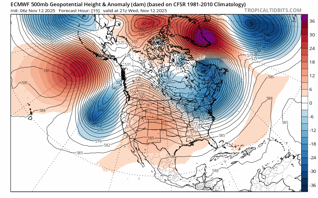
Rather than riding along with the jet stream on a fairly predictable path, the low pinches off and then wobbles around, stuck between the main steering currents in the atmosphere. (Blues represent lower pressure heights and reds higher pressure heights. Note the closed lines around the CA coast.)
Returning to the storm at hand, there’s still quite a bit of spread in precip amounts and snow levels, especially between the Euro and GFS models with the GFS more bullish on total precip amounts through Sat (11/15) than the Euro:
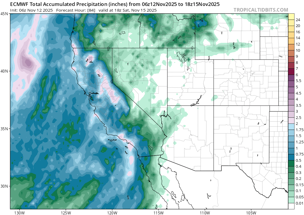
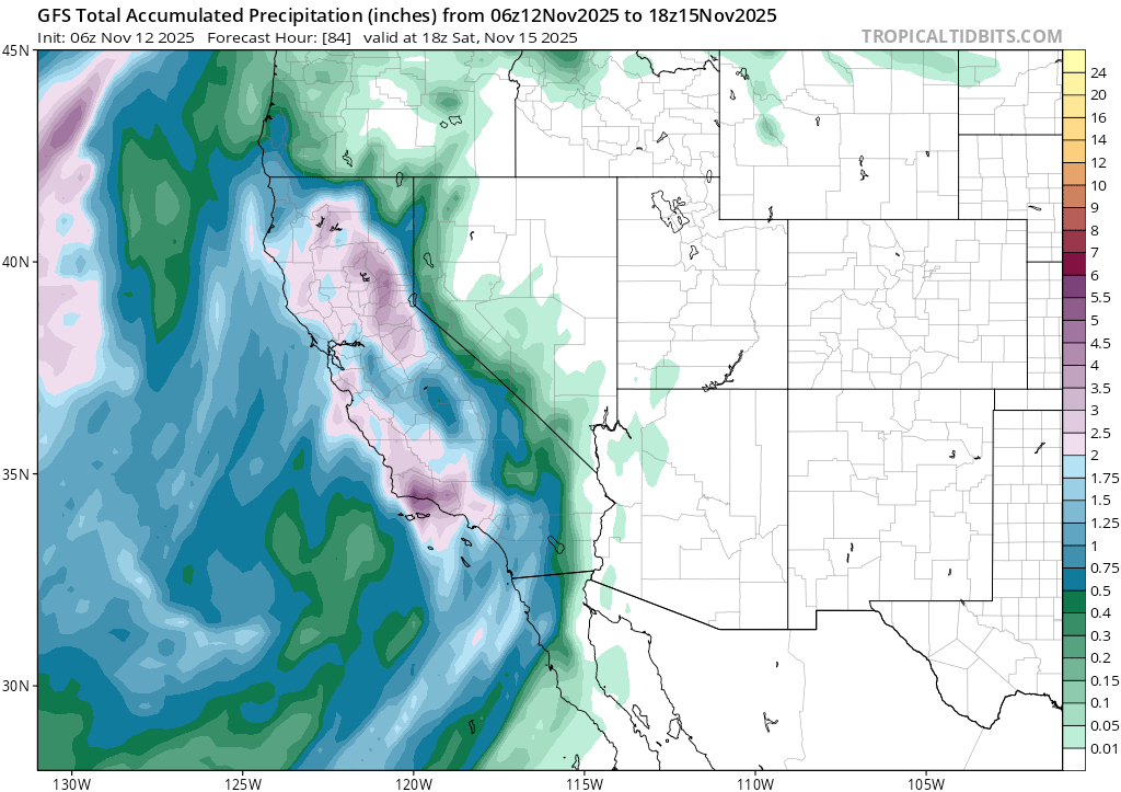
Over the course of the lead up to this storm, the Euro has tended to pickup on the evolution of the forecast more quickly than the GFS, but throughout the whole process, the GFS has remained more bullish on precip amounts. It’s going to be an interesting couple of days to see what actually pans out.
But there’s more! Looking beyond Saturday, another round of rain and possibly more snow could re-enter the picture around the beginning of the work week. And models show more storms potentially coming in through after that.
Despite all the forecast variance, it’s safe to say that the days of the nearly perfect fall are quickly coming to a close, soon to be replaced by cool, unsettled weather and the long awaited return to sliding on snow.
