Nearly a week ago the season kicked off with a bang as the first significant snowfall blanketed the Tahoe Sierra. Snow totals from a few inches to over a foot in the Mt. Rose and Carson Pass areas blanketed the region. By late Tuesday, a few clips of folks ripping powder in the Mt. Rose area surfaced on the interwebs.
The October 13-15 storm was a quirky one that at one point around late afternoon on the 14th, brought snowfall and 33°F to lake level in South Lake Tahoe while it was around 6° warmer and raining in Carnelian Bay. South and Eastern parts of the Basin also picked up higher snow amounts than the traditional magnets on the NW side of the Basin. The Eastern Sierra from Ebbetts Pass down to the Mono Recesses picked up feet of snow while points north of Tahoe generally received less than a foot.
What happened? A look at the storm from the 14th is revealing. Here are the winds from the lower atmosphere.
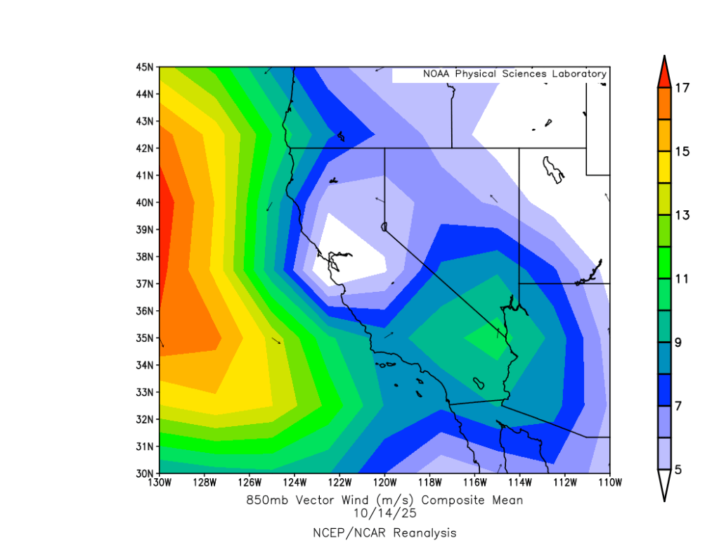
Bands of rain and snow drenched Tahoe for most of the day of 10/14, but tracked in mainly from the SE. Looking at the position of the low, it’s easy to see how points south received more moisture with the flow off the Pacific bringing more rain and high elevation snow to the Central and Southern Sierra, while Tahoe received more of the wrap-around effect, with the Carson Range benefiting from enhanced upslope flow.
Since late week, skies cleared and temps have warmed considerably into the 60s around the lake, melting most of last week’s snow. Shady N and NE aspects above 8000′ still hold some residual crusty snow, with facets developing underneath.
It’ll be worth remembering these patches should they hold on until the next snow. Looking at the models, a potentially more potent storm with a solid moisture plume may impact the area next weekend, 10/24-10/26.
Until then, pleasantly warm, sunny days and cool nights are on tap for the coming work week.
